Bolan Lake Dam dam

Bolan Lake Dam
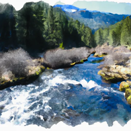
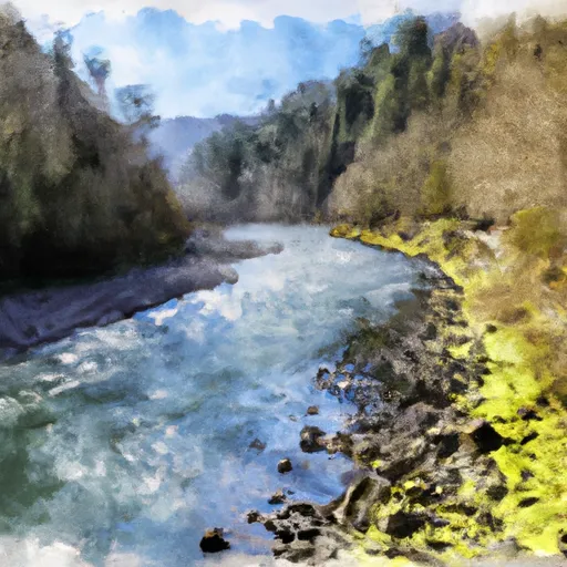
Bolan Lake Dam, located in Josephine County, Oregon, is a concrete gravity dam primarily used for fish and wildlife pond purposes. Built in 1972 by the Oregon State Game Commission, this Federal-owned structure on Bolan Creek stands at a height of 12 feet with a storage capacity of 165 acre-feet. The dam is managed and operated by the Forest Service and has a low hazard potential, with a moderate risk assessment rating.
The dam's design features a multi-arch core supported by rock and soil foundations, with an uncontrolled spillway width of 10 feet. The structure has not been rated for its condition but undergoes inspection every 10 years, with the last assessment conducted in May 2018. Despite its relatively small surface area of 50 acres and limited drainage area, Bolan Lake Dam serves as an important recreational spot in Cave Junction, Oregon, attracting water resource and climate enthusiasts to enjoy the tranquil surroundings and diverse wildlife supported by the pond.
With its focus on enhancing fish and wildlife habitat, Bolan Lake Dam serves as a valuable resource for both conservation and recreation in the region. As it continues to be managed by the Forest Service and monitored for safety and operational effectiveness, the dam remains a key feature in the local ecosystem, offering a unique opportunity for visitors to connect with nature and appreciate the intersection of water resource management and environmental stewardship.
Plan around the weather
Same NOAA / yr.no feed Snoflo's iOS app uses. Watch the precipitation column on the meteogram -- rain on the basin upstream typically lifts inflow 24-72 hours later.
Next 5 days, hour by hour
Temperature line with weather symbols on top, snow + rain accumulation as columns, humidity as a dotted line.
5-day forecast table
Every 3 hours, broken out across temperature, snow, rain, humidity, and wind. Each cell is colour-coded relative to the column min/max.
| Time | Condition | Temp (°F) | Snow (in) | Rain (in) | Humidity (%) | Wind (mps) | Wind dir |
|---|---|---|---|---|---|---|---|
| Loading detailed forecast… | |||||||
15-day temperature & precipitation
Daily temperatures, snow, and rain projected over the next two weeks.
Nearby streamflow gauges
USGS streamgauges around Bolan Lake Dam -- inflows here typically show up in storage 24-72 hours later.
| Streamgauge | Discharge | View |
|---|---|---|
| Sucker Cr Bl Lt Grayback Cr Nr Holland | 23 cfs | → |
| Indian C Nr Happy Camp Ca | 47 cfs | → |
| Klamath R Nr Seiad Valley Ca | 1,110 cfs | → |
| Illinois River Near Kerby | 37 cfs | → |
| Applegate River Near Copper | 150 cfs | → |
| Star Gulch Near Ruch | 0 cfs | → |
Make a day of it
Boat launches, lakeside camping, fishing access, and other reservoirs near Bolan Lake Dam.
Boat launches
See all →


Campgrounds
See all →


Fishing spots
See all →


River runs
See all →


More reservoirs
See all →
About Bolan Lake Dam
Where does the data for Bolan Lake Dam come from?
Structural and regulatory data come from the U.S. Army Corps of Engineers' National Inventory of Dams (NID). Weather forecast comes from NOAA / yr.no -- the same feed Snoflo's iOS app uses.
How often is the report updated?
NID structural data refreshes annually as the Corps publishes updated assessments. The weather forecast refreshes throughout the day.
What does the Low hazard rating mean?
The Corps of Engineers' hazard potential classification grades probable consequences if the dam fails: High = probable loss of human life; Significant = no probable loss of human life but possible economic loss / environmental damage; Low = no probable loss of human life, only minor economic / environmental losses. See the Dam Data Reference card below for the full definitions.
What's "% of normal"?
The current storage value compared to the historical average storage on this calendar day. 100% = right on average; values above 100% mean above-normal storage (wet year); values below mean below-normal (dry year or drought).
Can I get alerts when storage crosses a threshold?
Yes -- alerts are managed in the Snoflo iOS app. Favorite this dam, set a threshold, and you'll get a push the moment conditions cross.
Dam data reference
Condition Assessment
- Satisfactory
- No existing or potential dam safety deficiencies are recognized. Acceptable performance is expected under all loading conditions (static, hydrologic, seismic) in accordance with the minimum applicable state or federal regulatory criteria or tolerable risk guidelines.
- Fair
- No existing dam safety deficiencies are recognized for normal operating conditions. Rare or extreme hydrologic and/or seismic events may result in a dam safety deficiency. Risk may be in the range to take further action.
- Poor
- A dam safety deficiency is recognized for normal operating conditions which may realistically occur. Remedial action is necessary. POOR may also be used when uncertainties exist as to critical analysis parameters which identify a potential dam safety deficiency.
- Unsatisfactory
- A dam safety deficiency is recognized that requires immediate or emergency remedial action for problem resolution.
- Not Rated
- The dam has not been inspected, is not under state or federal jurisdiction, or has been inspected but, for whatever reason, has not been rated.
Hazard Potential Classification
- High
- Dams assigned the high hazard potential classification are those where failure or mis-operation will probably cause loss of human life.
- Significant
- Dams assigned the significant hazard potential classification are those dams where failure or mis-operation results in no probable loss of human life but can cause economic loss, environmental damage, disruption of lifeline facilities, or impact other concerns. Significant hazard potential classification dams are often located in predominantly rural or agricultural areas but could be in areas with population and significant infrastructure.
- Low
- Dams assigned the low hazard potential classification are those where failure or mis-operation results in no probable loss of human life and low economic and/or environmental losses. Losses are principally limited to the owner's property.
- Undetermined
- Dams for which a downstream hazard potential has not been designated or is not provided.