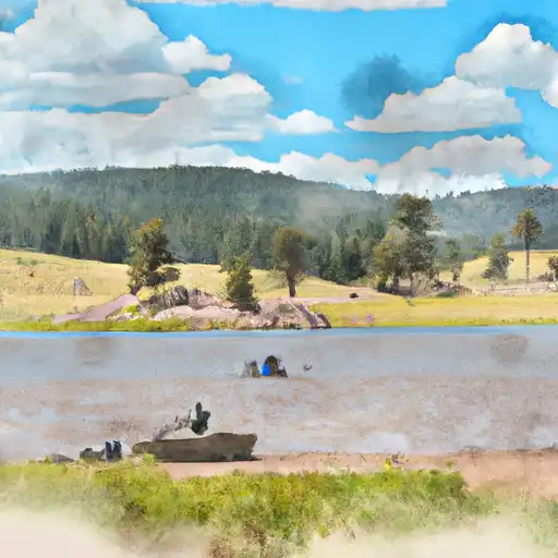
Los Lagos No. 3 Dam

Los Lagos No. 3
Located in Boulder, Colorado, Los Lagos No. 3 is a privately-owned earth dam built in 1894 by the USDA NRCS for irrigation purposes. With a height of 10 feet and a length of 75 feet, this dam has a storage capacity of 71 acre-feet and serves multiple purposes including fire protection, stock, small fish pond, irrigation, and water supply. The dam is regulated by the Colorado Department of Water Resources and undergoes regular inspections to ensure its structural integrity.
The dam's spillway is uncontrolled with a width of 5 feet, and it has a significant hazard potential, although its condition is currently assessed as satisfactory. The last inspection took place in June 2020, with a frequency of every two years. The risk assessment for Los Lagos No. 3 is moderate, indicating a level 3 risk, but no specific risk management measures have been outlined at this time. As a key feature in the Beaver Creek watershed, this dam plays a crucial role in water resource management and climate resilience efforts in the area.
Overall, Los Lagos No. 3 stands as a historic and essential infrastructure for water supply and irrigation in Boulder, Colorado. With its long-standing presence and multi-purpose functionality, this dam continues to be a focal point for water resource enthusiasts and climate advocates interested in sustainable water management practices. As efforts to address climate change and water scarcity intensify, Los Lagos No. 3 serves as a reminder of the importance of maintaining and regulating water infrastructure for the benefit of both human and environmental needs.
Plan around the weather
Same NOAA / yr.no feed Snoflo's iOS app uses. Watch the precipitation column on the meteogram -- rain on the basin upstream typically lifts inflow 24-72 hours later.
Next 5 days, hour by hour
Temperature line with weather symbols on top, snow + rain accumulation as columns, humidity as a dotted line.
5-day forecast table
Every 3 hours, broken out across temperature, snow, rain, humidity, and wind. Each cell is colour-coded relative to the column min/max.
| Time | Condition | Temp (°F) | Snow (in) | Rain (in) | Humidity (%) | Wind (mps) | Wind dir |
|---|---|---|---|---|---|---|---|
| Loading detailed forecast… | |||||||
15-day temperature & precipitation
Daily temperatures, snow, and rain projected over the next two weeks.
Nearby streamflow gauges
USGS streamgauges around Los Lagos No. 3 -- inflows here typically show up in storage 24-72 hours later.
| Streamgauge | Discharge | View |
|---|---|---|
| Middle Boulder Creek At Nederland | 18 cfs | → |
| Moffat Water Tunnel At East Portal | 45 cfs | → |
| Boulder Creek Near Orodell | 30 cfs | → |
| South St. Vrain Creek Near Ward | 16 cfs | → |
| Fourmile Creek At Orodell | 0 cfs | → |
| Coal Creek Near Plainview | -999 cfs | → |


About Los Lagos No. 3
Where does the data for Los Lagos No. 3 come from?
Structural and regulatory data come from the U.S. Army Corps of Engineers' National Inventory of Dams (NID). Weather forecast comes from NOAA / yr.no -- the same feed Snoflo's iOS app uses.
How often is the report updated?
NID structural data refreshes annually as the Corps publishes updated assessments. The weather forecast refreshes throughout the day.
What does the Significant hazard rating mean?
The Corps of Engineers' hazard potential classification grades probable consequences if the dam fails: High = probable loss of human life; Significant = no probable loss of human life but possible economic loss / environmental damage; Low = no probable loss of human life, only minor economic / environmental losses. See the Dam Data Reference card below for the full definitions.
What's "% of normal"?
The current storage value compared to the historical average storage on this calendar day. 100% = right on average; values above 100% mean above-normal storage (wet year); values below mean below-normal (dry year or drought).
Can I get alerts when storage crosses a threshold?
Yes -- alerts are managed in the Snoflo iOS app. Favorite this dam, set a threshold, and you'll get a push the moment conditions cross.
Dam data reference
Condition Assessment
- Satisfactory
- No existing or potential dam safety deficiencies are recognized. Acceptable performance is expected under all loading conditions (static, hydrologic, seismic) in accordance with the minimum applicable state or federal regulatory criteria or tolerable risk guidelines.
- Fair
- No existing dam safety deficiencies are recognized for normal operating conditions. Rare or extreme hydrologic and/or seismic events may result in a dam safety deficiency. Risk may be in the range to take further action.
- Poor
- A dam safety deficiency is recognized for normal operating conditions which may realistically occur. Remedial action is necessary. POOR may also be used when uncertainties exist as to critical analysis parameters which identify a potential dam safety deficiency.
- Unsatisfactory
- A dam safety deficiency is recognized that requires immediate or emergency remedial action for problem resolution.
- Not Rated
- The dam has not been inspected, is not under state or federal jurisdiction, or has been inspected but, for whatever reason, has not been rated.
Hazard Potential Classification
- High
- Dams assigned the high hazard potential classification are those where failure or mis-operation will probably cause loss of human life.
- Significant
- Dams assigned the significant hazard potential classification are those dams where failure or mis-operation results in no probable loss of human life but can cause economic loss, environmental damage, disruption of lifeline facilities, or impact other concerns. Significant hazard potential classification dams are often located in predominantly rural or agricultural areas but could be in areas with population and significant infrastructure.
- Low
- Dams assigned the low hazard potential classification are those where failure or mis-operation results in no probable loss of human life and low economic and/or environmental losses. Losses are principally limited to the owner's property.
- Undetermined
- Dams for which a downstream hazard potential has not been designated or is not provided.