Joe Wilson Recr. Dam

Joe Wilson Recr.
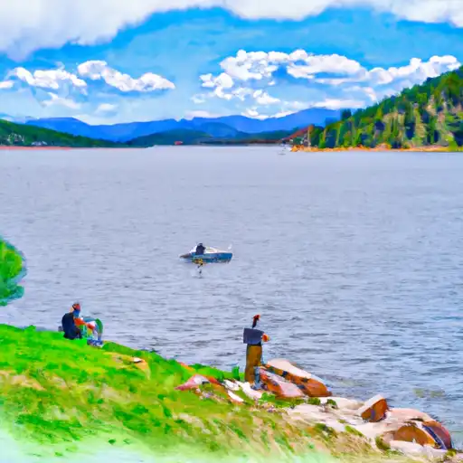
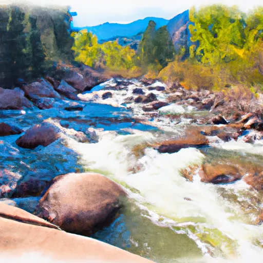
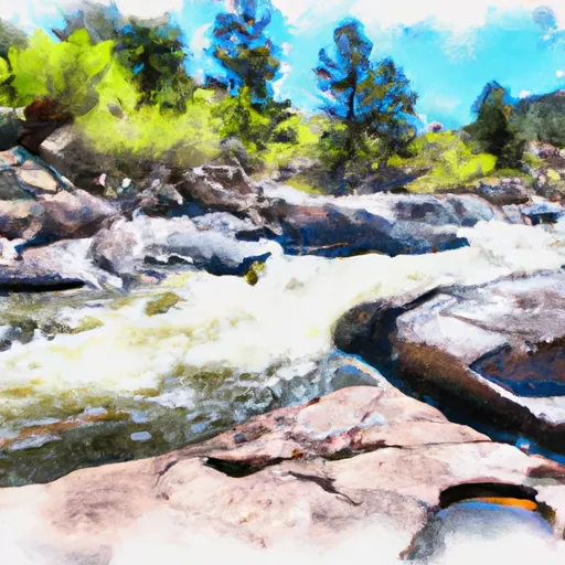
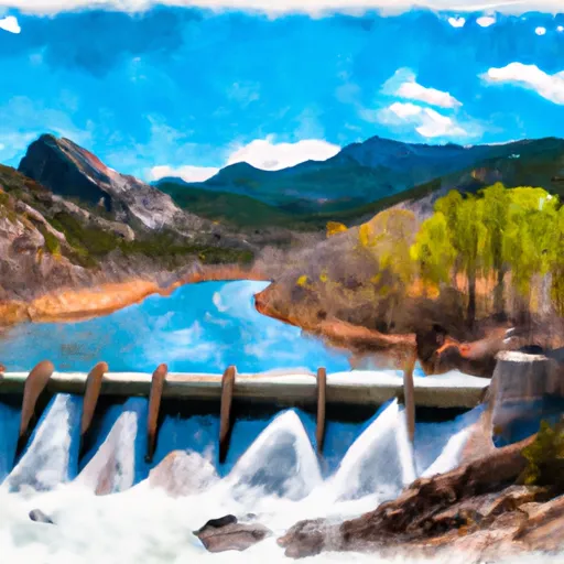
Joe Wilson Recreation Area, nestled in the scenic Teller County, Colorado, is a private water resource gem established in 1964. Managed by the Soil Conservation Service, this Earth dam stands proudly along Fish Creek, offering a tranquil environment for water and climate enthusiasts to enjoy a multitude of recreational activities. With a height of 31 feet and a maximum storage capacity of 86 acre-feet, this dam serves primarily for recreation purposes, boasting a surface area of 6 acres and a drainage area of 16 square miles.
The dam's spillway, with a width of 83 feet, ensures uncontrolled water release in case of overflow, maintaining a low hazard potential and a satisfactory condition assessment. The surrounding area is regulated by the Colorado Division of Water Resources, with the state permitting, inspecting, and enforcing safety measures regularly. Joe Wilson Recreation Area is a haven for outdoor adventurers, offering a serene escape for fishing, boating, and wildlife observation, all against the backdrop of the stunning Wilson Lake Sports. With its rich history and captivating natural beauty, this hidden gem is definitely worth exploring for anyone with a passion for water resources and climate conservation.
Visitors can immerse themselves in the tranquility of the surroundings, knowing that the dam's risk assessment is moderate and that emergency preparedness measures are in place. The recreational area provides a safe and enjoyable experience for all, with a slide outlet gate and a history of regular inspections to ensure the dam's integrity. So, whether you're seeking a peaceful day by the water or an adventure-filled outing, Joe Wilson Recreation Area promises an unforgettable experience in the heart of Colorado's majestic landscape.
Plan around the weather
Same NOAA / yr.no feed Snoflo's iOS app uses. Watch the precipitation column on the meteogram -- rain on the basin upstream typically lifts inflow 24-72 hours later.
Next 5 days, hour by hour
Temperature line with weather symbols on top, snow + rain accumulation as columns, humidity as a dotted line.
5-day forecast table
Every 3 hours, broken out across temperature, snow, rain, humidity, and wind. Each cell is colour-coded relative to the column min/max.
| Time | Condition | Temp (°F) | Snow (in) | Rain (in) | Humidity (%) | Wind (mps) | Wind dir |
|---|---|---|---|---|---|---|---|
| Loading detailed forecast… | |||||||
15-day temperature & precipitation
Daily temperatures, snow, and rain projected over the next two weeks.
Nearby streamflow gauges
USGS streamgauges around Joe Wilson Recr. -- inflows here typically show up in storage 24-72 hours later.
| Streamgauge | Discharge | View |
|---|---|---|
| South Platte River Near Lake George | 101 cfs | → |
| S Platte R Ab 11-Mile Canyon Re | 93 cfs | → |
| South Platte River Above Cheesman Lake | 108 cfs | → |
| West Cr. Abv Shrewsbury Gulch Nr Westcreek Co | 1 cfs | → |
| South Platte River Below Cheesman Lake | 239 cfs | → |
| Trout Creek Blw Fern Cr Nr Westcreek | 1 cfs | → |


About Joe Wilson Recr.
Where does the data for Joe Wilson Recr. come from?
Structural and regulatory data come from the U.S. Army Corps of Engineers' National Inventory of Dams (NID). Weather forecast comes from NOAA / yr.no -- the same feed Snoflo's iOS app uses.
How often is the report updated?
NID structural data refreshes annually as the Corps publishes updated assessments. The weather forecast refreshes throughout the day.
What does the Low hazard rating mean?
The Corps of Engineers' hazard potential classification grades probable consequences if the dam fails: High = probable loss of human life; Significant = no probable loss of human life but possible economic loss / environmental damage; Low = no probable loss of human life, only minor economic / environmental losses. See the Dam Data Reference card below for the full definitions.
What's "% of normal"?
The current storage value compared to the historical average storage on this calendar day. 100% = right on average; values above 100% mean above-normal storage (wet year); values below mean below-normal (dry year or drought).
Can I get alerts when storage crosses a threshold?
Yes -- alerts are managed in the Snoflo iOS app. Favorite this dam, set a threshold, and you'll get a push the moment conditions cross.
Dam data reference
Condition Assessment
- Satisfactory
- No existing or potential dam safety deficiencies are recognized. Acceptable performance is expected under all loading conditions (static, hydrologic, seismic) in accordance with the minimum applicable state or federal regulatory criteria or tolerable risk guidelines.
- Fair
- No existing dam safety deficiencies are recognized for normal operating conditions. Rare or extreme hydrologic and/or seismic events may result in a dam safety deficiency. Risk may be in the range to take further action.
- Poor
- A dam safety deficiency is recognized for normal operating conditions which may realistically occur. Remedial action is necessary. POOR may also be used when uncertainties exist as to critical analysis parameters which identify a potential dam safety deficiency.
- Unsatisfactory
- A dam safety deficiency is recognized that requires immediate or emergency remedial action for problem resolution.
- Not Rated
- The dam has not been inspected, is not under state or federal jurisdiction, or has been inspected but, for whatever reason, has not been rated.
Hazard Potential Classification
- High
- Dams assigned the high hazard potential classification are those where failure or mis-operation will probably cause loss of human life.
- Significant
- Dams assigned the significant hazard potential classification are those dams where failure or mis-operation results in no probable loss of human life but can cause economic loss, environmental damage, disruption of lifeline facilities, or impact other concerns. Significant hazard potential classification dams are often located in predominantly rural or agricultural areas but could be in areas with population and significant infrastructure.
- Low
- Dams assigned the low hazard potential classification are those where failure or mis-operation results in no probable loss of human life and low economic and/or environmental losses. Losses are principally limited to the owner's property.
- Undetermined
- Dams for which a downstream hazard potential has not been designated or is not provided.