Long Hollow Dam

Long Hollow
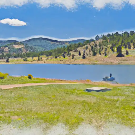
Long Hollow, also known as Bobby K Taylor Reservoir, is a private water resource located in La Plata, Colorado. Managed by GEI Consultants, Inc., this earth dam was completed in 2014 and stands at a height of 110 feet, with a storage capacity of 8,592 acre-feet for irrigation, recreation, and water supply purposes. The reservoir covers a surface area of 250 acres and has a maximum discharge of 19,500 cubic feet per second, making it a significant water source in the region.
Despite its high hazard potential, Long Hollow has been assessed to be in satisfactory condition as of March 2020, with regular inspections conducted to ensure its safety. The dam's spillway type is uncontrolled, with a width of 100 feet, and it is designed to withstand potential risks associated with its location. With its moderate risk assessment rating of 3, the reservoir plays a crucial role in water management in the area, providing essential resources for agricultural and recreational activities while adhering to state regulations and enforcement.
Overall, Long Hollow serves as a vital infrastructure for water storage and distribution in Colorado. With its modern design and efficient operation, the reservoir exemplifies the importance of sustainable water resource management in the face of changing climate conditions, showcasing the resilience and adaptability needed to address the challenges of the future.
Plan around the weather
Same NOAA / yr.no feed Snoflo's iOS app uses. Watch the precipitation column on the meteogram -- rain on the basin upstream typically lifts inflow 24-72 hours later.
Next 5 days, hour by hour
Temperature line with weather symbols on top, snow + rain accumulation as columns, humidity as a dotted line.
5-day forecast table
Every 3 hours, broken out across temperature, snow, rain, humidity, and wind. Each cell is colour-coded relative to the column min/max.
| Time | Condition | Temp (°F) | Snow (in) | Rain (in) | Humidity (%) | Wind (mps) | Wind dir |
|---|---|---|---|---|---|---|---|
| Loading detailed forecast… | |||||||
15-day temperature & precipitation
Daily temperatures, snow, and rain projected over the next two weeks.
Nearby streamflow gauges
USGS streamgauges around Long Hollow -- inflows here typically show up in storage 24-72 hours later.
| Streamgauge | Discharge | View |
|---|---|---|
| La Plata River At Colorado-New Mexico State Line | 2 cfs | → |
| La Plata River At La Plata | 1 cfs | → |
| Animas River Near Cedar Hill | 233 cfs | → |
| Florida River At Bondad | -888 cfs | → |
| La Plata River At Hesperus | 4 cfs | → |
| Animas River Below Aztec | 122 cfs | → |
Make a day of it
Boat launches, lakeside camping, fishing access, and other reservoirs near Long Hollow.
Boat launches
See all →


Campgrounds
See all →


Fishing spots
See all →


River runs
See all →


About Long Hollow
Where does the data for Long Hollow come from?
Structural and regulatory data come from the U.S. Army Corps of Engineers' National Inventory of Dams (NID). Weather forecast comes from NOAA / yr.no -- the same feed Snoflo's iOS app uses.
How often is the report updated?
NID structural data refreshes annually as the Corps publishes updated assessments. The weather forecast refreshes throughout the day.
What does the High hazard rating mean?
The Corps of Engineers' hazard potential classification grades probable consequences if the dam fails: High = probable loss of human life; Significant = no probable loss of human life but possible economic loss / environmental damage; Low = no probable loss of human life, only minor economic / environmental losses. See the Dam Data Reference card below for the full definitions.
What's "% of normal"?
The current storage value compared to the historical average storage on this calendar day. 100% = right on average; values above 100% mean above-normal storage (wet year); values below mean below-normal (dry year or drought).
Can I get alerts when storage crosses a threshold?
Yes -- alerts are managed in the Snoflo iOS app. Favorite this dam, set a threshold, and you'll get a push the moment conditions cross.
Dam data reference
Condition Assessment
- Satisfactory
- No existing or potential dam safety deficiencies are recognized. Acceptable performance is expected under all loading conditions (static, hydrologic, seismic) in accordance with the minimum applicable state or federal regulatory criteria or tolerable risk guidelines.
- Fair
- No existing dam safety deficiencies are recognized for normal operating conditions. Rare or extreme hydrologic and/or seismic events may result in a dam safety deficiency. Risk may be in the range to take further action.
- Poor
- A dam safety deficiency is recognized for normal operating conditions which may realistically occur. Remedial action is necessary. POOR may also be used when uncertainties exist as to critical analysis parameters which identify a potential dam safety deficiency.
- Unsatisfactory
- A dam safety deficiency is recognized that requires immediate or emergency remedial action for problem resolution.
- Not Rated
- The dam has not been inspected, is not under state or federal jurisdiction, or has been inspected but, for whatever reason, has not been rated.
Hazard Potential Classification
- High
- Dams assigned the high hazard potential classification are those where failure or mis-operation will probably cause loss of human life.
- Significant
- Dams assigned the significant hazard potential classification are those dams where failure or mis-operation results in no probable loss of human life but can cause economic loss, environmental damage, disruption of lifeline facilities, or impact other concerns. Significant hazard potential classification dams are often located in predominantly rural or agricultural areas but could be in areas with population and significant infrastructure.
- Low
- Dams assigned the low hazard potential classification are those where failure or mis-operation results in no probable loss of human life and low economic and/or environmental losses. Losses are principally limited to the owner's property.
- Undetermined
- Dams for which a downstream hazard potential has not been designated or is not provided.