Big Birch Lake Dam

Big Birch Lake
Big Birch Lake in Todd, Minnesota, is a captivating destination for water resource and climate enthusiasts. This concrete dam, completed in 1992, serves as a Fish and Wildlife Pond with a storage capacity of 81,434 acre-feet. The dam stands at a height of 12 feet and spans 16 feet in length, regulating water flow through Adley Creek. Managed by the Minnesota Department of Natural Resources, the dam is state-regulated, permitted, inspected, and enforced to ensure its safety and integrity.
The lake covers an expansive surface area of 2,112 acres, with a drainage area of 22 square miles and a normal storage capacity of 75,005 acre-feet. Despite its low hazard potential, the dam's risk assessment is rated as very high, highlighting the importance of effective risk management measures. With its controlled spillway and stable condition, Big Birch Lake provides a scenic and sustainable habitat for wildlife while offering recreational opportunities for visitors to enjoy its pristine waters.
Water enthusiasts can appreciate the engineering marvel of Big Birch Lake's dam, designed by Erickson Eng, and its crucial role in maintaining ecological balance and water resource management in the region. As a state-regulated structure with a focus on conservation and wildlife preservation, this picturesque destination showcases the harmonious coexistence of human intervention and natural beauty, making it a must-visit location for those passionate about water resources and climate sustainability.
Plan around the weather
Same NOAA / yr.no feed Snoflo's iOS app uses. Watch the precipitation column on the meteogram -- rain on the basin upstream typically lifts inflow 24-72 hours later.
Next 5 days, hour by hour
Temperature line with weather symbols on top, snow + rain accumulation as columns, humidity as a dotted line.
5-day forecast table
Every 3 hours, broken out across temperature, snow, rain, humidity, and wind. Each cell is colour-coded relative to the column min/max.
| Time | Condition | Temp (°F) | Snow (in) | Rain (in) | Humidity (%) | Wind (mps) | Wind dir |
|---|---|---|---|---|---|---|---|
| Loading detailed forecast… | |||||||
15-day temperature & precipitation
Daily temperatures, snow, and rain projected over the next two weeks.
Nearby streamflow gauges
USGS streamgauges around Big Birch Lake -- inflows here typically show up in storage 24-72 hours later.
| Streamgauge | Discharge | View |
|---|---|---|
| Long Prairie River At Long Prairie | 71 cfs | → |
| Mississippi River Near Royalton | 1,130 cfs | → |
| Sauk River Near St. Cloud | 136 cfs | → |
| Mississippi River At St. Cloud | 1,690 cfs | → |
| Crow Wing River Near Pillager | 460 cfs | → |
| Mississippi River At Brainerd | 808 cfs | → |
Make a day of it
Boat launches, lakeside camping, fishing access, and other reservoirs near Big Birch Lake.
Boat launches
See all →


Campgrounds
See all →


Fishing spots
See all →


River runs
See all →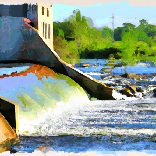


About Big Birch Lake
Where does the data for Big Birch Lake come from?
Structural and regulatory data come from the U.S. Army Corps of Engineers' National Inventory of Dams (NID). Weather forecast comes from NOAA / yr.no -- the same feed Snoflo's iOS app uses.
How often is the report updated?
NID structural data refreshes annually as the Corps publishes updated assessments. The weather forecast refreshes throughout the day.
What does the Low hazard rating mean?
The Corps of Engineers' hazard potential classification grades probable consequences if the dam fails: High = probable loss of human life; Significant = no probable loss of human life but possible economic loss / environmental damage; Low = no probable loss of human life, only minor economic / environmental losses. See the Dam Data Reference card below for the full definitions.
What's "% of normal"?
The current storage value compared to the historical average storage on this calendar day. 100% = right on average; values above 100% mean above-normal storage (wet year); values below mean below-normal (dry year or drought).
Can I get alerts when storage crosses a threshold?
Yes -- alerts are managed in the Snoflo iOS app. Favorite this dam, set a threshold, and you'll get a push the moment conditions cross.
Dam data reference
Condition Assessment
- Satisfactory
- No existing or potential dam safety deficiencies are recognized. Acceptable performance is expected under all loading conditions (static, hydrologic, seismic) in accordance with the minimum applicable state or federal regulatory criteria or tolerable risk guidelines.
- Fair
- No existing dam safety deficiencies are recognized for normal operating conditions. Rare or extreme hydrologic and/or seismic events may result in a dam safety deficiency. Risk may be in the range to take further action.
- Poor
- A dam safety deficiency is recognized for normal operating conditions which may realistically occur. Remedial action is necessary. POOR may also be used when uncertainties exist as to critical analysis parameters which identify a potential dam safety deficiency.
- Unsatisfactory
- A dam safety deficiency is recognized that requires immediate or emergency remedial action for problem resolution.
- Not Rated
- The dam has not been inspected, is not under state or federal jurisdiction, or has been inspected but, for whatever reason, has not been rated.
Hazard Potential Classification
- High
- Dams assigned the high hazard potential classification are those where failure or mis-operation will probably cause loss of human life.
- Significant
- Dams assigned the significant hazard potential classification are those dams where failure or mis-operation results in no probable loss of human life but can cause economic loss, environmental damage, disruption of lifeline facilities, or impact other concerns. Significant hazard potential classification dams are often located in predominantly rural or agricultural areas but could be in areas with population and significant infrastructure.
- Low
- Dams assigned the low hazard potential classification are those where failure or mis-operation results in no probable loss of human life and low economic and/or environmental losses. Losses are principally limited to the owner's property.
- Undetermined
- Dams for which a downstream hazard potential has not been designated or is not provided.