Sandarosa Dam

Sandarosa
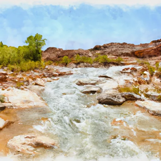
Sandarosa is a privately owned irrigation dam located in Box Elder, Utah, along the Deep Creek. Managed by the Utah Division of Water Rights, this Earth-type dam was completed in 1982 and has a structural height of 47 feet, providing a storage capacity of 3750 acre-feet for irrigation purposes. The dam is situated in a low hazard area with a low risk potential, as indicated by the inspection data from June 2019.
Despite its relatively low risk profile, Sandarosa plays a crucial role in the local water resource management, supporting agricultural activities in the region. The dam's design and construction ensure efficient water storage and distribution for irrigation needs, contributing to the overall water supply sustainability in the area. With state regulatory oversight and regular inspections, Sandarosa remains a reliable infrastructure for water management in the region.
As a key component of the water infrastructure in Box Elder, Utah, Sandarosa reflects the collaborative efforts between private ownership and state regulation to ensure the safety and efficiency of water resource utilization. With its strategic location along the Deep Creek and the support of the Utah Division of Water Rights, Sandarosa stands as a testament to effective water management practices that balance agricultural needs with environmental conservation in the region.
Plan around the weather
Same NOAA / yr.no feed Snoflo's iOS app uses. Watch the precipitation column on the meteogram -- rain on the basin upstream typically lifts inflow 24-72 hours later.
Next 5 days, hour by hour
Temperature line with weather symbols on top, snow + rain accumulation as columns, humidity as a dotted line.
5-day forecast table
Every 3 hours, broken out across temperature, snow, rain, humidity, and wind. Each cell is colour-coded relative to the column min/max.
| Time | Condition | Temp (°F) | Snow (in) | Rain (in) | Humidity (%) | Wind (mps) | Wind dir |
|---|---|---|---|---|---|---|---|
| Loading detailed forecast… | |||||||
15-day temperature & precipitation
Daily temperatures, snow, and rain projected over the next two weeks.
Nearby streamflow gauges
USGS streamgauges around Sandarosa -- inflows here typically show up in storage 24-72 hours later.
| Streamgauge | Discharge | View |
|---|---|---|
| Dunn Creek Near Park Valley | 0 cfs | → |
| Raft River Ab Onemile Creek Nr Malta Id | 2 cfs | → |
| Bear River Near Corinne | 141 cfs | → |
| Bear River At Idaho-Utah State Line | 843 cfs | → |
| Marsh Creek Nr Mccammon Id | 26 cfs | → |
| Logan River Above State Dam | 98 cfs | → |


About Sandarosa
Where does the data for Sandarosa come from?
Structural and regulatory data come from the U.S. Army Corps of Engineers' National Inventory of Dams (NID). Weather forecast comes from NOAA / yr.no -- the same feed Snoflo's iOS app uses.
How often is the report updated?
NID structural data refreshes annually as the Corps publishes updated assessments. The weather forecast refreshes throughout the day.
What does the Low hazard rating mean?
The Corps of Engineers' hazard potential classification grades probable consequences if the dam fails: High = probable loss of human life; Significant = no probable loss of human life but possible economic loss / environmental damage; Low = no probable loss of human life, only minor economic / environmental losses. See the Dam Data Reference card below for the full definitions.
What's "% of normal"?
The current storage value compared to the historical average storage on this calendar day. 100% = right on average; values above 100% mean above-normal storage (wet year); values below mean below-normal (dry year or drought).
Can I get alerts when storage crosses a threshold?
Yes -- alerts are managed in the Snoflo iOS app. Favorite this dam, set a threshold, and you'll get a push the moment conditions cross.
Dam data reference
Condition Assessment
- Satisfactory
- No existing or potential dam safety deficiencies are recognized. Acceptable performance is expected under all loading conditions (static, hydrologic, seismic) in accordance with the minimum applicable state or federal regulatory criteria or tolerable risk guidelines.
- Fair
- No existing dam safety deficiencies are recognized for normal operating conditions. Rare or extreme hydrologic and/or seismic events may result in a dam safety deficiency. Risk may be in the range to take further action.
- Poor
- A dam safety deficiency is recognized for normal operating conditions which may realistically occur. Remedial action is necessary. POOR may also be used when uncertainties exist as to critical analysis parameters which identify a potential dam safety deficiency.
- Unsatisfactory
- A dam safety deficiency is recognized that requires immediate or emergency remedial action for problem resolution.
- Not Rated
- The dam has not been inspected, is not under state or federal jurisdiction, or has been inspected but, for whatever reason, has not been rated.
Hazard Potential Classification
- High
- Dams assigned the high hazard potential classification are those where failure or mis-operation will probably cause loss of human life.
- Significant
- Dams assigned the significant hazard potential classification are those dams where failure or mis-operation results in no probable loss of human life but can cause economic loss, environmental damage, disruption of lifeline facilities, or impact other concerns. Significant hazard potential classification dams are often located in predominantly rural or agricultural areas but could be in areas with population and significant infrastructure.
- Low
- Dams assigned the low hazard potential classification are those where failure or mis-operation results in no probable loss of human life and low economic and/or environmental losses. Losses are principally limited to the owner's property.
- Undetermined
- Dams for which a downstream hazard potential has not been designated or is not provided.