Patch Inc. Dam

Patch Inc. Dam
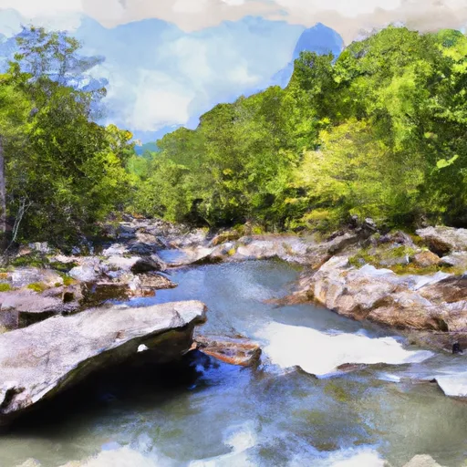
Patch INC. Dam, located in Carroll, Virginia, is a state-regulated structure with a primary purpose of recreation. Standing at a height of 40 feet, this earth dam provides essential fire protection and serves as a stock or small fish pond, in addition to its recreational function. Managed by the Department of Conservation and Recreation, this dam has a storage capacity of 45 acre-feet, making it a valuable resource for water conservation in the region.
While the hazard potential of Patch INC. Dam is currently undetermined, with its condition not yet rated, the structure undergoes regular inspections to ensure its safety and functionality. Despite lacking certain details such as completion year and specific dimensions, the dam's significance lies in its contribution to water resource management and recreational activities in the area. As a key element in the local landscape, this dam underscores the importance of sustainable water use and climate resilience in the face of evolving environmental challenges.
With its picturesque location and vital role in providing water storage and recreational opportunities, Patch INC. Dam stands as a testament to the intersection of water resource management and climate adaptation. As enthusiasts of water resources and climate change, it is imperative to monitor and support initiatives that promote the sustainable utilization of such infrastructure for the benefit of both present and future generations.
Plan around the weather
Same NOAA / yr.no feed Snoflo's iOS app uses. Watch the precipitation column on the meteogram -- rain on the basin upstream typically lifts inflow 24-72 hours later.
Next 5 days, hour by hour
Temperature line with weather symbols on top, snow + rain accumulation as columns, humidity as a dotted line.
5-day forecast table
Every 3 hours, broken out across temperature, snow, rain, humidity, and wind. Each cell is colour-coded relative to the column min/max.
| Time | Condition | Temp (°F) | Snow (in) | Rain (in) | Humidity (%) | Wind (mps) | Wind dir |
|---|---|---|---|---|---|---|---|
| Loading detailed forecast… | |||||||
15-day temperature & precipitation
Daily temperatures, snow, and rain projected over the next two weeks.
Nearby streamflow gauges
USGS streamgauges around Patch Inc. Dam -- inflows here typically show up in storage 24-72 hours later.
| Streamgauge | Discharge | View |
|---|---|---|
| Chestnut Creek At Galax | 38 cfs | → |
| New River Near Galax | 1,000 cfs | → |
| New River At Ivanhoe | 1,390 cfs | → |
| New River At Allisonia | 1,950 cfs | → |
| Ararat River At Ararat | 145 cfs | → |
| Reed Creek At Grahams Forge | 154 cfs | → |
Make a day of it
Boat launches, lakeside camping, fishing access, and other reservoirs near Patch Inc. Dam.
Boat launches
See all →


Campgrounds
See all →


Fishing spots
See all →


River runs
See all →


About Patch Inc. Dam
Where does the data for Patch Inc. Dam come from?
Structural and regulatory data come from the U.S. Army Corps of Engineers' National Inventory of Dams (NID). Weather forecast comes from NOAA / yr.no -- the same feed Snoflo's iOS app uses.
How often is the report updated?
NID structural data refreshes annually as the Corps publishes updated assessments. The weather forecast refreshes throughout the day.
What does the Undetermined hazard rating mean?
The Corps of Engineers' hazard potential classification grades probable consequences if the dam fails: High = probable loss of human life; Significant = no probable loss of human life but possible economic loss / environmental damage; Low = no probable loss of human life, only minor economic / environmental losses. See the Dam Data Reference card below for the full definitions.
What's "% of normal"?
The current storage value compared to the historical average storage on this calendar day. 100% = right on average; values above 100% mean above-normal storage (wet year); values below mean below-normal (dry year or drought).
Can I get alerts when storage crosses a threshold?
Yes -- alerts are managed in the Snoflo iOS app. Favorite this dam, set a threshold, and you'll get a push the moment conditions cross.
Dam data reference
Condition Assessment
- Satisfactory
- No existing or potential dam safety deficiencies are recognized. Acceptable performance is expected under all loading conditions (static, hydrologic, seismic) in accordance with the minimum applicable state or federal regulatory criteria or tolerable risk guidelines.
- Fair
- No existing dam safety deficiencies are recognized for normal operating conditions. Rare or extreme hydrologic and/or seismic events may result in a dam safety deficiency. Risk may be in the range to take further action.
- Poor
- A dam safety deficiency is recognized for normal operating conditions which may realistically occur. Remedial action is necessary. POOR may also be used when uncertainties exist as to critical analysis parameters which identify a potential dam safety deficiency.
- Unsatisfactory
- A dam safety deficiency is recognized that requires immediate or emergency remedial action for problem resolution.
- Not Rated
- The dam has not been inspected, is not under state or federal jurisdiction, or has been inspected but, for whatever reason, has not been rated.
Hazard Potential Classification
- High
- Dams assigned the high hazard potential classification are those where failure or mis-operation will probably cause loss of human life.
- Significant
- Dams assigned the significant hazard potential classification are those dams where failure or mis-operation results in no probable loss of human life but can cause economic loss, environmental damage, disruption of lifeline facilities, or impact other concerns. Significant hazard potential classification dams are often located in predominantly rural or agricultural areas but could be in areas with population and significant infrastructure.
- Low
- Dams assigned the low hazard potential classification are those where failure or mis-operation results in no probable loss of human life and low economic and/or environmental losses. Losses are principally limited to the owner's property.
- Undetermined
- Dams for which a downstream hazard potential has not been designated or is not provided.