Glade Mountain No 1 Dam

Glade Mtn No 1
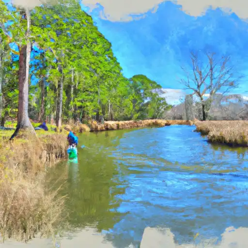
Glade Mtn No 1 is a Federal-owned dam located in Smyth, Virginia, with a primary purpose of recreation. Built in 1955 by the USDA Forest Service, this earth dam stands at 74 feet tall and spans 650 feet in length, with a storage capacity of 50 acre-feet. Despite its low hazard potential, the dam has a very high risk assessment rating of 1, indicating a need for careful monitoring and maintenance.
The dam features a controlled spillway with a width of 15 feet and outlet gates that include a slide (sluice gate). While the dam has not been rated for its condition assessment, it undergoes inspections every 10 years, with the last inspection conducted in August 2011. Although the dam does not have a state regulatory agency overseeing its operations, the Forest Service fulfills various roles from funding to construction, inspection, and regulatory functions.
Overall, Glade Mtn No 1 serves as a crucial structure for both recreational and fish and wildlife pond purposes in the area. Despite its age, the dam is well-managed by the Forest Service, ensuring the safety and integrity of the surrounding environment and water resources. Its location in the Huntington District makes it a significant contributor to the local ecosystem and a valuable asset for water resource and climate enthusiasts to study and appreciate.
Plan around the weather
Same NOAA / yr.no feed Snoflo's iOS app uses. Watch the precipitation column on the meteogram -- rain on the basin upstream typically lifts inflow 24-72 hours later.
Next 5 days, hour by hour
Temperature line with weather symbols on top, snow + rain accumulation as columns, humidity as a dotted line.
5-day forecast table
Every 3 hours, broken out across temperature, snow, rain, humidity, and wind. Each cell is colour-coded relative to the column min/max.
| Time | Condition | Temp (°F) | Snow (in) | Rain (in) | Humidity (%) | Wind (mps) | Wind dir |
|---|---|---|---|---|---|---|---|
| Loading detailed forecast… | |||||||
15-day temperature & precipitation
Daily temperatures, snow, and rain projected over the next two weeks.
Nearby streamflow gauges
USGS streamgauges around Glade Mtn No 1 -- inflows here typically show up in storage 24-72 hours later.
| Streamgauge | Discharge | View |
|---|---|---|
| M F Holston River At Seven Mile Ford | 171 cfs | → |
| S F Holston River At Riverside Nr Chilhowie | 78 cfs | → |
| New River At Ivanhoe | 1,390 cfs | → |
| N F Holston River Near Saltville | 316 cfs | → |
| New River Near Galax | 1,000 cfs | → |
| Reed Creek At Grahams Forge | 154 cfs | → |
Make a day of it
Boat launches, lakeside camping, fishing access, and other reservoirs near Glade Mtn No 1.
Boat launches
See all →


Campgrounds
See all →


River runs
See all →


About Glade Mtn No 1
Where does the data for Glade Mountain No 1 come from?
Structural and regulatory data come from the U.S. Army Corps of Engineers' National Inventory of Dams (NID). Weather forecast comes from NOAA / yr.no -- the same feed Snoflo's iOS app uses.
How often is the report updated?
NID structural data refreshes annually as the Corps publishes updated assessments. The weather forecast refreshes throughout the day.
What does the Low hazard rating mean?
The Corps of Engineers' hazard potential classification grades probable consequences if the dam fails: High = probable loss of human life; Significant = no probable loss of human life but possible economic loss / environmental damage; Low = no probable loss of human life, only minor economic / environmental losses. See the Dam Data Reference card below for the full definitions.
What's "% of normal"?
The current storage value compared to the historical average storage on this calendar day. 100% = right on average; values above 100% mean above-normal storage (wet year); values below mean below-normal (dry year or drought).
Can I get alerts when storage crosses a threshold?
Yes -- alerts are managed in the Snoflo iOS app. Favorite this dam, set a threshold, and you'll get a push the moment conditions cross.
Dam data reference
Condition Assessment
- Satisfactory
- No existing or potential dam safety deficiencies are recognized. Acceptable performance is expected under all loading conditions (static, hydrologic, seismic) in accordance with the minimum applicable state or federal regulatory criteria or tolerable risk guidelines.
- Fair
- No existing dam safety deficiencies are recognized for normal operating conditions. Rare or extreme hydrologic and/or seismic events may result in a dam safety deficiency. Risk may be in the range to take further action.
- Poor
- A dam safety deficiency is recognized for normal operating conditions which may realistically occur. Remedial action is necessary. POOR may also be used when uncertainties exist as to critical analysis parameters which identify a potential dam safety deficiency.
- Unsatisfactory
- A dam safety deficiency is recognized that requires immediate or emergency remedial action for problem resolution.
- Not Rated
- The dam has not been inspected, is not under state or federal jurisdiction, or has been inspected but, for whatever reason, has not been rated.
Hazard Potential Classification
- High
- Dams assigned the high hazard potential classification are those where failure or mis-operation will probably cause loss of human life.
- Significant
- Dams assigned the significant hazard potential classification are those dams where failure or mis-operation results in no probable loss of human life but can cause economic loss, environmental damage, disruption of lifeline facilities, or impact other concerns. Significant hazard potential classification dams are often located in predominantly rural or agricultural areas but could be in areas with population and significant infrastructure.
- Low
- Dams assigned the low hazard potential classification are those where failure or mis-operation results in no probable loss of human life and low economic and/or environmental losses. Losses are principally limited to the owner's property.
- Undetermined
- Dams for which a downstream hazard potential has not been designated or is not provided.