Summersville Dam Dam

Summersville Dam
Summersville Dam, also known as Summersville Lake, is a federal-owned rockfill dam located on the Gauley River in West Virginia. Completed in 1965, the dam serves primarily for flood risk reduction, with additional purposes including fish and wildlife pond, hydroelectric, and recreation. With a structural height of 390 feet and a storage capacity of 413,400 acre-feet, the dam plays a crucial role in reducing the risk of flooding to downstream communities, although some risk still remains due to the potential for spillway erosion and uncontrolled release of the pool.
US Army Corps of Engineers (USACE) is responsible for the design, construction, operation, and regulation of Summersville Dam. The dam is regularly inspected, monitored, and maintained to manage risks effectively. USACE collaborates with local emergency management entities and conducts dam safety training to ensure preparedness for any emergency situations. In the event of unacceptable risks, USACE implements short- and long-term actions to mitigate them, prioritizing the safety of the surrounding communities and the environment.
Despite the moderate risk assessment based on the most recent evaluation, Summersville Dam remains a critical infrastructure for flood risk reduction in the region. The dam's risk management measures, including routine inspections, continuous monitoring, and emergency response planning, demonstrate USACE's commitment to ensuring the dam's safety and the protection of downstream areas from potential flooding events.
Plan around the weather
Same NOAA / yr.no feed Snoflo's iOS app uses. Watch the precipitation column on the meteogram -- rain on the basin upstream typically lifts inflow 24-72 hours later.
Next 5 days, hour by hour
Temperature line with weather symbols on top, snow + rain accumulation as columns, humidity as a dotted line.
5-day forecast table
Every 3 hours, broken out across temperature, snow, rain, humidity, and wind. Each cell is colour-coded relative to the column min/max.
| Time | Condition | Temp (°F) | Snow (in) | Rain (in) | Humidity (%) | Wind (mps) | Wind dir |
|---|---|---|---|---|---|---|---|
| Loading detailed forecast… | |||||||
15-day temperature & precipitation
Daily temperatures, snow, and rain projected over the next two weeks.
Nearby streamflow gauges
USGS streamgauges around Summersville Dam -- inflows here typically show up in storage 24-72 hours later.
| Streamgauge | Discharge | View |
|---|---|---|
| Peters Creek Near Lockwood | 38 cfs | → |
| Meadow River At Nallen | 230 cfs | → |
| Gauley River Near Craigsville | 310 cfs | → |
| Gauley River Above Belva | 997 cfs | → |
| Kanawha River At Kanawha Falls | 5,940 cfs | → |
| Elk River At Clay | 11,200 cfs | → |
Make a day of it
Boat launches, lakeside camping, fishing access, and other reservoirs near Summersville Dam.
Boat launches
See all →


Campgrounds
See all →


River runs
See all →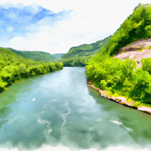


About Summersville Dam
Where does the data for Summersville Dam come from?
Structural and regulatory data come from the U.S. Army Corps of Engineers' National Inventory of Dams (NID). Weather forecast comes from NOAA / yr.no -- the same feed Snoflo's iOS app uses.
How often is the report updated?
NID structural data refreshes annually as the Corps publishes updated assessments. The weather forecast refreshes throughout the day.
What does the High hazard rating mean?
The Corps of Engineers' hazard potential classification grades probable consequences if the dam fails: High = probable loss of human life; Significant = no probable loss of human life but possible economic loss / environmental damage; Low = no probable loss of human life, only minor economic / environmental losses. See the Dam Data Reference card below for the full definitions.
What's "% of normal"?
The current storage value compared to the historical average storage on this calendar day. 100% = right on average; values above 100% mean above-normal storage (wet year); values below mean below-normal (dry year or drought).
Can I get alerts when storage crosses a threshold?
Yes -- alerts are managed in the Snoflo iOS app. Favorite this dam, set a threshold, and you'll get a push the moment conditions cross.
Dam data reference
Condition Assessment
- Satisfactory
- No existing or potential dam safety deficiencies are recognized. Acceptable performance is expected under all loading conditions (static, hydrologic, seismic) in accordance with the minimum applicable state or federal regulatory criteria or tolerable risk guidelines.
- Fair
- No existing dam safety deficiencies are recognized for normal operating conditions. Rare or extreme hydrologic and/or seismic events may result in a dam safety deficiency. Risk may be in the range to take further action.
- Poor
- A dam safety deficiency is recognized for normal operating conditions which may realistically occur. Remedial action is necessary. POOR may also be used when uncertainties exist as to critical analysis parameters which identify a potential dam safety deficiency.
- Unsatisfactory
- A dam safety deficiency is recognized that requires immediate or emergency remedial action for problem resolution.
- Not Rated
- The dam has not been inspected, is not under state or federal jurisdiction, or has been inspected but, for whatever reason, has not been rated.
Hazard Potential Classification
- High
- Dams assigned the high hazard potential classification are those where failure or mis-operation will probably cause loss of human life.
- Significant
- Dams assigned the significant hazard potential classification are those dams where failure or mis-operation results in no probable loss of human life but can cause economic loss, environmental damage, disruption of lifeline facilities, or impact other concerns. Significant hazard potential classification dams are often located in predominantly rural or agricultural areas but could be in areas with population and significant infrastructure.
- Low
- Dams assigned the low hazard potential classification are those where failure or mis-operation results in no probable loss of human life and low economic and/or environmental losses. Losses are principally limited to the owner's property.
- Undetermined
- Dams for which a downstream hazard potential has not been designated or is not provided.