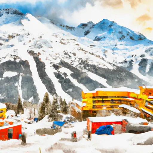
Winter Storm Warnings
February 20 2026
...ACCUMULATING SNOW ACROSS THE PANHANDLE TO END THE WEEK...
.A front continues to move across the panhandle, with additional
onshore flow behind the front generating snow showers. The
highest snow accumulations are still expected along the outer
coast with orographic enhancement. A secondary batch of heavier
showers has begun to develop along the NE gulf coast and is
anticipated to progress southward as a deformation band
associated with the surface low tonight into Friday. For inland
areas, snow is expected to be light and fluffy in nature due to
cold temperatures both aloft and down to the surface. Coastal
communities will likely see wetter snow due to slightly warming
surface temperatures through the day.
* WHAT...Snow. Additional snow accumulations of 3 to 5 inches.
* WHERE...City and Borough of Juneau.
* WHEN...Until 9 AM AKST Friday.
* IMPACTS...Travel could be difficult. The hazardous conditions
could impact the morning commute.
* ADDITIONAL DETAILS...Snow showers continue to impact the Juneau
area. These showers will last through morning and impact the
morning commute as the low dips southward into the gulf and a
deformation band sets up.
...ACCUMULATING SNOW ACROSS THE PANHANDLE TO END THE WEEK...
.A front continues to move across the panhandle, with additional
onshore flow behind the front generating snow showers. The
highest snow accumulations are still expected along the outer
coast with orographic enhancement. A secondary batch of heavier
showers has begun to develop along the NE gulf coast and is
anticipated to progress southward as a deformation band
associated with the surface low tonight into Friday. For inland
areas, snow is expected to be light and fluffy in nature due to
cold temperatures both aloft and down to the surface. Coastal
communities will likely see wetter snow due to slightly warming
surface temperatures through the day.
* WHAT...Snow. Additional snow accumulations of 2 to 4 inches.
* WHERE...Glacier Bay, Eastern Chichagof Island and Admiralty
Island.
* WHEN...Until 9 AM AKST Friday.
* IMPACTS...Travel could be very difficult.
* ADDITIONAL DETAILS...Heavier snow showers are still expected to
develop further inland overnight and last this morning as the
surface low tracks southward near the outer coast and a
deformation band sets up.
...ACCUMULATING SNOW ACROSS THE PANHANDLE TO END THE WEEK...
.A front continues to move across the panhandle, with additional
onshore flow behind the front generating snow showers. The
highest snow accumulations are still expected along the outer
coast with orographic enhancement. A secondary batch of heavier
showers has begun to develop along the NE gulf coast and is
anticipated to progress southward as a deformation band
associated with the surface low tonight into Friday. For inland
areas, snow is expected to be light and fluffy in nature due to
cold temperatures both aloft and down to the surface. Coastal
communities will likely see wetter snow due to slightly warming
surface temperatures through the day.
* WHAT...Heavy snow. Additional snow accumulations of 3 to 5
inches.
* WHERE...City and Borough of Sitka.
* WHEN...Until 9 AM AKST Friday.
* IMPACTS...Travel will be very difficult. The hazardous
conditions could impact the morning commute.
* ADDITIONAL DETAILS...A secondary surge of heavier showers is
expected to impact the area this morning as the surface low
drops southward into the gulf.
...ACCUMULATING SNOW ACROSS THE PANHANDLE TO END THE WEEK...
.A front continues to move across the panhandle, with additional
onshore flow behind the front generating snow showers. The
highest snow accumulations are still expected along the outer
coast with orographic enhancement. A secondary batch of heavier
showers has begun to develop along the NE gulf coast and is
anticipated to progress southward as a deformation band
associated with the surface low tonight into Friday. For inland
areas, snow is expected to be light and fluffy in nature due to
cold temperatures both aloft and down to the surface. Coastal
communities will likely see wetter snow due to slightly warming
surface temperatures through the day.
* WHAT...Heavy snow. Additional snow accumulations of 2 to 4
inches.
* WHERE...Prince of Wales Island.
* WHEN...Until 9 AM AKST Friday.
* IMPACTS...Travel will be very difficult.
* ADDITIONAL DETAILS...The heaviest snow showers are expected to
impact the northern half of Prince of Wales Island through this
morning. For the far southeastern coast, snow showers may
increase in intensity as the low tracks southward and winds
increase out of the southeast today.
...ACCUMULATING SNOW ACROSS THE PANHANDLE TO END THE WEEK...
.A front continues to move across the panhandle, with additional
onshore flow behind the front generating snow showers. The
highest snow accumulations are still expected along the outer
coast with orographic enhancement. A secondary batch of heavier
showers has begun to develop along the NE gulf coast and is
anticipated to progress southward as a deformation band
associated with the surface low tonight into Friday. For inland
areas, snow is expected to be light and fluffy in nature due to
cold temperatures both aloft and down to the surface. Coastal
communities will likely see wetter snow due to slightly warming
surface temperatures through the day.
* WHAT...Snow. Additional snow accumulations of 2 to 7 inches.
* WHERE...Ketchikan Gateway Borough and Annette Island.
* WHEN...From 6 PM this evening to 9 AM AKST Friday.
* IMPACTS...Travel could be very difficult. The hazardous
conditions could impact the morning commute.
* ADDITIONAL DETAILS...The heaviest snowfall rates are expected
through this morning as the low drifts southward in the gulf
and southeasterly winds increase along Dixon Entrance.
...ACCUMULATING SNOW ACROSS THE PANHANDLE TO END THE WEEK...
.A front continues to move across the panhandle, with additional
onshore flow behind the front generating snow showers. The
highest snow accumulations are still expected along the outer
coast with orographic enhancement. A secondary batch of heavier
showers has begun to develop along the NE gulf coast and is
anticipated to progress southward as a deformation band
associated with the surface low tonight into Friday. For inland
areas, snow is expected to be light and fluffy in nature due to
cold temperatures both aloft and down to the surface. Coastal
communities will likely see wetter snow due to slightly warming
surface temperatures through the day.
* WHAT...Snow. Additional snow accumulations of 1 to 3 inches.
* WHERE...Petersburg Borough, Western Kupreanof Island and Kuiu
Island and City and Borough of Wrangell.
* WHEN...Until 6 AM AKST Friday.
* IMPACTS...Travel could be very difficult.
* ADDITIONAL DETAILS...A secondary batch of heavier showers
remains possible as the surface low drops southward in the gulf
today.
...ACCUMULATING SNOW ACROSS THE PANHANDLE TO END THE WEEK...
.A front continues to move across the panhandle, with additional
onshore flow behind the front generating snow showers. The
highest snow accumulations are still expected along the outer
coast with orographic enhancement. A secondary batch of heavier
showers has begun to develop along the NE gulf coast and is
anticipated to progress southward as a deformation band
associated with the surface low tonight into Friday. For inland
areas, snow is expected to be light and fluffy in nature due to
cold temperatures both aloft and down to the surface. Coastal
communities will likely see wetter snow due to slightly warming
surface temperatures through the day.
* WHAT...Heavy snow. Additional snow accumulations of 2 to 4
inches.
* WHERE...Cape Fairweather to Lisianski Strait.
* WHEN...Until 6 AM AKST Friday.
* IMPACTS...Travel will be very difficult.
* ADDITIONAL DETAILS...A secondary batch of heavier showers will
then impact the area as a surface low develops and drops
southward into the gulf this morning.
* WHAT...Blizzard conditions possible. Total snow accumulations
between 4 and 8 inches possible. Winds could gust as high as 50
mph.
* WHERE...Bering Strait Coast, Interior Seward Peninsula, Northern
Seward Peninsula, Shishmaref, and Southern Seward Peninsula Coast.
* WHEN...From late Friday night through Sunday afternoon.
* IMPACTS...Visibilities may drop below 1/4 mile due to falling and
blowing snow. Travel could be very difficult. Areas of blowing
snow could significantly reduce visibility. Gusty winds could
bring down tree branches.
* ADDITIONAL DETAILS...Freezing rain and rain may mix in at times
along the coast.
* WHAT...Blizzard conditions possible. Total snow accumulations
between 5 and 10 inches possible. Winds could gust as high as 65
mph.
* WHERE...Baldwin Peninsula, Kivalina and Red Dog Dock, Lower Kobuk
Valley, and Noatak Valley.
* WHEN...From late Friday night through Sunday afternoon.
* IMPACTS...Visibilities may drop below 1/4 mile due to falling and
blowing snow. Travel could be very difficult. Areas of blowing
snow could significantly reduce visibility.
* WHAT...Blizzard conditions possible. Total snow accumulations
between 4 and 8 inches possible. Winds could gust as high as 60
mph.
* WHERE...Central Arctic Plains, Central Beaufort Sea Coast, Central
Brooks Range, Eastern Beaufort Sea Coast, and Romanzof Mountains.
* WHEN...From Saturday afternoon through late Monday night.
* IMPACTS...Whiteout conditions are possible and may make travel
treacherous and potentially life-threatening. Travel could be
difficult. Areas of blowing snow could significantly reduce
visibility.
* WHAT...Blizzard conditions possible. Total snow accumulations
between 5 and 10 inches possible. Winds could gust as high as 65
mph.
* WHERE...Howard Pass and the Delong Mountains, Northern Arctic
Coast, Northwest Arctic Coast, and Western Arctic Plains.
* WHEN...From Saturday morning through Monday morning.
* IMPACTS...Whiteout conditions are possible and may make travel
treacherous and potentially life-threatening. Travel could be
difficult. Areas of blowing snow could significantly reduce
visibility. Very strong winds could result in power outages.
* WHAT...Blizzard conditions possible. Total snow accumulations
between 4 and 10 inches possible. Winds could gust as high as 70
mph.
* WHERE...Western Arctic Coast.
* WHEN...From late Friday night through Sunday afternoon.
* IMPACTS...Visibilities may drop below 1/4 mile due to falling and
blowing snow. Travel could be very difficult. Areas of blowing
snow could significantly reduce visibility. Very strong winds
could result in power outages.
* WHAT...For the Small Craft Advisory, east winds 20 to 25 kt
with gusts up to 35 kt and seas 8 to 11 ft. For the first Gale
Warning, northeast winds 30 to 40 kt with gusts up to 55 kt
and seas 7 to 12 ft expected. For the Storm Warning, northeast
winds 30 to 40 kt with gusts up to 55 kt and seas 7 to 11 ft
expected. For the second Gale Warning, northeast winds 30 to
40 kt with gusts up to 55 kt and seas 7 to 10 ft expected.
* WHERE...Cape Spencer to Cape Fairweather out to 15 NM.
* WHEN...For the Small Craft Advisory, until 6 AM AKST early
this morning. For the first Gale Warning, from 6 AM this
morning to midnight AKST tonight. For the Storm Warning, from
midnight tonight to 3 AM AKST Saturday. For the second Gale
Warning, from 3 AM to 6 AM AKST Saturday.
* IMPACTS...Storm force winds and hazardous seas will capsize or
damage vessels and reduce visibility.
* WHAT...For the Gale Warning, north winds 35 to 45 kt with
gusts up to 50 kt and seas 7 to 12 ft expected. For the Heavy
Freezing Spray Warning, heavy freezing spray at a rate of 2 cm
per hour or greater expected, and may rapidly accumulate on
vessels.
* WHERE...Northern Lynn Canal.
* WHEN...For the Gale Warning, from 6 AM this morning to 6 AM
AKST Saturday. For the Heavy Freezing Spray Warning, from 3 AM
to 6 AM AKST Saturday.
* IMPACTS...Operating a vessel in heavy freezing spray is
hazardous. Freezing spray may render mechanical and electronic
components inoperative. Rapid ice accretion on decks and
superstructures may result in a catastrophic loss of stability.
Strong winds will cause hazardous seas which could capsize or
damage vessels and reduce visibility.
* WHAT...For the Gale Warning, northeast winds 30 to 40 kt with
gusts up to 55 kt and seas 7 to 9 ft. For the Storm Warning,
northeast winds 35 to 45 kt with gusts up to 65 kt and seas 6
to 9 ft expected. For the Heavy Freezing Spray Warning, heavy
freezing spray at a rate of 2 cm per hour or greater expected,
and may rapidly accumulate on vessels.
* WHERE...Yakutat Bay.
* WHEN...For the Gale Warning, until 6 AM AKST early this
morning. For the Storm Warning, from 6 AM this morning to 6 AM
AKST Saturday. For the Heavy Freezing Spray Warning, from 9 PM
this evening to 6 AM AKST Saturday.
* IMPACTS...Operating a vessel in heavy freezing spray is
hazardous. Freezing spray may render mechanical and electronic
components inoperative. Rapid ice accretion on decks and
superstructures may result in a catastrophic loss of stability.
Storm force winds and hazardous seas will capsize or damage
vessels and reduce visibility.
* WHAT...For the first Gale Warning, northeast winds 30 to 40 kt
with gusts up to 55 kt and seas 7 to 12 ft expected. For the
Storm Warning, northeast winds 35 to 45 kt with gusts up to 60
kt and seas 8 to 13 ft expected. For the second Gale Warning,
northeast winds 30 to 40 kt with gusts up to 60 kt and seas 7
to 10 ft expected.
* WHERE...Cape Fairweather to Icy Cape out to 15 NM.
* WHEN...For the first Gale Warning, until noon AKST today. For
the Storm Warning, from noon today to 3 AM AKST Saturday. For
the second Gale Warning, from 3 AM to 6 AM AKST Saturday.
* IMPACTS...Storm force winds and hazardous seas will capsize or
damage vessels and reduce visibility.
* WHAT...For the Small Craft Advisory, north winds 20 to 30 kt
with gusts up to 35 kt expected. For the Gale Warning, north
winds 25 to 35 kt with gusts up to 45 kt expected. For the
Heavy Freezing Spray Warning, heavy freezing spray at a rate
of 2 cm per hour or greater expected, and may rapidly
accumulate on vessels.
* WHERE...Glacier Bay.
* WHEN...For the Small Craft Advisory, from 6 AM this morning to
noon AKST today. For the Gale Warning, from noon today to 6 AM
AKST Saturday. For the Heavy Freezing Spray Warning, from 9 PM
this evening to 6 AM AKST Saturday.
* IMPACTS...Operating a vessel in heavy freezing spray is
hazardous. Freezing spray may render mechanical and electronic
components inoperative. Rapid ice accretion on decks and
superstructures may result in a catastrophic loss of stability.
Strong winds will cause hazardous seas which could capsize or
damage vessels and reduce visibility.
* WHAT...Northeast winds 25 to 35 mph with gusts near 70 mph
possible.
* WHERE...Downtown Juneau and Douglas.
* WHEN...From Friday night through Monday morning.
* IMPACTS...High winds could blow around unsecured objects,
damage property and cause power outages. Travel by land, sea,
or air could be difficult.
* ADDITIONAL DETAILS...Taku wind event with the highest gusts
mainly confined to the downtown Juneau and south Douglas
areas. Wind chills could be as low as 0 at times as well.
* WHAT...Northeast winds 30 to 40 mph with gusts up to 65 mph
possible.
* WHERE...Municipality of Skagway.
* WHEN...From late Friday night through Sunday evening.
* IMPACTS...High winds could blow around unsecured objects,
damage property and cause power outages. Travel by land, sea,
or air could be difficult.
* ADDITIONAL DETAILS...Wind chills will also be rather cold
especially near White Pass. Could see wind chills of around 35
below on the higher elevations of Klondike Highway.
Coastal Waters Forecast for Southwest Alaska+Bristol Bay+The
Alaska Peninsula Waters and the Aleutian Islands up to 100 nm out.
Wind forecasts reflect the predominant speed and direction
expected. Sea forecasts represent an average of the highest
one-third of the combined wind wave and swell height.
.TONIGHT...NW wind 50 kt. Gusts to 65 kt after midnight Seas 10 ft.
Freezing spray.
.FRI...NW wind 55 kt. Gusts to 70 kt. Seas 12 ft. Freezing spray.
.FRI NIGHT...NW wind 50 kt diminishing to 35 kt after midnight.
Seas 10 ft. Freezing spray.
.SAT...N wind 25 kt. Seas 5 ft.
.SAT NIGHT...NW wind 20 kt. Seas 3 ft.
.SUN THROUGH MON...W wind 20 kt. Seas 4 ft.
.TUE...W wind 40 kt. Seas 10 ft.
Coastal Waters Forecast for Southwest Alaska+Bristol Bay+The
Alaska Peninsula Waters and the Aleutian Islands up to 100 nm out.
Wind forecasts reflect the predominant speed and direction
expected. Sea forecasts represent an average of the highest
one-third of the combined wind wave and swell height.
.TONIGHT...NW wind 40 kt increasing to 50 kt after midnight. Gusts to
65 kt after midnight. Seas 16 ft.
.FRI...NW wind 55 kt. Gusts to 70 kt. Seas 20 ft. Freezing spray.
.FRI NIGHT...N wind 50 kt diminishing to 40 kt after midnight.
Seas 18 ft.
.SAT...N wind 30 kt. Seas 11 ft.
.SAT NIGHT...N wind 20 kt. Seas 7 ft.
.SUN...NW wind 15 kt. Seas 7 ft.
.MON...W wind 25 kt. Seas 12 ft.
.TUE...W wind 40 kt. Seas 15 ft.
Coastal Waters Forecast for Southwest Alaska+Bristol Bay+The
Alaska Peninsula Waters and the Aleutian Islands up to 100 nm out.
Wind forecasts reflect the predominant speed and direction
expected. Sea forecasts represent an average of the highest
one-third of the combined wind wave and swell height.
.TONIGHT...SE wind 50 kt diminishing to 40 kt after midnight. Seas
19 ft. Rain.
.FRI...S wind 40 kt. Seas 19 ft.
.FRI NIGHT...SE wind 30 kt. Seas 16 ft. Rain.
.SAT...SW wind 20 kt. Seas 14 ft.
.SAT NIGHT...SW wind 15 kt. Seas 11 ft.
.SUN THROUGH MON...NW wind 20 kt. Seas 9 ft.
.TUE...N wind 25 kt. Seas 10 ft.
Coastal Waters Forecast for Southwest Alaska+Bristol Bay+The
Alaska Peninsula Waters and the Aleutian Islands up to 100 nm out.
Wind forecasts reflect the predominant speed and direction
expected. Sea forecasts represent an average of the highest
one-third of the combined wind wave and swell height.
.TONIGHT...NW wind 25 kt. Seas in ice free waters 8 ft. Heavy
freezing spray.
.FRI...NW wind 25 kt. Seas in ice free waters 8 ft. Freezing
spray.
.FRI NIGHT...N wind 20 kt. Seas in ice free waters 5 ft. Freezing
spray.
.SAT AND SAT NIGHT...NE wind 15 kt. Seas in ice free waters 2 ft.
.SUN...N wind 10 kt. Seas in ice free waters 1 foot.
.MON...W wind 15 kt. Seas in ice free waters 3 ft.
.TUE...W wind 30 kt. Seas in ice free waters 9 ft.
Offshore waters forecast for the Gulf of Alaska West of 144W
Wind forecasts reflect the predominant speed and direction
expected. Sea forecasts represent an average of the highest
one-third of the combined wind wave and swell height.
.TONIGHT...NW wind 35 to 50 kt. Seas 15 to 23 ft. Freezing spray.
.FRI...N wind 25 to 40 kt. Seas 12 to 17 ft. Freezing spray.
.FRI NIGHT...N wind 20 to 30 kt. Seas 9 to 14 ft. Freezing spray.
.SAT...NE wind 15 to 25 kt. Seas 5 to 10 ft.
.SAT NIGHT...N wind 10 to 20 kt. Seas 4 to 7 ft.
.SUN THROUGH MON...W wind up to 20 kt. Seas 4 to 9 ft.
.TUE...W wind 15 to 30 kt. Seas 8 to 13 ft.
Offshore waters forecast for the Gulf of Alaska West of 144W
Wind forecasts reflect the predominant speed and direction
expected. Sea forecasts represent an average of the highest
one-third of the combined wind wave and swell height.
.TONIGHT...NW wind 35 to 50 kt. Seas 16 to 24 ft. Snow showers.
Freezing spray.
.FRI...N wind 30 to 45 kt. Seas 17 to 23 ft. Snow showers.
.FRI NIGHT...N wind 25 to 40 kt. Seas 13 to 21 ft.
.SAT...N wind 20 to 30 kt. Seas 9 to 14 ft.
.SAT NIGHT...N wind 25 kt. Seas 6 to 9 ft.
.SUN THROUGH TUE...W wind 15 to 30 kt. Seas 6 to 11 ft.
Offshore Waters Forecast for the Bering Sea
Wind forecasts reflect the predominant speed and direction
expected. Sea forecasts represent an average of the highest
one-third of the combined wind wave and swell height.
.TONIGHT...SE wind 35 to 50 kt. Seas 11 to 19 ft. Rain.
.FRI...S wind 40 kt. Seas 16 to 19 ft.
.FRI NIGHT...S wind 20 to 30 kt. Seas 16 ft. Rain.
.SAT...S wind 15 to 30 kt. Seas 12 to 15 ft.
.SAT NIGHT...SW wind up to 15 kt. Seas 8 to 13 ft.
.SUN THROUGH MON...NW wind up to 20 kt. Seas 5 to 10 ft.
.TUE...N wind 20 kt. Seas 10 ft.
Coastal Waters Forecast for the Northern Gulf of Alaska Coast
up to 100 nm out including Kodiak Island and Cook Inlet.
Wind forecasts reflect the predominant speed and direction
expected. Sea forecasts represent an average of the highest
one-third of the combined wind wave and swell height.
.TONIGHT...NW wind 30 kt increasing to 55 kt after midnight.
Gusts to 65 kt out of the Copper River Delta after midnight.
Seas 10 ft. Freezing spray.
.FRI...N wind 55 kt. Gusts to 70 kt out of the Copper River Delta.
Seas 10 ft. Heavy freezing spray.
.FRI NIGHT...N wind 50 kt. Gusts to 65 kt out of the Copper River
Delta. Seas 8 ft. Heavy freezing spray.
.SAT...N wind 50 kt. Seas 7 ft.
.SAT NIGHT...N wind 40 kt. Seas 5 ft.
.SUN...N wind 25 kt. Seas 3 ft.
.MON...Variable wind 10 kt. Seas 7 ft.
.TUE...NE wind 15 kt. Seas 9 ft.
Coastal Waters Forecast for the Northern Gulf of Alaska Coast
up to 100 nm out including Kodiak Island and Cook Inlet.
Wind forecasts reflect the predominant speed and direction
expected. Sea forecasts represent an average of the highest
one-third of the combined wind wave and swell height.
.TONIGHT...N wind 25 kt increasing to 50 kt after midnight.
Seas building to 5 ft. Freezing spray.
.FRI...N wind 50 kt. Seas 5 ft. Freezing spray.
.FRI NIGHT...N wind 45 kt. Seas 4 ft. Heavy freezing spray.
.SAT...N wind 40 kt. Seas 4 ft.
.SAT NIGHT...N wind 30 kt. Seas 3 ft.
.SUN...N wind 25 kt. Seas 3 ft.
.MON...N wind 20 kt. Seas 3 ft.
.TUE...N wind 40 kt. Seas 4 ft.
Coastal Waters Forecast for the Northern Gulf of Alaska Coast
up to 100 nm out including Kodiak Island and Cook Inlet.
Wind forecasts reflect the predominant speed and direction
expected. Sea forecasts represent an average of the highest
one-third of the combined wind wave and swell height.
.TONIGHT...NW wind 35 kt increasing to 50 kt overnight.
Seas 16 ft. Freezing spray.
.FRI...N wind 45 kt. Seas 12 ft. Freezing spray.
.FRI NIGHT...N wind 30 kt. Seas 10 ft. Freezing spray.
.SAT...N wind 30 kt. Seas 8 ft.
.SAT NIGHT...N wind 20 kt. Seas 5 ft.
.SUN...Variable wind 10 kt. Seas 4 ft.
.MON...W wind 20 kt. Seas 8 ft.
.TUE...NW wind 30 kt. Seas 16 ft.
Coastal Waters Forecast for the Northern Gulf of Alaska Coast
up to 100 nm out including Kodiak Island and Cook Inlet.
Wind forecasts reflect the predominant speed and direction
expected. Sea forecasts represent an average of the highest
one-third of the combined wind wave and swell height.
.TONIGHT...N wind 30 kt increasing to 45 kt overnight.
Gusts to 40 kt increasing to 55 kt overnight. Seas 10 ft.
Heavy freezing spray developing overnight.
.FRI...N wind 45 kt diminishing to 35 kt in the afternoon.
Gusts to 55 kt diminishing to 45 kt in the afternoon.
Seas 10 ft. Heavy freezing spray.
.FRI NIGHT...N wind 30 kt. Gusts to 40 kt. Seas 7 ft.
Freezing spray.
.SAT...N wind 30 kt. Seas 6 ft.
.SAT NIGHT...N wind 20 kt. Seas 4 ft.
.SUN THROUGH MON...N wind 15 kt. Seas 3 ft.
.TUE...N wind 30 kt. Seas 6 ft.
Coastal Waters Forecast for the Northern Gulf of Alaska Coast
up to 100 nm out including Kodiak Island and Cook Inlet.
Wind forecasts reflect the predominant speed and direction
expected. Sea forecasts represent an average of the highest
one-third of the combined wind wave and swell height.
.TONIGHT...NW wind 30 kt increasing to 55 kt after midnight.
Gusts to 65 kt out of the Copper River Delta after midnight.
Seas 10 ft. Freezing spray.
.FRI...N wind 55 kt. Gusts to 70 kt out of the Copper River Delta.
Seas 10 ft. Heavy freezing spray.
.FRI NIGHT...N wind 50 kt. Gusts to 65 kt out of the Copper River
Delta. Seas 8 ft. Heavy freezing spray.
.SAT...N wind 50 kt. Seas 7 ft.
.SAT NIGHT...N wind 40 kt. Seas 5 ft.
.SUN...N wind 25 kt. Seas 3 ft.
.MON...Variable wind 10 kt. Seas 7 ft.
.TUE...NE wind 15 kt. Seas 9 ft.
Coastal Waters Forecast for the Northern Gulf of Alaska Coast
up to 100 nm out including Kodiak Island and Cook Inlet.
Wind forecasts reflect the predominant speed and direction
expected. Sea forecasts represent an average of the highest
one-third of the combined wind wave and swell height.
.TONIGHT...NE wind 25 kt increasing to 45 kt after midnight.
Seas 4 ft building to 9 ft after midnight. Freezing spray.
.FRI...NE wind 50 kt. Seas 10 ft. Freezing spray.
.FRI NIGHT...NE wind 45 kt. Seas 9 ft. Freezing spray.
.SAT...NE wind 40 kt. Seas 8 ft.
.SAT NIGHT...NE wind 30 kt. Seas 5 ft.
.SUN...NE wind 20 kt. Seas 4 ft.
.MON...NE wind 15 kt. Seas 3 ft.
.TUE...NE wind 35 kt. Seas 7 ft.
Coastal Waters Forecast for the Northern Gulf of Alaska Coast
up to 100 nm out including Kodiak Island and Cook Inlet.
Wind forecasts reflect the predominant speed and direction
expected. Sea forecasts represent an average of the highest
one-third of the combined wind wave and swell height.
.TONIGHT...NW wind 35 kt increasing to 50 kt overnight.
Gusts to 50 kt out of bays and passes increasing to 70 kt
overnight. Seas 11 ft. Heavy freezing spray.
.FRI...NW wind 50 kt diminishing to 40 kt in the afternoon.
Gusts to 65 kt out of bays and passes diminishing to 55 kt
in the afternoon. Seas 12 ft. Heavy freezing spray.
.FRI NIGHT...NW wind 35 kt. Seas 8 ft. Freezing spray.
.SAT...N wind 30 kt. Seas 7 ft.
.SAT NIGHT...N wind 20 kt. Seas 4 ft.
.SUN...W wind 25 kt. Seas 3 ft.
.MON...W wind 20 kt. Seas 5 ft.
.TUE...W wind 35 kt. Seas 9 ft.
Coastal Waters Forecast for the Northern Gulf of Alaska Coast
up to 100 nm out including Kodiak Island and Cook Inlet.
Wind forecasts reflect the predominant speed and direction
expected. Sea forecasts represent an average of the highest
one-third of the combined wind wave and swell height.
.TONIGHT...NW wind 40 kt increasing to 50 kt overnight.
Seas 19 ft. Freezing spray.
.FRI...NW wind 50 kt. Seas 19 ft. Freezing spray.
.FRI NIGHT...N wind 50 kt diminishing to 40 kt after midnight.
Seas 17 ft. Freezing spray.
.SAT...N wind 35 kt. Seas 13 ft.
.SAT NIGHT...N wind 25 kt. Seas 8 ft.
.SUN...NW wind 20 kt. Seas 6 ft.
.MON...W wind 25 kt. Seas 10 ft.
.TUE...W wind 40 kt. Seas 17 ft.
Coastal Waters Forecast for the Northern Gulf of Alaska Coast
up to 100 nm out including Kodiak Island and Cook Inlet.
Wind forecasts reflect the predominant speed and direction
expected. Sea forecasts represent an average of the highest
one-third of the combined wind wave and swell height.
.TONIGHT...NW wind 35 kt increasing to 50 kt overnight.
Gusts to 50 kt out of bays and passes increasing to 70 kt
overnight. Seas 11 ft. Heavy freezing spray.
.FRI...NW wind 50 kt diminishing to 40 kt in the afternoon.
Gusts to 65 kt out of bays and passes diminishing to 55 kt
in the afternoon. Seas 12 ft. Heavy freezing spray.
.FRI NIGHT...NW wind 35 kt. Seas 8 ft. Freezing spray.
.SAT...N wind 30 kt. Seas 7 ft.
.SAT NIGHT...N wind 20 kt. Seas 4 ft.
.SUN...W wind 25 kt. Seas 3 ft.
.MON...W wind 20 kt. Seas 5 ft.
.TUE...W wind 35 kt. Seas 9 ft.
Coastal Waters Forecast for the Northern Gulf of Alaska Coast
up to 100 nm out including Kodiak Island and Cook Inlet.
Wind forecasts reflect the predominant speed and direction
expected. Sea forecasts represent an average of the highest
one-third of the combined wind wave and swell height.
.TONIGHT...N wind 25 kt increasing to 50 kt after midnight.
Seas building to 5 ft. Freezing spray.
.FRI...N wind 50 kt. Seas 5 ft. Freezing spray.
.FRI NIGHT...N wind 45 kt. Seas 4 ft. Heavy freezing spray.
.SAT...N wind 40 kt. Seas 4 ft.
.SAT NIGHT...N wind 30 kt. Seas 3 ft.
.SUN...N wind 25 kt. Seas 3 ft.
.MON...N wind 20 kt. Seas 3 ft.
.TUE...N wind 40 kt. Seas 4 ft.
Coastal Waters Forecast for the Northern Gulf of Alaska Coast
up to 100 nm out including Kodiak Island and Cook Inlet.
Wind forecasts reflect the predominant speed and direction
expected. Sea forecasts represent an average of the highest
one-third of the combined wind wave and swell height.
.TONIGHT...NW wind 45 kt increasing to 60 kt overnight.
Seas 19 ft. Extreme freezing spray at a rate of 4 cm per
hour or greater may rapidly accumulate on vessels.
.FRI...NW wind 55 kt. Seas 14 ft. Extreme freezing spray at a
rate of 4 cm per hour or greater may rapidly accumulate on vessels.
.FRI NIGHT...NW wind 40 kt. Seas 12 ft. Heavy freezing spray.
.SAT...NW wind 35 kt. Seas 10 ft.
.SAT NIGHT...NW wind 25 kt. Seas 7 ft.
.SUN THROUGH MON...NW wind 25 kt. Seas 6 ft.
.TUE...W wind 45 kt. Seas 12 ft.
Coastal Waters Forecast for the Northern Gulf of Alaska Coast
up to 100 nm out including Kodiak Island and Cook Inlet.
Wind forecasts reflect the predominant speed and direction
expected. Sea forecasts represent an average of the highest
one-third of the combined wind wave and swell height.
.TONIGHT...NW wind 40 kt becoming N 30 kt after midnight.
Seas 12 ft subsiding to 7 ft after midnight. Heavy freezing spray.
.FRI...N wind 25 kt becoming NE 35 kt in the afternoon.
Seas 7 ft building to 11 ft in the afternoon. Heavy freezing spray.
.FRI NIGHT...N wind 30 kt. Seas 9 ft. Freezing spray.
.SAT...NE wind 25 kt. Seas 8 ft.
.SAT NIGHT...N wind 20 kt. Seas 5 ft.
.SUN THROUGH MON...N wind 15 kt. Seas 3 ft.
.TUE...NW wind 25 kt. Seas 5 ft.
Coastal Waters Forecast for the Northern Gulf of Alaska Coast
up to 100 nm out including Kodiak Island and Cook Inlet.
Wind forecasts reflect the predominant speed and direction
expected. Sea forecasts represent an average of the highest
one-third of the combined wind wave and swell height.
.TONIGHT...NW wind 35 kt increasing to 50 kt overnight.
Seas 11 ft. Freezing spray.
.FRI...NW wind 45 kt. Seas 11 ft. Freezing spray.
.FRI NIGHT...N wind 30 kt except N 45 kt N of Dangerous Cape.
Seas 11 ft. Freezing spray.
.SAT...N wind 40 kt. Seas 10 ft.
.SAT NIGHT...N wind 25 kt. Seas 7 ft.
.SUN THROUGH MON...W wind 20 kt. Seas 7 ft.
.TUE...W wind 40 kt. Seas 9 ft.
Coastal Waters Forecast for the Northern Gulf of Alaska Coast
up to 100 nm out including Kodiak Island and Cook Inlet.
Wind forecasts reflect the predominant speed and direction
expected. Sea forecasts represent an average of the highest
one-third of the combined wind wave and swell height.
.TONIGHT...NW wind 45 kt increasing to 60 kt overnight.
Seas 19 ft. Extreme freezing spray at a rate of 4 cm per
hour or greater may rapidly accumulate on vessels.
.FRI...NW wind 55 kt. Seas 14 ft. Extreme freezing spray at a
rate of 4 cm per hour or greater may rapidly accumulate on vessels.
.FRI NIGHT...NW wind 40 kt. Seas 12 ft. Heavy freezing spray.
.SAT...NW wind 35 kt. Seas 10 ft.
.SAT NIGHT...NW wind 25 kt. Seas 7 ft.
.SUN THROUGH MON...NW wind 25 kt. Seas 6 ft.
.TUE...W wind 45 kt. Seas 12 ft.
Coastal Waters Forecast for the Northern Gulf of Alaska Coast
up to 100 nm out including Kodiak Island and Cook Inlet.
Wind forecasts reflect the predominant speed and direction
expected. Sea forecasts represent an average of the highest
one-third of the combined wind wave and swell height.
.TONIGHT...NW wind 55 kt. Seas 21 ft. Freezing spray.
.FRI...NW wind 50 kt. Seas 17 ft. Freezing spray.
.FRI NIGHT...N wind 45 kt diminishing to 35 kt after midnight.
Seas 13 ft. Freezing spray.
.SAT...N wind 25 kt. Seas 10 ft.
.SAT NIGHT...N wind 20 kt. Seas 6 ft.
.SUN THROUGH MON...W wind 25 kt. Seas 8 ft.
.TUE...W wind 45 kt. Seas 22 ft.
Coastal Waters Forecast for the Northern Gulf of Alaska Coast
up to 100 nm out including Kodiak Island and Cook Inlet.
Wind forecasts reflect the predominant speed and direction
expected. Sea forecasts represent an average of the highest
one-third of the combined wind wave and swell height.
.TONIGHT...NW wind 55 kt. Seas 17 ft. Freezing spray.
.FRI...NW wind 50 kt. Seas 12 ft. Freezing spray.
.FRI NIGHT...N wind 45 kt. Seas 11 ft. Freezing spray.
.SAT...N wind 40 kt. Seas 10 ft.
.SAT NIGHT...N wind 30 kt. Seas 7 ft.
.SUN THROUGH MON...NW wind 25 kt. Seas 7 ft.
.TUE...W wind 45 kt. Seas 15 ft.
Coastal Waters Forecast for the Northern Gulf of Alaska Coast
up to 100 nm out including Kodiak Island and Cook Inlet.
Wind forecasts reflect the predominant speed and direction
expected. Sea forecasts represent an average of the highest
one-third of the combined wind wave and swell height.
.TONIGHT...W wind increasing to 40 kt. Gusts to 55 kt.
Seas building to 5 ft. Heavy freezing spray.
.FRI...W wind 35 kt. Gusts to 45 kt. Seas 5 ft.
Heavy freezing spray.
.FRI NIGHT...W wind 25 kt. Gusts to 35 kt near Whittier.
Seas 4 ft. Freezing spray.
.SAT...W wind 20 kt. Seas 3 ft.
.SAT NIGHT...W wind 15 kt. Seas 2 ft.
.SUN THROUGH MON...W wind 10 kt. Seas 2 ft.
.TUE...W wind 35 kt. Seas 5 ft.
Coastal Waters Forecast for the Northern Gulf of Alaska Coast
up to 100 nm out including Kodiak Island and Cook Inlet.
Wind forecasts reflect the predominant speed and direction
expected. Sea forecasts represent an average of the highest
one-third of the combined wind wave and swell height.
.TONIGHT...NW wind 35 kt becoming N 50 kt overnight.
Seas 9 ft. Freezing spray.
.FRI...N wind 50 kt. Seas 8 ft. Freezing spray.
.FRI NIGHT...N wind 40 kt. Seas 6 ft. Freezing spray.
.SAT...N wind 30 kt. Seas 5 ft.
.SAT NIGHT...N wind 15 kt. Seas 3 ft.
.SUN...Variable wind 10 kt. Seas 3 ft.
.MON...NW wind 20 kt. Seas 7 ft.
.TUE...NW wind 30 kt. Seas 8 ft.
Coastal Waters Forecast for the Northern Gulf of Alaska Coast
up to 100 nm out including Kodiak Island and Cook Inlet.
Wind forecasts reflect the predominant speed and direction
expected. Sea forecasts represent an average of the highest
one-third of the combined wind wave and swell height.
.TONIGHT...NW wind 30 kt increasing to 50 kt overnight. Gusts to
40 kt increasing to 65 overnight. Seas 4 ft building to 8 ft after
midnight. Freezing spray.
.FRI...NW wind 40 kt. Gusts to 55 kt early. Seas 7 ft. Freezing
spray.
.FRI NIGHT...NW wind 40 kt. Seas 8 ft. Freezing spray.
.SAT...N wind 40 kt. Seas 7 ft.
.SAT NIGHT...NW wind 25 kt. Seas 4 ft.
.SUN THROUGH MON...W wind 15 kt. Seas 3 ft.
.TUE...W wind 30 kt. Seas 4 ft.
Southeast Alaska Coastal Waters from Dixon Entrance to
Cape Suckling out 100 NM
Wind forecasts reflect the predominant speed and direction
expected. Seas forecasts represent the average of the highest
one-third of the combined windwave and swell height.
.TONIGHT...S wind 20 kt becoming E 40 kt late. Seas 7 ft building
to 12 ft late. Snow with rain early in the evening. Snow showers.
.FRI...NE wind 50 kt. Seas 14 ft. Snow showers in the morning.
Light freezing spray in the afternoon.
.FRI NIGHT...NE storm force wind to 50 kt. Seas 13 ft.
Freezing spray.
.SAT...NE gale to 45 kt. Seas 12 ft. Freezing spray.
.SAT NIGHT...NE gale to 45 kt. Seas 11 ft. Freezing spray.
.SUN...NE gale to 40 kt. Seas 9 ft.
.MON...E wind 15 kt. Seas 7 ft.
.TUE...E wind 25 kt. Seas 10 ft.
Coastal Waters Forecast for Yakutat Bay
Wind forecasts reflect the predominant speed and direction
expected. Sea forecasts represent the average of the highest
one-third of the combined windwave and swell height.
.TONIGHT...E wind 15 kt becoming NE 30 kt late. Out of
Disenchantment Bay NE wind 20 kt becoming 35 kt. Seas 9 ft. Snow
and rain early in the evening, then rain showers in the evening.
Snow showers.
.FRI...NE wind 45 kt. Out of Disenchantment Bay NE wind 50 kt.
Gusts to 65 kt. Seas 11 ft. Light freezing spray.
.FRI NIGHT...NE wind 40 kt. Out of Disenchantment Bay NE storm
force wind to 50 kt. Gusts to 65 kt. Seas 9 ft. Freezing spray.
.SAT...NE wind 30 kt. Out of Disenchantment Bay NE gale to 45 kt.
Seas 8 ft. Freezing spray.
.SAT NIGHT...NE gale to 45 kt. Gusts to 60 kt. Seas 7 ft.
Light freezing spray.
.SUN...NE wind 30 kt. Seas 6 ft.
.MON...NE wind 20 kt. Seas 4 ft.
.TUE...E wind 20 kt. Seas 5 ft.
* WHAT...North winds 45 to 60 mph with gusts up to 75 mph. Wind
chill readings dropping as low as 30 below zero Friday afternoon.
* WHERE...Thompson Pass.
* WHEN...From 11 PM this evening to 7 PM AKST Friday.
* IMPACTS...Travel could be difficult. The dangerously cold wind
chills as low as 30 below zero could cause frostbite on exposed
skin in as little as 10 minutes. Blowing snow due to high winds
may reduce visibility to as low as one half mile at times tonight
through Friday morning.
* ADDITIONAL DETAILS...Winds will strengthen through the day today,
then peak tonight through Friday. Winds will be slow to diminish
Friday night through Saturday.
* WHAT...Northwest winds 30 to 50 mph with gusts up to 75 mph. Wind
chill readings dropping as low as zero to 5 degrees above zero.
* WHERE...Northeast end of Kodiak Island.
* WHEN...From 9 PM this evening to 5 AM AKST Friday.
* IMPACTS...High winds could move loose debris, damage property, and
cause power outages. Travel could be difficult.
* ADDITIONAL DETAILS...Northwesterly winds will strengthen through
the day today, then peak late this evening through the overnight
hours.
Coastal Waters Forecast for the Northern Gulf of Alaska Coast
up to 100 nm out including Kodiak Island and Cook Inlet.
Wind forecasts reflect the predominant speed and direction
expected. Sea forecasts represent an average of the highest
one-third of the combined wind wave and swell height.
.TODAY...NW wind 40 kt. Seas 13 ft.
.TONIGHT...NW wind 50 kt. Seas 19 ft.
.FRI...NW wind 50 kt. Seas 19 ft. Freezing spray.
.FRI NIGHT...N wind 50 kt. Seas 17 ft.
.SAT...N wind 40 kt. Seas 13 ft.
.SUN...NW wind 25 kt. Seas 7 ft.
.MON...W wind 25 kt. Seas 10 ft.
Coastal Waters Forecast for the Northern Gulf of Alaska Coast
up to 100 nm out including Kodiak Island and Cook Inlet.
Wind forecasts reflect the predominant speed and direction
expected. Sea forecasts represent an average of the highest
one-third of the combined wind wave and swell height.
.TODAY...NW wind 20 kt. Seas 7 ft.
.TONIGHT...N wind 35 kt increasing to 55 kt after midnight. Seas
10 ft. Freezing spray.
.FRI...N wind 55 kt. Gusts to 70 kt out of the Copper River Delta. Seas
10 ft. Heavy freezing spray.
.FRI NIGHT...N wind 50 kt. Seas 8 ft.
.SAT...N wind 35 kt. Seas 7 ft.
.SUN...N wind 20 kt. Seas 3 ft.
.MON...Variable wind 10 kt. Seas 7 ft.
Coastal Waters Forecast for the Northern Gulf of Alaska Coast
up to 100 nm out including Kodiak Island and Cook Inlet.
Wind forecasts reflect the predominant speed and direction
expected. Sea forecasts represent an average of the highest
one-third of the combined wind wave and swell height.
.TODAY...NW wind 45 kt. Seas 15 ft. Freezing spray.
.TONIGHT...NW wind 60 kt. Seas 19 ft. Extreme freezing
spray at a rate of 4 cm per hour or greater may rapidly
accumulate on vessels.
.FRI...NW wind 50 kt. Seas 14 ft. Extreme freezing
spray at a rate of 4 cm per hour or greater may rapidly
accumulate on vessels in the morning.
.FRI NIGHT...NW wind 40 kt. Seas 11 ft.
.SAT...NW wind 30 kt. Seas 10 ft.
.SUN THROUGH MON...NW wind 25 kt. Seas 6 ft.
Coastal Waters Forecast for the Northern Gulf of Alaska Coast
up to 100 nm out including Kodiak Island and Cook Inlet.
Wind forecasts reflect the predominant speed and direction
expected. Sea forecasts represent an average of the highest
one-third of the combined wind wave and swell height.
.TODAY...NW wind 30 kt increasing to 40 kt in the afternoon. Seas
8 ft.
.TONIGHT...NW wind 50 kt. Seas 11 ft. Freezing spray.
.FRI...NW wind 45 kt. Seas 11 ft. Freezing spray.
.FRI NIGHT...N wind 50 kt. Seas 11 ft.
.SAT...NW wind 40 kt. Seas 10 ft.
.SUN...NW wind 25 kt. Seas 5 ft.
.MON...W wind 20 kt. Seas 8 ft.
Coastal Waters Forecast for the Northern Gulf of Alaska Coast
up to 100 nm out including Kodiak Island and Cook Inlet.
Wind forecasts reflect the predominant speed and direction
expected. Sea forecasts represent an average of the highest
one-third of the combined wind wave and swell height.
.TODAY...NW wind 30 kt. Gusts to 45 kt out of bays and passes. Seas
7 ft. Freezing spray.
.TONIGHT...NW wind 50 kt. Gusts to 70 kt out of bays and passes. Seas
12 ft. Freezing spray.
.FRI...NW wind 50 kt. Gusts to 65 kt out of bays and passes. Seas 14
ft. Freezing spray.
.FRI NIGHT...N wind 35 kt. Seas 9 ft.
.SAT...N wind 30 kt. Seas 6 ft.
.SUN THROUGH MON...W wind 20 kt. Seas 5 ft.
Coastal Waters Forecast for the Northern Gulf of Alaska Coast
up to 100 nm out including Kodiak Island and Cook Inlet.
Wind forecasts reflect the predominant speed and direction
expected. Sea forecasts represent an average of the highest
one-third of the combined wind wave and swell height.
.TODAY...W wind 25 kt increasing to 35 kt in the afternoon. Gusts to
35 kt increasing to 55 kt in the afternoon. Seas 5 ft. Freezing
spray.
.TONIGHT...W wind 40 kt. Gusts to 55 kt. Seas 5 ft. Freezing spray.
.FRI...W wind 35 kt. Gusts to 50 kt. Seas 5 ft. Heavy freezing
spray.
.FRI NIGHT...W wind 25 kt. Seas 4 ft.
.SAT...W wind 15 kt. Seas 2 ft.
.SUN THROUGH MON...W wind 10 kt. Seas 2 ft.
Coastal Waters Forecast for the Northern Gulf of Alaska Coast
up to 100 nm out including Kodiak Island and Cook Inlet.
Wind forecasts reflect the predominant speed and direction
expected. Sea forecasts represent an average of the highest
one-third of the combined wind wave and swell height.
.TODAY...NW wind 30 kt. Gusts to 45 kt. Seas 5 ft.
.TONIGHT...NW wind 35 kt increasing to 50 kt after midnight. Gusts to
45 kt increasing to 60 kt after midnight. Seas 8 ft. Freezing spray.
.FRI...NW wind 40 kt. Gusts to 60 kt in the morning. Seas 7 ft.
Freezing spray.
.FRI NIGHT...NW wind 40 kt. Seas 6 ft.
.SAT...NW wind 35 kt. Seas 6 ft.
.SUN...NW wind 20 kt. Seas 3 ft.
.MON...W wind 15 kt. Seas 2 ft.
Coastal Waters Forecast for the Northern Gulf of Alaska Coast
up to 100 nm out including Kodiak Island and Cook Inlet.
Wind forecasts reflect the predominant speed and direction
expected. Sea forecasts represent an average of the highest
one-third of the combined wind wave and swell height.
.TODAY...NW wind 45 kt. Seas 18 ft.
.TONIGHT...NW wind 55 kt. Seas 21 ft. Freezing spray.
.FRI...NW wind 50 kt. Seas 17 ft. Freezing spray.
.FRI NIGHT...N wind 45 kt. Seas 13 ft.
.SAT...N wind 30 kt. Seas 10 ft.
.SUN THROUGH MON...W wind 25 kt. Seas 8 ft.
Coastal Waters Forecast for the Northern Gulf of Alaska Coast
up to 100 nm out including Kodiak Island and Cook Inlet.
Wind forecasts reflect the predominant speed and direction
expected. Sea forecasts represent an average of the highest
one-third of the combined wind wave and swell height.
.TODAY...NW wind 40 kt increasing to 50 kt in the afternoon. Seas
15 ft.
.TONIGHT...NW wind 55 kt. Seas 17 ft. Freezing spray.
.FRI...NW wind 50 kt. Seas 11 ft. Freezing spray.
.FRI NIGHT...N wind 50 kt. Seas 11 ft.
.SAT...N wind 40 kt. Seas 10 ft.
.SUN THROUGH MON...NW wind 25 kt. Seas 7 ft.
Coastal Waters Forecast for the Northern Gulf of Alaska Coast
up to 100 nm out including Kodiak Island and Cook Inlet.
Wind forecasts reflect the predominant speed and direction
expected. Sea forecasts represent an average of the highest
one-third of the combined wind wave and swell height.
.TODAY...NW wind 30 kt increasing to 40 kt in the afternoon. Seas
13 ft.
.TONIGHT...NW wind 50 kt. Seas 16 ft. Freezing spray.
.FRI...N wind 45 kt. Seas 12 ft. Freezing spray.
.FRI NIGHT...N wind 30 kt. Seas 10 ft.
.SAT...N wind 30 kt. Seas 8 ft.
.SUN...W wind 20 kt. Seas 3 ft.
.MON...W wind 20 kt. Seas 8 ft.
Coastal Waters Forecast for the Northern Gulf of Alaska Coast
up to 100 nm out including Kodiak Island and Cook Inlet.
Wind forecasts reflect the predominant speed and direction
expected. Sea forecasts represent an average of the highest
one-third of the combined wind wave and swell height.
.TODAY...NW wind 30 kt. Seas 7 ft.
.TONIGHT...N wind 50 kt. Gusts to 65 kt out of Resurrection Bay.
Seas 9 ft. Freezing spray.
.FRI...N wind 50 kt. Seas 8 ft. Freezing spray.
.FRI NIGHT...N wind 40 kt. Seas 6 ft.
.SAT...N wind 25 kt. Seas 5 ft.
.SUN...NW wind 15 kt. Seas 3 ft.
.MON...NW wind 20 kt. Seas 7 ft.
Offshore waters forecast for the Gulf of Alaska West of 144W
Wind forecasts reflect the predominant speed and direction
expected. Sea forecasts represent an average of the highest
one-third of the combined wind wave and swell height.
.TODAY...NW wind 15 to 30 kt increasing to 25 to 40 kt in the
afternoon. Seas 6 to 11 ft building to 9 to 17 ft in the
afternoon.
.TONIGHT...NW wind 35 to 50 kt. Seas 16 to 24 ft. Snow showers.
.FRI...N wind 30 to 45 kt. Seas 17 to 23 ft. Snow showers.
.FRI NIGHT...N wind 25 to 40 kt. Seas 13 to 21 ft.
.SAT THROUGH SUN...N wind 20 to 35 kt. Seas 8 to 13 ft.
.MON...W wind 15 to 25 kt. Seas 8 to 12 ft.
Offshore waters forecast for the Gulf of Alaska West of 144W
Wind forecasts reflect the predominant speed and direction
expected. Sea forecasts represent an average of the highest
one-third of the combined wind wave and swell height.
.TODAY...NW wind 25 to 40 kt. Seas 9 to 17 ft.
.TONIGHT...NW wind 35 to 50 kt. Seas 15 to 23 ft. Freezing spray.
.FRI...N wind 25 to 40 kt. Seas 12 to 17 ft. Freezing spray.
.FRI NIGHT...N wind 20 to 30 kt. Seas 9 to 14 ft.
.SAT THROUGH SUN...N wind 10 to 25 kt. Seas 4 to 9 ft.
.MON...W wind 10 to 20 kt. Seas 6 to 10 ft.
Coastal Waters Forecast for Southwest Alaska+Bristol Bay+The
Alaska Peninsula Waters and the Aleutian Islands up to 100 nm out.
Wind forecasts reflect the predominant speed and direction
expected. Sea forecasts represent an average of the highest
one-third of the combined wind wave and swell height.
.TODAY...E wind 35 kt increasing to 50 kt in the afternoon. Seas
8 ft building to 16 ft in the afternoon. Rain.
.TONIGHT...SE wind 50 kt diminishing to 40 kt after midnight. Seas
19 ft. Rain.
.FRI...S wind 40 kt. Seas 19 ft.
.FRI NIGHT...S wind 30 kt. Seas 16 ft.
.SAT...SW wind 25 kt. Seas 14 ft.
.SUN THROUGH MON...NW wind 20 kt. Seas 10 ft.
Coastal Waters Forecast for Southwest Alaska+Bristol Bay+The
Alaska Peninsula Waters and the Aleutian Islands up to 100 nm out.
Wind forecasts reflect the predominant speed and direction
expected. Sea forecasts represent an average of the highest
one-third of the combined wind wave and swell height.
.TODAY...NW wind 35 kt. Seas 12 ft.
.TONIGHT...NW wind 40 kt increasing to 50 kt after midnight. Gusts to
65 kt after midnight. Seas 16 ft.
.FRI...NW wind 55 kt. Gusts to 70 kt. Seas 20 ft. Freezing spray.
.FRI NIGHT...N wind 50 kt. Seas 18 ft.
.SAT...N wind 30 kt. Seas 11 ft.
.SUN...NW wind 15 kt. Seas 7 ft.
.MON...W wind 25 kt. Seas 12 ft.
Coastal Waters Forecast for Southwest Alaska+Bristol Bay+The
Alaska Peninsula Waters and the Aleutian Islands up to 100 nm out.
Wind forecasts reflect the predominant speed and direction
expected. Sea forecasts represent an average of the highest
one-third of the combined wind wave and swell height.
.TODAY...NW wind 35 kt. Seas 8 ft. Freezing spray.
.TONIGHT...NW wind 35 kt increasing to 50 kt after midnight. Gusts
to 65 kt after midnight. Seas 10 ft. Freezing spray.
.FRI...NW wind 55 kt. Gusts to 70 kt. Seas 12 ft. Freezing spray.
.FRI NIGHT...NW wind 50 kt. Seas 10 ft.
.SAT...NW wind 30 kt. Seas 5 ft.
.SUN THROUGH MON...W wind 20 kt. Seas 4 ft.
Coastal Waters Forecast for Southwest Alaska+Bristol Bay+The
Alaska Peninsula Waters and the Aleutian Islands up to 100 nm out.
Wind forecasts reflect the predominant speed and direction
expected. Sea forecasts represent an average of the highest
one-third of the combined wind wave and swell height.
.TODAY...NW wind 25 kt. Seas in ice free waters 2 ft. Heavy
freezing spray.
.TONIGHT...NW wind 25 kt. Seas in ice free waters 8 ft. Heavy
freezing spray.
.FRI...NW wind 25 kt. Seas in ice free waters 8 ft. Freezing
spray.
.FRI NIGHT...N wind 20 kt. Seas in ice free waters 5 ft.
.SAT...NE wind 15 kt. Seas in ice free waters 2 ft.
.SUN...N wind 10 kt. Seas in ice free waters 1 foot.
.MON...W wind 15 kt. Seas in ice free waters 3 ft.
Offshore Waters Forecast for the Bering Sea
Wind forecasts reflect the predominant speed and direction
expected. Sea forecasts represent an average of the highest
one-third of the combined wind wave and swell height.
.TODAY...SE wind 15 to 30 kt increasing to 30 to 45 kt in the
afternoon. Seas 7 to 12 ft.
.TONIGHT...SE wind 35 to 50 kt. Seas 11 to 19 ft. Rain.
.FRI...S wind 40 kt. Seas 16 to 19 ft.
.FRI NIGHT...S wind 20 to 30 kt. Seas 14 to 17 ft.
.SAT...S wind 10 to 25 kt. Seas 9 to 15 ft.
.SUN...W wind up to 20 kt. Seas 7 to 12 ft.
.MON...NW wind 10 to 20 kt. Seas 5 to 10 ft.
Offshore waters forecast for the Gulf of Alaska West of 144W
Wind forecasts reflect the predominant speed and direction
expected. Sea forecasts represent an average of the highest
one-third of the combined wind wave and swell height.
.TONIGHT...W wind 15 to 25 kt. Seas 8 ft.
.THU...NW wind 25 to 40 kt. Seas 9 to 17 ft.
.THU NIGHT...NW wind 35 to 50 kt. Seas 15 to 23 ft.
Freezing spray.
.FRI...N wind 30 to 45 kt. Seas 12 to 18 ft.
.FRI NIGHT...N wind 20 to 35 kt. Seas 9 to 15 ft.
.SAT THROUGH MON...W wind 10 to 25 kt. Seas 5 to 10 ft.
Offshore waters forecast for the Gulf of Alaska West of 144W
Wind forecasts reflect the predominant speed and direction
expected. Sea forecasts represent an average of the highest
one-third of the combined wind wave and swell height.
.TONIGHT...W wind 10 to 20 kt. Seas 7 ft.
.THU...NW wind 15 to 30 kt increasing to 25 to 40 kt in the
afternoon. Seas 6 to 11 ft building to 9 to 17 ft in the
afternoon.
.THU NIGHT...NW wind 35 to 50 kt. Seas 16 to 24 ft. Snow showers.
.FRI...NW wind 30 to 45 kt. Seas 18 to 24 ft.
.FRI NIGHT...N wind 30 to 45 kt. Seas 13 to 21 ft.
.SAT THROUGH MON...W wind 20 to 35 kt. Seas 8 to 13 ft.
Offshore Waters Forecast for the Bering Sea
Wind forecasts reflect the predominant speed and direction
expected. Sea forecasts represent an average of the highest
one-third of the combined wind wave and swell height.
.TONIGHT...NE wind up to 15 kt becoming SE after midnight. Seas 9 ft.
.THU...SE wind 15 to 30 kt increasing to 30 to 45 kt in the afternoon.
Seas 7 to 12 ft.
.THU NIGHT...SE wind 35 to 50 kt. Seas 10 to 18 ft. Rain.
.FRI...S wind 30 to 40 kt. Seas 15 to 19 ft.
.FRI NIGHT...S wind 20 to 30 kt. Seas 13 to 17 ft.
.SAT...S wind 10 to 25 kt. Seas 10 to 15 ft.
.SUN...SW wind 10 to 20 kt. Seas 6 to 11 ft.
.MON...NW wind 20 kt. Seas 7 ft.
Coastal Waters Forecast for the Northern Gulf of Alaska Coast
up to 100 nm out including Kodiak Island and Cook Inlet.
Wind forecasts reflect the predominant speed and direction
expected. Sea forecasts represent an average of the highest
one-third of the combined wind wave and swell height.
.TONIGHT...Variable wind 15 kt becoming N wind 20 kt after midnight.
Seas 6 ft.
.THU...NW wind 30 kt. Seas 7 ft. Freezing spray.
.THU NIGHT...NW wind 50 kt. Seas 9 ft. Freezing spray.
.FRI...N wind 50 kt. Seas 9 ft.
.FRI NIGHT...N wind 30 kt. Seas 6 ft.
.SAT...N wind 25 kt. Seas 5 ft.
.SUN THROUGH MON...N wind 15 kt. Seas 7 ft.
Coastal Waters Forecast for the Northern Gulf of Alaska Coast
up to 100 nm out including Kodiak Island and Cook Inlet.
Wind forecasts reflect the predominant speed and direction
expected. Sea forecasts represent an average of the highest
one-third of the combined wind wave and swell height.
.TONIGHT...W wind 25 kt becoming NW 40 kt after midnight.
Seas 6 ft building to 12 ft after midnight. Freezing spray
in Kamishak Bay.
.THU...NW wind 45 kt. Seas 15 ft. Freezing spray, becoming
Heavy Freezing Spray in Kamishak Bay.
.THU NIGHT...NW wind 60 kt. Seas 19 ft. Extreme freezing
spray at a rate of 4 cm per hour or greater may rapidly
accumulate on vessels.
.FRI...NW wind 50 kt. Seas 14 ft.
.FRI NIGHT...NW wind 35 kt. Seas 11 ft.
.SAT...NW wind 35 kt. Seas 10 ft.
.SUN...NW wind 25 kt. Seas 5 ft.
.MON...NW wind 20 kt. Seas 5 ft.
Coastal Waters Forecast for the Northern Gulf of Alaska Coast
up to 100 nm out including Kodiak Island and Cook Inlet.
Wind forecasts reflect the predominant speed and direction
expected. Sea forecasts represent an average of the highest
one-third of the combined wind wave and swell height.
.TONIGHT...E wind 15 kt. Seas 7 ft. Snow and rain.
.THU...NW wind 20 kt. Seas 7 ft.
.THU NIGHT...N wind 30 kt increasing to 50 kt after midnight.
Gusts to 65 kt out of the Copper River Delta after midnight.
Seas 10 ft. Freezing spray.
.FRI...N wind 60 kt. Seas 10 ft.
.FRI NIGHT...N wind 40 kt. Seas 7 ft.
.SAT...N wind 35 kt. Seas 7 ft.
.SUN THROUGH MON...NE wind 15 kt. Seas 6 ft.
Coastal Waters Forecast for the Northern Gulf of Alaska Coast
up to 100 nm out including Kodiak Island and Cook Inlet.
Wind forecasts reflect the predominant speed and direction
expected. Sea forecasts represent an average of the highest
one-third of the combined wind wave and swell height.
.TONIGHT...W wind 20 kt. Seas 8 ft.
.THU...NW wind 30 kt increasing to 40 kt in the afternoon.
Seas 13 ft.
.THU NIGHT...NW wind 50 kt. Seas 16 ft. Freezing spray.
.FRI...N wind 45 kt. Seas 12 ft.
.FRI NIGHT...N wind 30 kt. Seas 10 ft.
.SAT...N wind 25 kt. Seas 8 ft.
.SUN THROUGH MON...NW wind 15 kt. Seas 7 ft.
Coastal Waters Forecast for the Northern Gulf of Alaska Coast
up to 100 nm out including Kodiak Island and Cook Inlet.
Wind forecasts reflect the predominant speed and direction
expected. Sea forecasts represent an average of the highest
one-third of the combined wind wave and swell height.
.TONIGHT...SW wind 20 kt becoming NW wind 30 kt overnight.
Gusts to 45 kt out of bays and passes toward morning. Seas 5 ft
building to 8 ft after midnight.
.THU...NW wind 30 kt. Gusts to 45 kt out of bays and passes.
Seas 7 ft. Freezing spray.
.THU NIGHT...NW wind 50 kt. Gusts to 65 kt out of bays and passes.
Seas 11 ft. Heavy freezing spray.
.FRI...NW wind 50 kt. Seas 13 ft.
.FRI NIGHT...NW wind 30 kt. Seas 6 ft.
.SAT...N wind 30 kt. Seas 6 ft.
.SUN...NW wind 15 kt. Seas 3 ft.
.MON...W wind 20 kt. Seas 5 ft.
Coastal Waters Forecast for the Northern Gulf of Alaska Coast
up to 100 nm out including Kodiak Island and Cook Inlet.
Wind forecasts reflect the predominant speed and direction
expected. Sea forecasts represent an average of the highest
one-third of the combined wind wave and swell height.
.TONIGHT...W wind 20 kt becoming NW 40 kt after midnight.
Seas 4 ft building to 10 ft after midnight.
.THU...NW wind 40 kt increasing to 50 kt in the afternoon.
Seas 15 ft. Freezing spray in the afternoon.
.THU NIGHT...NW wind 55 kt. Seas 17 ft. Freezing spray.
.FRI AND FRI NIGHT...N wind 50 kt. Seas 12 ft.
.SAT...N wind 40 kt. Seas 10 ft.
.SUN...NW wind 25 kt. Seas 6 ft.
.MON...NW wind 20 kt. Seas 9 ft.
Coastal Waters Forecast for the Northern Gulf of Alaska Coast
up to 100 nm out including Kodiak Island and Cook Inlet.
Wind forecasts reflect the predominant speed and direction
expected. Sea forecasts represent an average of the highest
one-third of the combined wind wave and swell height.
.TONIGHT...W wind 20 kt becoming NW 30 kt after midnight.
Seas 8 ft.
.THU...NW wind 40 kt. Seas 13 ft.
.THU NIGHT...NW wind 50 kt. Seas 19 ft. Freezing spray.
.FRI...NW wind 55 kt. Seas 20 ft.
.FRI NIGHT...N wind 50 kt. Seas 18 ft.
.SAT...N wind 40 kt. Seas 13 ft.
.SUN...NW wind 20 kt. Seas 7 ft.
.MON...W wind 25 kt. Seas 11 ft.
Coastal Waters Forecast for the Northern Gulf of Alaska Coast
up to 100 nm out including Kodiak Island and Cook Inlet.
Wind forecasts reflect the predominant speed and direction
expected. Sea forecasts represent an average of the highest
one-third of the combined wind wave and swell height.
.TONIGHT...W wind 25 kt becoming NW 40 kt after midnight.
Seas 6 ft building to 12 ft after midnight. Freezing spray
in Kamishak Bay.
.THU...NW wind 45 kt. Seas 15 ft. Freezing spray, becoming
Heavy Freezing Spray in Kamishak Bay.
.THU NIGHT...NW wind 60 kt. Seas 19 ft. Extreme freezing
spray at a rate of 4 cm per hour or greater may rapidly
accumulate on vessels.
.FRI...NW wind 50 kt. Seas 14 ft.
.FRI NIGHT...NW wind 35 kt. Seas 11 ft.
.SAT...NW wind 35 kt. Seas 10 ft.
.SUN...NW wind 25 kt. Seas 5 ft.
.MON...NW wind 20 kt. Seas 5 ft.
Coastal Waters Forecast for the Northern Gulf of Alaska Coast
up to 100 nm out including Kodiak Island and Cook Inlet.
Wind forecasts reflect the predominant speed and direction
expected. Sea forecasts represent an average of the highest
one-third of the combined wind wave and swell height.
.TONIGHT...N wind 15 kt. Seas 3 ft.
.THU...W wind 25 kt becoming NW 35 kt in the afternoon.
Gusts to 45 kt out of bays and passes in the afternoon.
Seas 5 ft building to 10 ft in the afternoon. Freezing spray.
.THU NIGHT...NW wind 30 kt. Gusts to 40 kt out of bays and
passes in the evening. Seas 9 ft. Heavy freezing spray.
.FRI...N wind 35 kt. Seas 9 ft.
.FRI NIGHT...N wind 30 kt. Seas 10 ft.
.SAT...NE wind 30 kt. Seas 8 ft.
.SUN...N wind 20 kt. Seas 4 ft.
.MON...N wind 15 kt. Seas 3 ft.
Coastal Waters Forecast for the Northern Gulf of Alaska Coast
up to 100 nm out including Kodiak Island and Cook Inlet.
Wind forecasts reflect the predominant speed and direction
expected. Sea forecasts represent an average of the highest
one-third of the combined wind wave and swell height.
.TONIGHT...SW wind 20 kt becoming NW wind 30 kt overnight.
Gusts to 45 kt out of bays and passes toward morning. Seas 5 ft
building to 8 ft after midnight.
.THU...NW wind 30 kt. Gusts to 45 kt out of bays and passes.
Seas 7 ft. Freezing spray.
.THU NIGHT...NW wind 50 kt. Gusts to 65 kt out of bays and passes.
Seas 11 ft. Heavy freezing spray.
.FRI...NW wind 50 kt. Seas 13 ft.
.FRI NIGHT...NW wind 30 kt. Seas 6 ft.
.SAT...N wind 30 kt. Seas 6 ft.
.SUN...NW wind 15 kt. Seas 3 ft.
.MON...W wind 20 kt. Seas 5 ft.
Coastal Waters Forecast for the Northern Gulf of Alaska Coast
up to 100 nm out including Kodiak Island and Cook Inlet.
Wind forecasts reflect the predominant speed and direction
expected. Sea forecasts represent an average of the highest
one-third of the combined wind wave and swell height.
.TONIGHT...NW wind 15 kt increasing to 25 kt after midnight.
Seas 7 ft.
.THU...NW wind 30 kt increasing to 40 kt in the afternoon.
Seas 8 ft.
.THU NIGHT...NW wind 40 kt increasing to 50 kt overnight.
Seas 12 ft. Freezing spray.
.FRI AND FRI NIGHT...NW wind 45 kt. Seas 12 ft.
.SAT...N wind 40 kt. Seas 10 ft.
.SUN...NW wind 20 kt. Seas 5 ft.
.MON...W wind 25 kt. Seas 9 ft.
Coastal Waters Forecast for the Northern Gulf of Alaska Coast
up to 100 nm out including Kodiak Island and Cook Inlet.
Wind forecasts reflect the predominant speed and direction
expected. Sea forecasts represent an average of the highest
one-third of the combined wind wave and swell height.
.TONIGHT...W wind 20 kt becoming NW 35 kt after midnight.
Seas 10 ft.
.THU...NW wind 45 kt. Seas 18 ft.
.THU NIGHT...NW wind 55 kt. Seas 21 ft. Freezing spray.
.FRI...NW wind 50 kt. Seas 18 ft.
.FRI NIGHT...N wind 45 kt. Seas 15 ft.
.SAT...N wind 30 kt. Seas 10 ft.
.SUN...NW wind 20 kt. Seas 6 ft.
.MON...NW wind 20 kt. Seas 10 ft.
Coastal Waters Forecast for the Northern Gulf of Alaska Coast
up to 100 nm out including Kodiak Island and Cook Inlet.
Wind forecasts reflect the predominant speed and direction
expected. Sea forecasts represent an average of the highest
one-third of the combined wind wave and swell height.
.TONIGHT...Variable wind less than 10 kt becoming NW wind 20 kt
overnight. Gusts to 30 kt after midnight. Seas 3 ft.
.THU...NW wind 30 kt. Gusts to 45 kt. Seas 5 ft.
.THU NIGHT...NW wind 35 kt increasing to 50 kt after midnight.
Gusts to 45 kt increasing to 60 kt overnight. Seas 8 ft.
Freezing spray.
.FRI AND FRI NIGHT...NW wind 40 kt. Seas 7 ft.
.SAT...N wind 35 kt. Seas 6 ft.
.SUN THROUGH MON...W wind 15 kt. Seas 3 ft.
Coastal Waters Forecast for Southwest Alaska+Bristol Bay+The
Alaska Peninsula Waters and the Aleutian Islands up to 100 nm out.
Wind forecasts reflect the predominant speed and direction
expected. Sea forecasts represent an average of the highest
one-third of the combined wind wave and swell height.
.TONIGHT...NW wind 25 kt increasing to 35 kt after midnight. Seas 7 ft.
.THU...NW wind 35 kt. Seas 8 ft. Freezing spray.
.THU NIGHT...NW wind 35 kt increasing to 50 kt after midnight. Gusts
to 50 kt increasing to 65 kt after midnight. Seas 11 ft. Freezing spray.
.FRI...NW wind 55 kt. Seas 13 ft.
.FRI NIGHT...NW wind 45 kt. Seas 12 ft.
.SAT...NW wind 30 kt. Seas 6 ft.
.SUN...NW wind 15 kt. Seas 2 ft.
.MON...W wind 25 kt. Seas 8 ft.
Coastal Waters Forecast for Southwest Alaska+Bristol Bay+The
Alaska Peninsula Waters and the Aleutian Islands up to 100 nm out.
Wind forecasts reflect the predominant speed and direction
expected. Sea forecasts represent an average of the highest
one-third of the combined wind wave and swell height.
.TONIGHT...NW wind 30 kt. Seas 9 ft.
.THU...NW wind 35 kt. Seas 12 ft.
.THU NIGHT...NW wind 35 kt increasing to 50 kt after midnight.
Gusts to 50 kt increasing to 65 kt after midnight. Seas 16 ft.
.FRI...NW wind 55 kt. Seas 21 ft.
.FRI NIGHT...N wind 45 kt. Seas 19 ft.
.SAT...N wind 30 kt. Seas 12 ft.
.SUN...NW wind 20 kt. Seas 7 ft.
.MON...W wind 25 kt. Seas 12 ft.
Coastal Waters Forecast for Southwest Alaska+Bristol Bay+The
Alaska Peninsula Waters and the Aleutian Islands up to 100 nm out.
Wind forecasts reflect the predominant speed and direction
expected. Sea forecasts represent an average of the highest
one-third of the combined wind wave and swell height.
.TONIGHT...SE wind 20 kt. Seas 7 ft.
.THU...E wind 35 kt increasing to 50 kt in the afternoon.
Seas 8 ft building to 16 ft in the afternoon. Rain.
.THU NIGHT...SE wind 50 kt diminishing to 40 kt after midnight.
Seas 19 ft. Rain.
.FRI...SE wind 40 kt. Seas 19 ft.
.FRI NIGHT...S wind 30 kt. Seas 16 ft.
.SAT...S wind 25 kt. Seas 13 ft.
.SUN...SW wind 25 kt. Seas 10 ft.
.MON...NW wind 20 kt. Seas 8 ft.
A series of winter weather advisories and warnings are in effect across Alaska, with heavy snow and difficult travel conditions expected to impact the region until the morning of February 20. The City and Borough of Juneau, Glacier Bay, Eastern Chichagof Island, Admiralty Island, the City and Borough of Sitka, Prince of Wales Island, Ketchikan Gateway Borough, Annette Island, Petersburg Borough, Western Kupreanof Island, Kuiu Island, City and Borough of Wrangell, and Cape Fairweather to Lisianski Strait are all facing additional snow accumulations ranging from 1 to 7 inches. Commuters in these areas should be prepared for very difficult travel conditions. Additionally, Haines Borough and Klukwan are under a Cold Weather Advisory with dangerously cold temperatures as low as 15 below expected, combined with a Wind Advisory indicating gusts up to 45 mph. Residents and travelers in these regions are urged to exercise caution, delay unnecessary travel, and prepare for potential power outages, road closures, and frostbite risks.
Avalanche Conditions