Dry Gulch Campground Campground
Community Reviews
Been here? Share the conditions.
Reviews, ratings & photos are added in the free Snoflo iOS app — rate a spot, tag the conditions, and your visit is verified by location. Add or manage your reviews from the app.
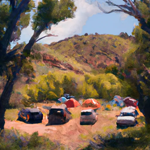
Dry Gulch Campground
Reservations are accepted at Dry Gulch Campground, ensuring that campers have a guaranteed spot to relax and enjoy the surroundings. It is advisable to make reservations in advance, especially during peak seasons when the campground tends to be more crowded.
The best time to visit Dry Gulch Campground is during the summer months when the weather is warm and dry. However, it's important to note that temperatures can soar during the day, so campers should come prepared with plenty of water and sun protection. Additionally, it can get chilly at night, so packing warm clothing and suitable bedding is essential.
While exploring this campground, campers should be cautious of wildlife, such as snakes and bears, which are known to inhabit the area. It is important to store food properly and follow all safety guidelines to avoid any unwanted encounters. As always, respecting nature and leaving no trace is highly encouraged to preserve the beauty of this stunning camping area.
What's on-site at Dry Gulch Campground
Key facilities Snoflo tracks for this campground. Confirm with the operator before booking -- amenities can change seasonally.
Plan your trip down to the hour
Same weather feed Snoflo's iOS app uses -- updated continuously from NOAA / yr.no.
Next 5 days, hour by hour
Temperature line with weather symbols on top, snow + rain accumulation as columns, humidity as a dotted line.
5-day forecast table
Every 3 hours, broken out across temperature, snow, rain, humidity, and wind. Each cell is colour-coded relative to the column min/max so trends jump out at a glance.
| Time | Condition | Temp (°F) | Snow (in) | Rain (in) | Humidity (%) | Wind (mps) | Wind dir |
|---|---|---|---|---|---|---|---|
| Loading detailed forecast… | |||||||
15-day temperature & precipitation
Daily temperatures, snow, and rain projected over the next two weeks. Hover any point for the full breakdown.
Other campgrounds in the area
Snoflo-tracked campsites within driving distance of Dry Gulch Campground, with reservations status.
| Campground | Reservations | Toilets | View |
|---|---|---|---|
| Dirt Flat | ✓ | ✓ | → |
| Indian Flat | ✗ | ✓ | → |
| Crane Flat | ✗ | ✗ | → |
| Tamarack Flat | ✗ | ✗ | → |
| Hodgdon Meadow - Yosemite National Park | ✓ | ✓ | → |
Nearby streamflow
USGS streamgauges within reach of Dry Gulch Campground -- pulled live from the National Water Information System.
| Streamgauge | Discharge | View |
|---|---|---|
| Merced R A Pohono Bridge Nr Yosemite Ca | 158 cfs | → |
| Tuolumne R Ab Early Intake Nr Mather Ca | 117 cfs | → |
| Merced R A Happy Isles Bridge Nr Yosemite Ca | 124 cfs | → |
| Tuolumne R Bl Early Intake Nr Mather Ca | 136 cfs | → |
| Cherry C Bl Dion R Holm Ph | 103 cfs | → |
| Cherry C Nr Early Intake Ca | 38 cfs | → |
Nearby snow depths
NRCS SNOTEL stations within reach of Dry Gulch Campground -- relevant when planning a shoulder-season or alpine trip.
| SNOTEL station | Snowpack | 24h Snowfall | View |
|---|---|---|---|
| Nohrsc White Wolf Raws | 1.1 in | 0.0 in | → |
| Ahwahnee 2.5 Nnw | 0.0 in | 0.0 in | → |
| Tenaya Lake | 0.2 in | 0.0 in | → |
| Groveland 2 | 0.0 in | 0.0 in | → |
| Nohrsc Lower Kibbie | 0.0 in | 0.0 in | → |
| Nohrsc Poison Ridge | 0.4 in | 0.0 in | → |
Plan a longer trip
The closest parks, lakes, boat launches, and paddle runs so a camping night can grow into a full weekend.
Parks
- Stanislaus National Forest
- Yosemite National Park
- Wilderness Emigrant
- Hoover Wilderness
- Heaven For Kids Rotary Park
- Railtown 1897 State Historic Park
Boat launches
- Merals Pool Put-In
- Forest Route 1n10 Tuolumne County
- Bagby Recreation Area
- Forest Route 1n04, Groveland
- Lake Mcclure - Mcclure Point
- Lake Mcclure - Barrett Cove
Fishing spots
Points of interest
- Trumbull Peak Special Interest Area
- Hetch Hetchy Railroad Museum
- Merced Grove
- Tunnel Tree
- Inspiration Point
- Tunnel View
Paddle runs
- Headwaters Near The Tuolumne And Mariposa County Lines To Western Boundary Of Yosemite National Park
- Confluence With Middle Fork Tuolumne River To Confluence With Tuolumne River
- Clavey River From Cottonwood Road To Confluence With Tuolumne
- Clavey River From 3n01 To Cottonwood Road
- Clavey River At Confluence Of Bell And Lily Creeks To 3n01
Camping essentials & Leave No Trace
- Pack it in, pack it out
- Take all trash, food scraps, and gear back with you to keep campsites clean and protect wildlife.
- Respect wildlife
- Observe animals from a distance, store food securely, and never feed wildlife to maintain natural behavior and safety.
- Know before you go
- Check weather, fire restrictions, trail conditions, and permit requirements to ensure a safe and well-planned trip.
- Minimize campfire impact
- Use established fire rings, keep fires small, fully extinguish them, or opt for a camp stove when fires are restricted.
- Leave what you find
- Preserve natural and cultural features by avoiding removal of plants, rocks, artifacts, or other elements of the environment.
Set push alerts in the Snoflo app
Save Dry Gulch Campground as a favorite, set a custom threshold (precipitation, snowpack, freezing temperatures), and the iOS app will push the moment conditions cross.
About Dry Gulch Campground
Can I make reservations at Dry Gulch Campground?
Yes -- this campground accepts reservations. Snoflo recommends booking early for peak season; check the operator (Recreation.gov / state park system / private operator) for the booking window and cancellation policy.
How fresh is the weather data on this page?
The hourly forecast updates throughout the day from the NOAA / yr.no public feeds. Streamflow data is pulled live from USGS streamgauges and snowpack from the NRCS SNOTEL network.
What's the best time of year to visit?
Use the 15-day temperature & precipitation outlook on this page to plan -- pick a window with comfortable temperatures and low precipitation. For longer trips, the 5-day hourly meteogram shows snow + rain accumulation hour-by-hour.
How do I get to Dry Gulch Campground?
Tap Directions in the hero above to open driving directions in Google Maps, or Open in map to center the Snoflo interactive map on the campground.
Can I get alerts when conditions change?
Yes -- alerts are managed through the Snoflo iOS app. Favorite this campground, set a threshold (temperature, snowpack, precipitation), and you'll get a push the moment it crosses.
Other campgrounds near here
Snoflo-tracked campgrounds within driving distance of Dry Gulch Campground.