Mountain Oak Campground campground
Community Reviews
Been here? Share the conditions.
Reviews, ratings & photos are added in the free Snoflo iOS app — rate a spot, tag the conditions, and your visit is verified by location. Add or manage your reviews from the app.
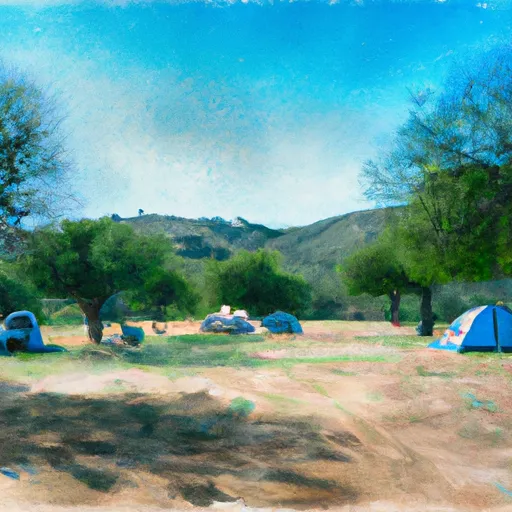
Mountain Oak Campground
Reservations are accepted at Mountain Oak Campground, ensuring that campers can secure their spot in advance. This is especially important during peak seasons when the campground tends to fill up quickly. It is recommended to make reservations early to avoid disappointment.
The best time of year to visit Mountain Oak Campground is during the spring or fall when the weather is mild and pleasant. Summers can be quite hot, so it is advisable to bring plenty of water and sunscreen. Additionally, being situated in a forested area, visitors should be cautious of wildlife and take necessary precautions to store food properly to avoid attracting animals.
In summary, Mountain Oak Campground in California offers a range of amenities such as restrooms, showers, drinking water, picnic tables, and fire rings. Reservations are accepted, and it is recommended to make them in advance. The best time to visit is during spring or fall, and campers should be cautious of wildlife and properly store food.
What's on-site at Mountain Oak Campground
Key facilities Snoflo tracks for this campground. Confirm with the operator before booking -- amenities can change seasonally.
Plan your trip down to the hour
Same weather feed Snoflo's iOS app uses -- updated continuously from NOAA / yr.no.
Next 5 days, hour by hour
Temperature line with weather symbols on top, snow + rain accumulation as columns, humidity as a dotted line.
5-day forecast table
Every 3 hours, broken out across temperature, snow, rain, humidity, and wind. Each cell is colour-coded relative to the column min/max so trends jump out at a glance.
| Time | Condition | Temp (°F) | Snow (in) | Rain (in) | Humidity (%) | Wind (mps) | Wind dir |
|---|---|---|---|---|---|---|---|
| Loading detailed forecast… | |||||||
15-day temperature & precipitation
Daily temperatures, snow, and rain projected over the next two weeks. Hover any point for the full breakdown.
Other campgrounds in the area
Snoflo-tracked campsites within driving distance of Mountain Oak Campground, with reservations status.
| Campground | Reservations | Toilets | View |
|---|---|---|---|
| Mt. Oak Campground | ✗ | ✗ | → |
| Mountain Oak | ✓ | ✓ | → |
| Lake | ✗ | ✓ | → |
| Lake Campground | ✗ | ✗ | → |
| Peavine Campground | ✓ | ✗ | → |
Nearby streamflow
USGS streamgauges within reach of Mountain Oak Campground -- pulled live from the National Water Information System.
| Streamgauge | Discharge | View |
|---|---|---|
| Big Rock C Nr Valyermo Ca | 13 cfs | → |
| Cajon C Bl Lone Pine C Nr Keenbrook Ca | 4 cfs | → |
| Lone Pine C Nr Keenbrook Ca | 1 cfs | → |
| Lytle C Nr Fontana Ca | 49 cfs | → |
| Fontana Uwc Surface Div Nr Fontana Ca | 17 cfs | → |
| Fontana Ph Forebay Spillway Nr Fontana Ca | · | → |
Nearby snow depths
NRCS SNOTEL stations within reach of Mountain Oak Campground -- relevant when planning a shoulder-season or alpine trip.
| SNOTEL station | Snowpack | 24h Snowfall | View |
|---|---|---|---|
| Hesperia 1ene | 0.0 in | 0.0 in | → |
| Lake Arrowhead 1.5 Se | 0.0 in | 0.0 in | → |
Plan a longer trip
The closest parks, lakes, boat launches, and paddle runs so a camping night can grow into a full weekend.
Parks
- Devils Punchbowl Park
- Pearblossom Park
- Wilderness Pleasant View Ridge
- Wilderness Cucamonga
- Stephen Sorensen Park
- Everett Martin Park
Boat launches
- Little Rock Reservoir
- Eucalyptus Park Road, San Dimas
- Pacific Crest Trail, Hesperia
- Santa Fe Dam Recreation Area
- Silverwood Lake Marina
Fishing spots
- Mt Baldy Trout Pools
- Puddingstone Reservoir
- Puddingstone Lake
- Glen Helen Lakes
- Silverwood Lake State Recreation Area
- Santa Fe Dam
Points of interest
- Summit Scenic Overlook
- Chaparral Neighborhoods Native Plant Garden
- Sailors Bay
- Ultralight Alcove
- Liberty Point
- Model Plane Way
Paddle runs
- East Fork - Confluence Of Vincent Gulch And Prairie Fork (Nw 1/4, Sw 1/4 Sec 16 ) To Laurel Gulch (Nw 1/4, Sw 1/4, Sec 17, T2n, R8w)
- Mainstream - Headwaters To Confluence With Cooper Canyon
- Laurel Gulch To Confluence With Mineo Canyon (Se 1/4, Sw 1/4, Sec 17, T2n, R8w)
- North Fork - Confluence Of Soldier And Coldbrook Creeks (Se1/4,Sw1/4, Sec) 5, T2n,,R9w To Conflluence With West Fork Of San Gabriel (Sw 1/4,Sw1/4, Sec 17, T2n, R8w)
- Mainstream - Confluence With Cooper Canyon To Confluence Wit South Fork Little Rock Creek
- Cooper Canyon- Near State Highway 2 (Sw 1/4, Ne 1/4, Sec 16, T3n, R10w To Confluence With Little Rock Creek
Camping essentials & Leave No Trace
- Pack it in, pack it out
- Take all trash, food scraps, and gear back with you to keep campsites clean and protect wildlife.
- Respect wildlife
- Observe animals from a distance, store food securely, and never feed wildlife to maintain natural behavior and safety.
- Know before you go
- Check weather, fire restrictions, trail conditions, and permit requirements to ensure a safe and well-planned trip.
- Minimize campfire impact
- Use established fire rings, keep fires small, fully extinguish them, or opt for a camp stove when fires are restricted.
- Leave what you find
- Preserve natural and cultural features by avoiding removal of plants, rocks, artifacts, or other elements of the environment.
Set push alerts in the Snoflo app
Save Mountain Oak Campground as a favorite, set a custom threshold (precipitation, snowpack, freezing temperatures), and the iOS app will push the moment conditions cross.
About Mountain Oak Campground
Can I make reservations at Mountain Oak Campground?
Yes -- this campground accepts reservations. Snoflo recommends booking early for peak season; check the operator (Recreation.gov / state park system / private operator) for the booking window and cancellation policy.
How fresh is the weather data on this page?
The hourly forecast updates throughout the day from the NOAA / yr.no public feeds. Streamflow data is pulled live from USGS streamgauges and snowpack from the NRCS SNOTEL network.
What's the best time of year to visit?
Use the 15-day temperature & precipitation outlook on this page to plan -- pick a window with comfortable temperatures and low precipitation. For longer trips, the 5-day hourly meteogram shows snow + rain accumulation hour-by-hour.
How do I get to Mountain Oak Campground?
Tap Directions in the hero above to open driving directions in Google Maps, or Open in map to center the Snoflo interactive map on the campground.
Can I get alerts when conditions change?
Yes -- alerts are managed through the Snoflo iOS app. Favorite this campground, set a threshold (temperature, snowpack, precipitation), and you'll get a push the moment it crosses.
Other campgrounds near here
Snoflo-tracked campgrounds within driving distance of Mountain Oak Campground.