

-
 Snoflo Premium
Get unlimited access to all our content
With no Ad interruptions! - Start Your Free Trial Login with existing account
Gridley
Eden Index
Climate
9.7
•
Recreation
3.7
•
Community
1.4
•
Safeguard
5.5/10
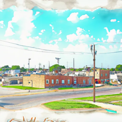
Gridley, Kansas is a small town located in the eastern part of the state. The climate is relatively mild, with warm summers and cold winters. The area receives an average of 38 inches of rainfall each year, and the nearby Neosho River provides a source of water for the town. As for outdoor recreation opportunities, the town is surrounded by fields and farmland, making it a great place for hiking, biking, and birdwatching. Additionally, there are several nearby lakes and reservoirs that offer boating, fishing, and swimming. Overall, Gridley is a peaceful and scenic town that offers plenty of opportunities to enjoy the great outdoors.
What is the Eden Index?
The Snoflo Eden Index serves as a comprehensive rating system for regions, evaluating their desirability through a holistic assessment of climate health, outdoor recreation opportunities, and natural disaster risk, acknowledging the profound impact of these factors on livability and well-being.
Climate Health Indicator (CHI): 9.7
Gridley receives approximately
973mm of rain per year,
with humidity levels near 79%
and air temperatures averaging around
13°C.
Gridley has a plant hardyness factor of
6, meaning
plants and agriculture in this region thrive during a short period during spring and early summer. Most
plants will die off during the colder winter months.
By considering the ideal temperature range, reliable water supplies, clean air, and stable seasonal rain or snowpacks, the Climate Health Indicator (CHI) underscores the significance of a healthy climate as the foundation for quality living.
A healthy climate is paramount for ensuring a high quality of life and livability in a region, fostering both physical well-being and environmental harmony. This can be characterized by ideal temperatures, reliable access to water supplies, clean air, and consistent seasonal rain or snowpacks.
Weather Forecast
Streamflow Conditions
Neosho
Area Rivers
Neosho
Snowpack Depths
Neosho
Reservoir Storage Capacity
Neosho
Groundwater Levels
Recreational Opportunity Index (ROI): 3.7
The Recreational Opportunity Index (ROI) recognizes the value of outdoor recreational options, such as parks, hiking trails, camping sites, and fishing spots, while acknowledging that climate plays a pivotal role in ensuring the comfort and consistency of these experiences.
Access to outdoor recreational opportunities, encompassing activities such as parks, hiking, camping, and fishing, is crucial for overall well-being, and the climate plays a pivotal role in enabling and enhancing these experiences, ensuring that individuals can engage in nature-based activities comfortably and consistently.
Camping Areas
| Campground | Campsites | Reservations | Toilets | Showers | Elevation |
|---|---|---|---|---|---|
| Outlet Park - Melvern | None | 979 ft | |||
| Arrow Rock - Melvern Reservoir | None | 1,087 ft | |||
| Sun Dance - Melvern Lake | None | 1,079 ft | |||
| Turkey Point - Melvern Lake | None | 1,075 ft | |||
| Redmond Cove North - John Redmond Reservoir | None | 1,045 ft | |||
| Eisenhower State Park | 230 | 1,082 ft | |||
| Hickory Creek West - John Redmond Reservoir | None | 1,047 ft | |||
| Johnstone Park | 6 | 670 ft | |||
| Coeur DAlene - Melvern Lake | None | 1,057 ft | |||
| Hickory Creek East - John Redmond Reservoir | None | 1,050 ft |
Catastrophe Safeguard Index (CSI):
The Catastrophe Safeguard Index (CSI) recognizes that natural disaster risk, encompassing floods, fires, hurricanes, and tornadoes, can drastically affect safety and the overall appeal of an area.
The level of natural disaster risk in a region significantly affects safety and the overall livability, with climate change amplifying these risks by potentially increasing the frequency and intensity of events like floods, fires, hurricanes, and tornadoes, thereby posing substantial challenges to community resilience and well-being.
Community Resilience Indicator (CRI): 1.4
The Community Resilience Indicator (CRI) recognizes that education, healthcare, and socioeconomics are crucial to the well-being of a region. The CRI acknowledges the profound impact of these elements on residents' overall quality of life. By evaluating educational resources, healthcare accessibility, and economic inclusivity, the index captures the essential aspects that contribute to a thriving community, fostering resident satisfaction, equity, and social cohesion.