

-
 Snoflo Premium
Get unlimited access to all our content
With no Ad interruptions! - Start Your Free Trial Login with existing account
Hiawassee
Eden Index
Climate
8.8
•
Recreation
7.8
•
Community
2.3
•
Safeguard
6.8/10
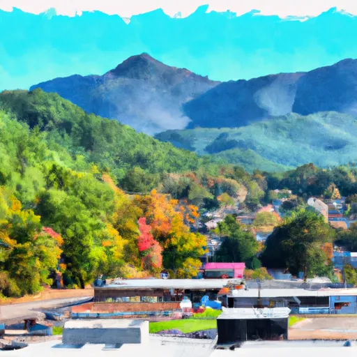
Hiawassee is a town located in the southern Appalachian Mountains of Georgia. The climate is mild year-round, with average temperatures ranging from the low 50s in winter to the mid-80s in summer. The area is surrounded by several lakes and rivers, including Lake Chatuge and the Hiawassee River, making it a popular destination for water sports such as fishing, boating, and kayaking. The area is also known for its hiking trails, including the famous Appalachian Trail. Outdoor enthusiasts can also enjoy camping, horseback riding, and golfing. The town hosts several annual events, including the Georgia Mountain Fair and the Hiawassee Festival of Arts.
What is the Eden Index?
The Snoflo Eden Index serves as a comprehensive rating system for regions, evaluating their desirability through a holistic assessment of climate health, outdoor recreation opportunities, and natural disaster risk, acknowledging the profound impact of these factors on livability and well-being.
Climate Health Indicator (CHI): 8.8
Hiawassee receives approximately
1532mm of rain per year,
with humidity levels near 76%
and air temperatures averaging around
13°C.
Hiawassee has a plant hardyness factor of
7, meaning
plants and agriculture in this region tend to thrive during the non-winter months.
By considering the ideal temperature range, reliable water supplies, clean air, and stable seasonal rain or snowpacks, the Climate Health Indicator (CHI) underscores the significance of a healthy climate as the foundation for quality living.
A healthy climate is paramount for ensuring a high quality of life and livability in a region, fostering both physical well-being and environmental harmony. This can be characterized by ideal temperatures, reliable access to water supplies, clean air, and consistent seasonal rain or snowpacks.
Weather Forecast
Streamflow Conditions
Middle Tennessee-Hiwassee
Area Rivers
Middle Tennessee-Hiwassee
Snowpack Depths
Middle Tennessee-Hiwassee
Reservoir Storage Capacity
Middle Tennessee-Hiwassee
Groundwater Levels
Recreational Opportunity Index (ROI): 7.8
The Recreational Opportunity Index (ROI) recognizes the value of outdoor recreational options, such as parks, hiking trails, camping sites, and fishing spots, while acknowledging that climate plays a pivotal role in ensuring the comfort and consistency of these experiences.
Access to outdoor recreational opportunities, encompassing activities such as parks, hiking, camping, and fishing, is crucial for overall well-being, and the climate plays a pivotal role in enabling and enhancing these experiences, ensuring that individuals can engage in nature-based activities comfortably and consistently.
Camping Areas
| Campground | Campsites | Reservations | Toilets | Showers | Elevation |
|---|---|---|---|---|---|
| Laurel Park - Lake Lanier | None | 1,118 ft | |||
| Newton Factory Shoals Rec Area | None | 608 ft | |||
| James Shackleford County Park | None | 904 ft | |||
| Duckett Mill - Lake Lanier | None | 1,163 ft | |||
| Boggs Creek | 31 | 1,798 ft | |||
| Fort Yargo State Park | None | 914 ft | |||
| Dames Ferry County Park | None | 424 ft | |||
| Hard Labor Creek State Park | None | 713 ft | |||
| Indian Springs State Park | None | 503 ft | |||
| River Forks - Lake Lanier | 73 | 1,123 ft |
Nearby Ski Areas
Catastrophe Safeguard Index (CSI):
The Catastrophe Safeguard Index (CSI) recognizes that natural disaster risk, encompassing floods, fires, hurricanes, and tornadoes, can drastically affect safety and the overall appeal of an area.
The level of natural disaster risk in a region significantly affects safety and the overall livability, with climate change amplifying these risks by potentially increasing the frequency and intensity of events like floods, fires, hurricanes, and tornadoes, thereby posing substantial challenges to community resilience and well-being.
Community Resilience Indicator (CRI): 2.3
The Community Resilience Indicator (CRI) recognizes that education, healthcare, and socioeconomics are crucial to the well-being of a region. The CRI acknowledges the profound impact of these elements on residents' overall quality of life. By evaluating educational resources, healthcare accessibility, and economic inclusivity, the index captures the essential aspects that contribute to a thriving community, fostering resident satisfaction, equity, and social cohesion.