Adams County Fairground Lakes fishing
As of July 16, 2026, the nearest streamgauge to Adams County Fairground Lakes — South Platte River At Henderson — reports 127 cfs. Source: USGS gauge data, refreshed throughout the day.
Community Reviews
Been here? Share the conditions.
Reviews, ratings & photos are added in the free Snoflo iOS app — rate a spot, tag the conditions, and your visit is verified by location. Add or manage your reviews from the app.
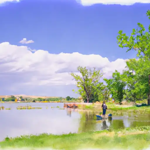
Adams County Fairground Lakes
What's biting at Adams County Fairground Lakes
Species commonly reported here -- tap any card for techniques, target seasons, and other waters where it's been caught.
Plan your trip down to the hour
Same weather feed Snoflo's iOS app uses -- updated continuously from NOAA / yr.no.
Next 5 days, hour by hour
Temperature line with weather symbols on top, snow + rain accumulation as columns, humidity as a dotted line.
5-day forecast table
Every 3 hours, broken out across temperature, snow, rain, humidity, and wind. Each cell is colour-coded relative to the column min/max so trends jump out at a glance.
| Time | Condition | Temp (°F) | Snow (in) | Rain (in) | Humidity (%) | Wind (mps) | Wind dir |
|---|---|---|---|---|---|---|---|
| Loading detailed forecast… | |||||||
15-day temperature & precipitation
Daily temperatures, snow, and rain projected over the next two weeks. Hover any point for the full breakdown.
Nearby streamflow
USGS streamgauges within reach of Adams County Fairground Lakes -- updated continuously from the National Water Information System.
| Streamgauge | Discharge | View |
|---|---|---|
| South Platte River At Henderson | 127 cfs | → |
| First Cr Ab 96th Ave | 1 cfs | → |
| Clear Creek At Mouth | 1 cfs | → |
| Big Dry Creek At Westminster | 1 cfs | → |
| First Cr Bel Buckley Rd | 1 cfs | → |
| Sand Crk Abv Burlington Ditch Nr Commerce City | 8 cfs | → |
Plan a longer trip
The closest campgrounds, parks, boat launches, and reservoirs so a fishing run can grow into a weekend.
Campgrounds
Parks
- Adams County Regional Park
- Springvale Park
- Northbrook Park
- Eagleview Park
- Skylake Park
- East Glen Park
Boat launches
- Brighton
- Adams County
- West 69th Avenue 4700, Westminster
- Standley Lake Trail Westminster
- Ralston Creek Trail Arvada
- Cherry Creek Park Road Centennial
Angling safety & ethics
- Know the regulations
- Check local fishing rules, seasons, size limits, and license requirements to ensure legal and sustainable angling.
- Handle fish responsibly
- Use wet hands, minimize air exposure, and release fish gently to improve survival rates when practicing catch-and-release.
- Choose the right gear
- Match your rod, line, and tackle to the species and conditions to increase success and reduce unnecessary harm to fish.
- Respect the waterway
- Avoid disturbing habitat, prevent bank erosion, and keep a safe distance from spawning areas to protect ecosystems.
- Keep it clean
- Pack out all line, hooks, bait containers, and trash. Discarded gear can injure wildlife and degrade waterways.
Set push alerts in the Snoflo app
Save Adams County Fairground Lakes as a favorite, set a custom threshold (water temperature, streamflow, snowpack), and the iOS app will push the moment conditions cross.
About Adams County Fairground Lakes
What fish species are found at Adams County Fairground Lakes?
Snoflo tracks the species commonly reported at Adams County Fairground Lakes -- see the Fish Species panel above for the live list with images and links to per-species pages.
How fresh is the weather data on this page?
The hourly forecast updates throughout the day from the NOAA / yr.no public feeds. Streamflow data comes live from USGS streamgauges, also refreshed continuously.
Can I get alerts when conditions change?
Yes -- alerts are managed through the Snoflo iOS app. Favorite this area, set a threshold (water temperature, streamflow, snowpack), and you'll get a push the moment it crosses.
Do I need a fishing license?
Yes. Check your state agency's regulations for license requirements, seasons, size limits, and any waterbody-specific rules before fishing Adams County Fairground Lakes.
How do I get to Adams County Fairground Lakes?
Tap Open in map in the hero above to center the Snoflo interactive map on this area, or grab the coordinates from the location facts panel.
Other angling spots near here
Snoflo-tracked fishing areas within driving distance of Adams County Fairground Lakes.