Confluence With Rancheria Creek To Forest Road 46n24x River Run
Community Reviews
Been here? Share the conditions.
Reviews, ratings & photos are added in the free Snoflo iOS app — rate a spot, tag the conditions, and your visit is verified by location. Add or manage your reviews from the app.
Confluence With Rancheria Creek To Forest Road 46n24x
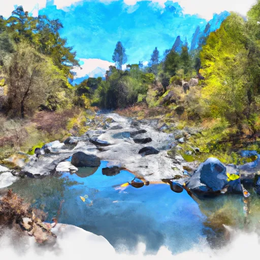
The segment mileage is approximately 7.5 miles long and includes technical rapids such as Pinball, Staircase, and Crack in the Wall. Other notable rapids include Double Drop, which is a steep and technical rapid that requires careful maneuvering, and Last Chance, which is a long and continuous rapid with several drops.
It is important to note that this section of the Whitewater River is located on public lands managed by the United States Forest Service. Therefore, specific regulations apply to the area, including the requirement of a permit for commercial outfitting and the prohibition of camping within 100 feet of the river.
In conclusion, the Whitewater River run from Confluence with Rancheria Creek to Forest Road 46N24X is a challenging and exciting stretch for experienced kayakers and rafters. Ideal streamflow ranges, class ratings, segment mileage, specific rapids/obstacles, and regulations should be taken into consideration before embarking on this adventure.
Plan your run down to the hour
Same weather feed Snoflo's iOS app uses -- updated continuously from NOAA / yr.no. Watch the precipitation column on the meteogram; rain ahead of a run typically lifts flows 12-48 hours later depending on the basin.
Next 5 days, hour by hour
Temperature line with weather symbols on top, snow + rain accumulation as columns, humidity as a dotted line.
5-day forecast table
Every 3 hours, broken out across temperature, snow, rain, humidity, and wind. Each cell is colour-coded relative to the column min/max.
| Time | Condition | Temp (°F) | Snow (in) | Rain (in) | Humidity (%) | Wind (mps) | Wind dir |
|---|---|---|---|---|---|---|---|
| Loading detailed forecast… | |||||||
15-day temperature & precipitation
Daily temperatures, snow, and rain projected over the next two weeks -- the upstream story that drives next week's flows.
Regional streamflow levels
USGS streamgauges around Confluence With Rancheria Creek To Forest Road 46n24x -- useful for spotting upstream pulses and gauging which tributary is contributing what.
| Streamgauge | Discharge | View |
|---|---|---|
| Klamath R Nr Seiad Valley Ca | 1,070 cfs | → |
| Indian C Nr Happy Camp Ca | 41 cfs | → |
| Scott R Nr Fort Jones Ca | 24 cfs | → |
| Applegate River Near Copper | 123 cfs | → |
| Star Gulch Near Ruch | 0 cfs | → |
| Sucker Cr Bl Lt Grayback Cr Nr Holland | 21 cfs | → |
Plan a longer trip
The closest boat launches, other paddle runs, and campgrounds so a day on the water can grow into a full weekend.
Boat launches
- H. Sluice Box River Access
- I. Portuguese Creek River Access
- G. Rocky Point River Access
- K. Seattle Creek River Access
- L. China Point River Access
- M. Gordons Ferry River Access
Other river runs
- Sluice Box To Green Riffle
- Confluence With Fish Creek To Confluence With Rancheria Creek
- Headwaters In Marble Mtn. Wilderness To Confluence With Fish Creek
- Bridge In Sec 19 To Bridge In Sec 25, T16n, R7e
- Bridge In Sec 25 To Confluence With Klamath River
Campgrounds
- Grider Creek - Horse
- Grider Creek Campground
- Wildwood Rv Parking
- Fort Goff
- Fort Goff Campground
- Oneil Creek Campground
Fishing spots
Whitewater safety
- Check the flow before you run
- Use the linked-gauge card and Regional Flow panel above. Class ratings change with flow -- a Class III at low water can become Class IV+ at high water.
- Know your skill ceiling
- Pick runs comfortably below your ceiling. Cold-water and big-water runs raise the consequences of any mistake.
- Wear the right gear
- Helmet, PFD, drysuit / wetsuit when water is below 60°F. Throw bag, knife, and whistle on your person, not in the boat.
- Scout, set safety, and run with a team
- Scout new rapids on foot, set safety with throw bags above the consequence pool, and run with at least one other competent paddler.
- Respect the river
- Strainers, undercuts, low-head dams, and wood can kill at any class rating. When in doubt, portage.
Set push alerts in the Snoflo app
Save Confluence With Rancheria Creek To Forest Road 46n24x as a favorite, set a discharge threshold (e.g. "alert me when flow hits 600 cfs"), and the iOS app pushes the moment the linked gauge crosses.
About Confluence With Rancheria Creek To Forest Road 46n24x
What's the optimal flow for Confluence With Rancheria Creek To Forest Road 46n24x?
The optimal flow depends on the section and the craft. Check the Run Details panel for the linked gauge and current status.
How fresh is the cfs reading on this page?
The linked USGS streamgauge reports continuously (every 15 minutes); Snoflo refreshes throughout the day. Hover the streamflow sparkline to read individual datapoints.
What's the whitewater class?
See the Run Details panel for the class rating Snoflo tracks for this run. Class ratings change with flow -- a Class III at low water can become Class IV in high water.
Where do I put in / take out?
Tap Directions in the hero above to open driving directions to the put-in. For shuttle planning, check the Nearby Boat Launches panel and the river run operator's site.
Can I get alerts when flows hit the optimal range?
Yes -- alerts are managed in the Snoflo iOS app. Favorite this run, set a discharge threshold, and you'll get a push the moment the gauge crosses.
Other runs near here
Snoflo-tracked paddle runs within driving distance of Confluence With Rancheria Creek To Forest Road 46n24x.