Crazy Mountain Ranch Dam

Crazy Mountain Ranch
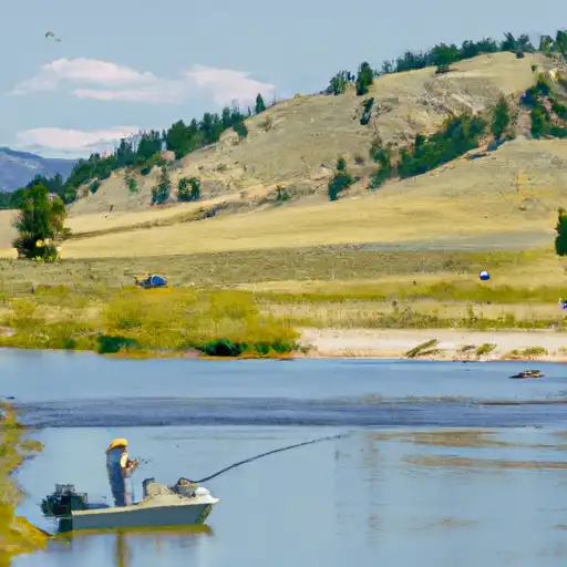
Crazy Mountain Ranch, also known as Nauharodney, is a private property located in Clyde Park, Montana, within Park County. The ranch is situated along Hammond Creek and features a recreational dam that was completed in 1968. The dam is primarily used for fish and wildlife ponds, as well as recreational activities, with a storage capacity of 270 acre-feet.
The earth dam at Crazy Mountain Ranch stands at a height of 36 feet with a hydraulic height of 32 feet. The dam spans a length of 700 feet and features an uncontrolled spillway. Despite being classified as having a high hazard potential, the dam is currently in satisfactory condition as of the last assessment in March 2020. Regular inspections are conducted every five years to ensure the safety and integrity of the structure.
With its picturesque location and recreational amenities, Crazy Mountain Ranch is a popular destination for water resource and climate enthusiasts. From fishing and wildlife observation to leisurely strolls along the scenic creek, visitors can enjoy a peaceful retreat in the heart of Montana's beautiful landscape. The ranch's commitment to safety and maintenance ensures a secure environment for all who come to appreciate its natural wonders.
Plan around the weather
Same NOAA / yr.no feed Snoflo's iOS app uses. Watch the precipitation column on the meteogram -- rain on the basin upstream typically lifts inflow 24-72 hours later.
Next 5 days, hour by hour
Temperature line with weather symbols on top, snow + rain accumulation as columns, humidity as a dotted line.
5-day forecast table
Every 3 hours, broken out across temperature, snow, rain, humidity, and wind. Each cell is colour-coded relative to the column min/max.
| Time | Condition | Temp (°F) | Snow (in) | Rain (in) | Humidity (%) | Wind (mps) | Wind dir |
|---|---|---|---|---|---|---|---|
| Loading detailed forecast… | |||||||
15-day temperature & precipitation
Daily temperatures, snow, and rain projected over the next two weeks.
Nearby streamflow gauges
USGS streamgauges around Crazy Mountain Ranch -- inflows here typically show up in storage 24-72 hours later.
| Streamgauge | Discharge | View |
|---|---|---|
| Shields River Nr Livingston Mt | 101 cfs | → |
| Yellowstone River Near Livingston Mt | 3,890 cfs | → |
| Boulder River At Big Timber Mt | 394 cfs | → |
| South Fork Musselshell R Ab Martinsdale Mt | 43 cfs | → |
| Hyalite C At Hyalite R S Nr Bozeman Mt | 78 cfs | → |
| Musselshell River Nr Martinsdale | 40 cfs | → |
Make a day of it
Boat launches, lakeside camping, fishing access, and other reservoirs near Crazy Mountain Ranch.
Boat launches
See all →


Campgrounds
See all →


Fishing spots
See all →


River runs
See all →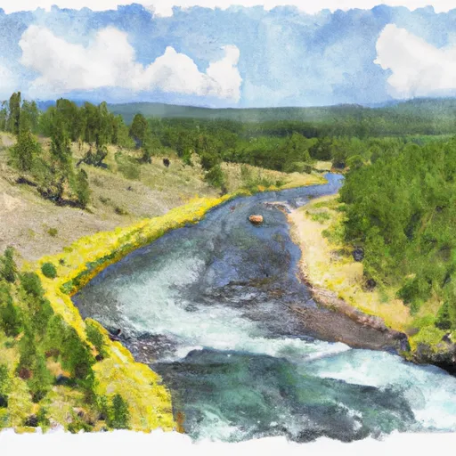


About Crazy Mountain Ranch
Where does the data for Crazy Mountain Ranch come from?
Structural and regulatory data come from the U.S. Army Corps of Engineers' National Inventory of Dams (NID). Weather forecast comes from NOAA / yr.no -- the same feed Snoflo's iOS app uses.
How often is the report updated?
NID structural data refreshes annually as the Corps publishes updated assessments. The weather forecast refreshes throughout the day.
What does the High hazard rating mean?
The Corps of Engineers' hazard potential classification grades probable consequences if the dam fails: High = probable loss of human life; Significant = no probable loss of human life but possible economic loss / environmental damage; Low = no probable loss of human life, only minor economic / environmental losses. See the Dam Data Reference card below for the full definitions.
What's "% of normal"?
The current storage value compared to the historical average storage on this calendar day. 100% = right on average; values above 100% mean above-normal storage (wet year); values below mean below-normal (dry year or drought).
Can I get alerts when storage crosses a threshold?
Yes -- alerts are managed in the Snoflo iOS app. Favorite this dam, set a threshold, and you'll get a push the moment conditions cross.
Dam data reference
Condition Assessment
- Satisfactory
- No existing or potential dam safety deficiencies are recognized. Acceptable performance is expected under all loading conditions (static, hydrologic, seismic) in accordance with the minimum applicable state or federal regulatory criteria or tolerable risk guidelines.
- Fair
- No existing dam safety deficiencies are recognized for normal operating conditions. Rare or extreme hydrologic and/or seismic events may result in a dam safety deficiency. Risk may be in the range to take further action.
- Poor
- A dam safety deficiency is recognized for normal operating conditions which may realistically occur. Remedial action is necessary. POOR may also be used when uncertainties exist as to critical analysis parameters which identify a potential dam safety deficiency.
- Unsatisfactory
- A dam safety deficiency is recognized that requires immediate or emergency remedial action for problem resolution.
- Not Rated
- The dam has not been inspected, is not under state or federal jurisdiction, or has been inspected but, for whatever reason, has not been rated.
Hazard Potential Classification
- High
- Dams assigned the high hazard potential classification are those where failure or mis-operation will probably cause loss of human life.
- Significant
- Dams assigned the significant hazard potential classification are those dams where failure or mis-operation results in no probable loss of human life but can cause economic loss, environmental damage, disruption of lifeline facilities, or impact other concerns. Significant hazard potential classification dams are often located in predominantly rural or agricultural areas but could be in areas with population and significant infrastructure.
- Low
- Dams assigned the low hazard potential classification are those where failure or mis-operation results in no probable loss of human life and low economic and/or environmental losses. Losses are principally limited to the owner's property.
- Undetermined
- Dams for which a downstream hazard potential has not been designated or is not provided.