Saunders Pond Dam

Saunders Pond Dam
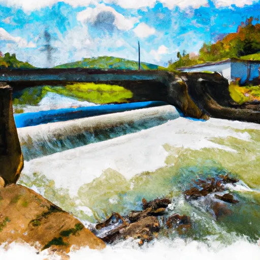
Saunders Pond Dam, located in Bedford, Virginia, serves as a crucial water supply infrastructure managed by the local government. With a height of 18 feet and a storage capacity of 53 acre-feet, this earth dam plays a significant role in ensuring a stable water supply for the region. The dam also offers recreational opportunities, making it a valuable asset for both water resource management and community engagement.
Managed by the Department of Conservation and Recreation, Saunders Pond Dam is regulated and inspected regularly to ensure its structural integrity and operational efficiency. The dam has been assessed to be in fair condition, with its last inspection conducted in October 2012. While the hazard potential is currently labeled as undetermined, ongoing risk management measures are likely in place to mitigate any potential threats. As an essential component of the local water supply network, Saunders Pond Dam continues to play a vital role in supporting the region's water needs and promoting recreational activities along Mattox Creek.
Despite its modest size, Saunders Pond Dam stands as a key piece of infrastructure in the Norfolk District's water management system. With a primary purpose of water supply and additional benefits for recreation, this earth dam underscores the importance of sustainable water resource management in the face of changing climate patterns. As climate enthusiasts and water resource advocates, monitoring and maintaining the condition of dams like Saunders Pond Dam is crucial for ensuring the resilience of our water infrastructure and the long-term sustainability of our communities amidst evolving environmental challenges.
Plan around the weather
Same NOAA / yr.no feed Snoflo's iOS app uses. Watch the precipitation column on the meteogram -- rain on the basin upstream typically lifts inflow 24-72 hours later.
Next 5 days, hour by hour
Temperature line with weather symbols on top, snow + rain accumulation as columns, humidity as a dotted line.
5-day forecast table
Every 3 hours, broken out across temperature, snow, rain, humidity, and wind. Each cell is colour-coded relative to the column min/max.
| Time | Condition | Temp (°F) | Snow (in) | Rain (in) | Humidity (%) | Wind (mps) | Wind dir |
|---|---|---|---|---|---|---|---|
| Loading detailed forecast… | |||||||
15-day temperature & precipitation
Daily temperatures, snow, and rain projected over the next two weeks.
Nearby streamflow gauges
USGS streamgauges around Saunders Pond Dam -- inflows here typically show up in storage 24-72 hours later.
| Streamgauge | Discharge | View |
|---|---|---|
| Goose Creek Near Huddleston | 40 cfs | → |
| Blackwater River Near Rocky Mount | 60 cfs | → |
| Pigg River Near Sandy Level | 99 cfs | → |
| Back Creek Near Dundee | 19 cfs | → |
| Roanoke River At Niagara | 169 cfs | → |
| Big Otter River Near Evington | 65 cfs | → |
Make a day of it
Boat launches, lakeside camping, fishing access, and other reservoirs near Saunders Pond Dam.
Boat launches
See all →


Campgrounds
See all →


Fishing spots
See all →
River runs
See all →


About Saunders Pond Dam
Where does the data for Saunders Pond Dam come from?
Structural and regulatory data come from the U.S. Army Corps of Engineers' National Inventory of Dams (NID). Weather forecast comes from NOAA / yr.no -- the same feed Snoflo's iOS app uses.
How often is the report updated?
NID structural data refreshes annually as the Corps publishes updated assessments. The weather forecast refreshes throughout the day.
What does the Undetermined hazard rating mean?
The Corps of Engineers' hazard potential classification grades probable consequences if the dam fails: High = probable loss of human life; Significant = no probable loss of human life but possible economic loss / environmental damage; Low = no probable loss of human life, only minor economic / environmental losses. See the Dam Data Reference card below for the full definitions.
What's "% of normal"?
The current storage value compared to the historical average storage on this calendar day. 100% = right on average; values above 100% mean above-normal storage (wet year); values below mean below-normal (dry year or drought).
Can I get alerts when storage crosses a threshold?
Yes -- alerts are managed in the Snoflo iOS app. Favorite this dam, set a threshold, and you'll get a push the moment conditions cross.
Dam data reference
Condition Assessment
- Satisfactory
- No existing or potential dam safety deficiencies are recognized. Acceptable performance is expected under all loading conditions (static, hydrologic, seismic) in accordance with the minimum applicable state or federal regulatory criteria or tolerable risk guidelines.
- Fair
- No existing dam safety deficiencies are recognized for normal operating conditions. Rare or extreme hydrologic and/or seismic events may result in a dam safety deficiency. Risk may be in the range to take further action.
- Poor
- A dam safety deficiency is recognized for normal operating conditions which may realistically occur. Remedial action is necessary. POOR may also be used when uncertainties exist as to critical analysis parameters which identify a potential dam safety deficiency.
- Unsatisfactory
- A dam safety deficiency is recognized that requires immediate or emergency remedial action for problem resolution.
- Not Rated
- The dam has not been inspected, is not under state or federal jurisdiction, or has been inspected but, for whatever reason, has not been rated.
Hazard Potential Classification
- High
- Dams assigned the high hazard potential classification are those where failure or mis-operation will probably cause loss of human life.
- Significant
- Dams assigned the significant hazard potential classification are those dams where failure or mis-operation results in no probable loss of human life but can cause economic loss, environmental damage, disruption of lifeline facilities, or impact other concerns. Significant hazard potential classification dams are often located in predominantly rural or agricultural areas but could be in areas with population and significant infrastructure.
- Low
- Dams assigned the low hazard potential classification are those where failure or mis-operation results in no probable loss of human life and low economic and/or environmental losses. Losses are principally limited to the owner's property.
- Undetermined
- Dams for which a downstream hazard potential has not been designated or is not provided.