Summit Lake Dam

Summit Lake
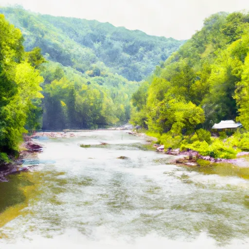
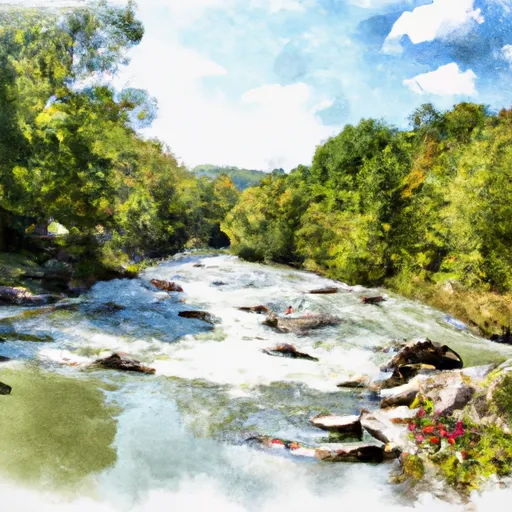
Summit Lake, located in Greenbrier, West Virginia, is a picturesque reservoir managed by the West Virginia Division of Natural Resources and owned by the Forest Service. Built in 1955 for recreational purposes, the earth dam stands at 34 feet high with a hydraulic height of 32 feet. With a storage capacity of 613 acre-feet and a normal storage level of 290 acre-feet, the reservoir covers a surface area of 39 acres and is fed by the Coats Run stream.
Despite its serene appearance, Summit Lake poses a high hazard potential due to its condition not being rated, making it crucial for regular inspections and maintenance to ensure public safety. The reservoir's spillway, controlled by a 4-foot-wide slide gate, has a maximum discharge capacity of 2,352 cubic feet per second. Although the dam has not been modified since 2019, its risk assessment remains very high, highlighting the importance of implementing effective risk management measures to mitigate any potential threats.
Water resource and climate enthusiasts visiting Summit Lake can enjoy a variety of recreational activities such as fishing and wildlife observation. As a vital water supply source for the local community, the reservoir serves as a valuable asset not only for leisure but also for sustaining the surrounding ecosystem. With its rich history and natural beauty, Summit Lake stands as a testament to the intersection of human ingenuity and environmental stewardship in preserving our precious water resources for future generations.
Plan around the weather
Same NOAA / yr.no feed Snoflo's iOS app uses. Watch the precipitation column on the meteogram -- rain on the basin upstream typically lifts inflow 24-72 hours later.
Next 5 days, hour by hour
Temperature line with weather symbols on top, snow + rain accumulation as columns, humidity as a dotted line.
5-day forecast table
Every 3 hours, broken out across temperature, snow, rain, humidity, and wind. Each cell is colour-coded relative to the column min/max.
| Time | Condition | Temp (°F) | Snow (in) | Rain (in) | Humidity (%) | Wind (mps) | Wind dir |
|---|---|---|---|---|---|---|---|
| Loading detailed forecast… | |||||||
15-day temperature & precipitation
Daily temperatures, snow, and rain projected over the next two weeks.
Nearby streamflow gauges
USGS streamgauges around Summit Lake -- inflows here typically show up in storage 24-72 hours later.
| Streamgauge | Discharge | View |
|---|---|---|
| Cranberry River Near Richwood | 51 cfs | → |
| Williams River At Dyer | 66 cfs | → |
| Gauley River Near Craigsville | 310 cfs | → |
| Greenbrier River At Buckeye | 154 cfs | → |
| Elk River Below Webster Springs | 103 cfs | → |
| Meadow River At Nallen | 230 cfs | → |
Make a day of it
Boat launches, lakeside camping, fishing access, and other reservoirs near Summit Lake.
Boat launches
See all →


Campgrounds
See all →


River runs
See all →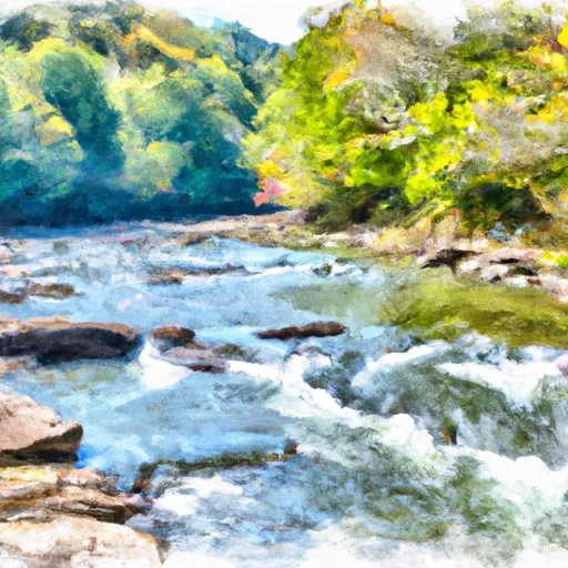


More reservoirs
See all →

About Summit Lake
Where does the data for Summit Lake come from?
Structural and regulatory data come from the U.S. Army Corps of Engineers' National Inventory of Dams (NID). Weather forecast comes from NOAA / yr.no -- the same feed Snoflo's iOS app uses.
How often is the report updated?
NID structural data refreshes annually as the Corps publishes updated assessments. The weather forecast refreshes throughout the day.
What does the High hazard rating mean?
The Corps of Engineers' hazard potential classification grades probable consequences if the dam fails: High = probable loss of human life; Significant = no probable loss of human life but possible economic loss / environmental damage; Low = no probable loss of human life, only minor economic / environmental losses. See the Dam Data Reference card below for the full definitions.
What's "% of normal"?
The current storage value compared to the historical average storage on this calendar day. 100% = right on average; values above 100% mean above-normal storage (wet year); values below mean below-normal (dry year or drought).
Can I get alerts when storage crosses a threshold?
Yes -- alerts are managed in the Snoflo iOS app. Favorite this dam, set a threshold, and you'll get a push the moment conditions cross.
Dam data reference
Condition Assessment
- Satisfactory
- No existing or potential dam safety deficiencies are recognized. Acceptable performance is expected under all loading conditions (static, hydrologic, seismic) in accordance with the minimum applicable state or federal regulatory criteria or tolerable risk guidelines.
- Fair
- No existing dam safety deficiencies are recognized for normal operating conditions. Rare or extreme hydrologic and/or seismic events may result in a dam safety deficiency. Risk may be in the range to take further action.
- Poor
- A dam safety deficiency is recognized for normal operating conditions which may realistically occur. Remedial action is necessary. POOR may also be used when uncertainties exist as to critical analysis parameters which identify a potential dam safety deficiency.
- Unsatisfactory
- A dam safety deficiency is recognized that requires immediate or emergency remedial action for problem resolution.
- Not Rated
- The dam has not been inspected, is not under state or federal jurisdiction, or has been inspected but, for whatever reason, has not been rated.
Hazard Potential Classification
- High
- Dams assigned the high hazard potential classification are those where failure or mis-operation will probably cause loss of human life.
- Significant
- Dams assigned the significant hazard potential classification are those dams where failure or mis-operation results in no probable loss of human life but can cause economic loss, environmental damage, disruption of lifeline facilities, or impact other concerns. Significant hazard potential classification dams are often located in predominantly rural or agricultural areas but could be in areas with population and significant infrastructure.
- Low
- Dams assigned the low hazard potential classification are those where failure or mis-operation results in no probable loss of human life and low economic and/or environmental losses. Losses are principally limited to the owner's property.
- Undetermined
- Dams for which a downstream hazard potential has not been designated or is not provided.