Glade Run Lake Dam

Glade Run Lake
Glade Run Lake in Webster, West Virginia, is a recreational spot managed by federal agencies. The dam, completed in 1960, stands at 32 feet high and holds a maximum storage of 24 acre-feet. With a surface area of 1.5 acres, it provides opportunities for fishing, boating, and other outdoor activities along the Glade Run river.
Despite its scenic beauty, Glade Run Lake's condition assessment is poor, with the last inspection in 2013 highlighting maintenance concerns. The hazard potential is undetermined, signaling a need for further evaluation and potential risk management measures. The lake's emergency action plan status and adherence to guidelines are not specified, raising questions about its preparedness for unexpected events.
For water resource and climate enthusiasts, Glade Run Lake represents a potential case study in the maintenance and management of recreational water bodies. As the Huntington District oversees this site, there is an opportunity for collaboration and improvement to ensure the safety and sustainability of this beloved outdoor destination. With a focus on enhancing infrastructure and emergency preparedness, Glade Run Lake can continue to thrive as a vital resource for both locals and visitors alike.
Plan around the weather
Same NOAA / yr.no feed Snoflo's iOS app uses. Watch the precipitation column on the meteogram -- rain on the basin upstream typically lifts inflow 24-72 hours later.
Next 5 days, hour by hour
Temperature line with weather symbols on top, snow + rain accumulation as columns, humidity as a dotted line.
5-day forecast table
Every 3 hours, broken out across temperature, snow, rain, humidity, and wind. Each cell is colour-coded relative to the column min/max.
| Time | Condition | Temp (°F) | Snow (in) | Rain (in) | Humidity (%) | Wind (mps) | Wind dir |
|---|---|---|---|---|---|---|---|
| Loading detailed forecast… | |||||||
15-day temperature & precipitation
Daily temperatures, snow, and rain projected over the next two weeks.
Nearby streamflow gauges
USGS streamgauges around Glade Run Lake -- inflows here typically show up in storage 24-72 hours later.
| Streamgauge | Discharge | View |
|---|---|---|
| Cranberry River Near Richwood | 41 cfs | → |
| Williams River At Dyer | 54 cfs | → |
| Gauley River Near Craigsville | 246 cfs | → |
| Elk River Below Webster Springs | 91 cfs | → |
| Greenbrier River At Buckeye | 133 cfs | → |
| Birch River At Herold | 11 cfs | → |
Make a day of it
Boat launches, lakeside camping, fishing access, and other reservoirs near Glade Run Lake.
Boat launches
See all →


Campgrounds
See all →


River runs
See all →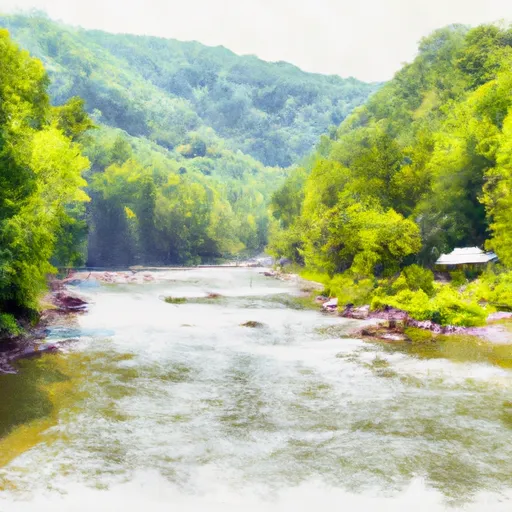


More reservoirs
See all →

About Glade Run Lake
Where does the data for Glade Run Lake come from?
Structural and regulatory data come from the U.S. Army Corps of Engineers' National Inventory of Dams (NID). Weather forecast comes from NOAA / yr.no -- the same feed Snoflo's iOS app uses.
How often is the report updated?
NID structural data refreshes annually as the Corps publishes updated assessments. The weather forecast refreshes throughout the day.
What does the Undetermined hazard rating mean?
The Corps of Engineers' hazard potential classification grades probable consequences if the dam fails: High = probable loss of human life; Significant = no probable loss of human life but possible economic loss / environmental damage; Low = no probable loss of human life, only minor economic / environmental losses. See the Dam Data Reference card below for the full definitions.
What's "% of normal"?
The current storage value compared to the historical average storage on this calendar day. 100% = right on average; values above 100% mean above-normal storage (wet year); values below mean below-normal (dry year or drought).
Can I get alerts when storage crosses a threshold?
Yes -- alerts are managed in the Snoflo iOS app. Favorite this dam, set a threshold, and you'll get a push the moment conditions cross.
Dam data reference
Condition Assessment
- Satisfactory
- No existing or potential dam safety deficiencies are recognized. Acceptable performance is expected under all loading conditions (static, hydrologic, seismic) in accordance with the minimum applicable state or federal regulatory criteria or tolerable risk guidelines.
- Fair
- No existing dam safety deficiencies are recognized for normal operating conditions. Rare or extreme hydrologic and/or seismic events may result in a dam safety deficiency. Risk may be in the range to take further action.
- Poor
- A dam safety deficiency is recognized for normal operating conditions which may realistically occur. Remedial action is necessary. POOR may also be used when uncertainties exist as to critical analysis parameters which identify a potential dam safety deficiency.
- Unsatisfactory
- A dam safety deficiency is recognized that requires immediate or emergency remedial action for problem resolution.
- Not Rated
- The dam has not been inspected, is not under state or federal jurisdiction, or has been inspected but, for whatever reason, has not been rated.
Hazard Potential Classification
- High
- Dams assigned the high hazard potential classification are those where failure or mis-operation will probably cause loss of human life.
- Significant
- Dams assigned the significant hazard potential classification are those dams where failure or mis-operation results in no probable loss of human life but can cause economic loss, environmental damage, disruption of lifeline facilities, or impact other concerns. Significant hazard potential classification dams are often located in predominantly rural or agricultural areas but could be in areas with population and significant infrastructure.
- Low
- Dams assigned the low hazard potential classification are those where failure or mis-operation results in no probable loss of human life and low economic and/or environmental losses. Losses are principally limited to the owner's property.
- Undetermined
- Dams for which a downstream hazard potential has not been designated or is not provided.