Porter Dam

Porter
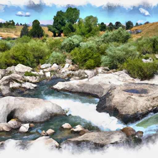
Porter is a private irrigation dam located in Teton, Wyoming, along Wallace Creek. Built in 1951, this earth dam stands at 17 feet high and stretches 245 feet in length, with a storage capacity of 52 acre-feet. Despite its low hazard potential, the dam is rated as being in poor condition, with a moderate risk assessment indicating the need for attention and potential improvements.
Owned privately, Porter is regulated and permitted by the Wyoming State Engineer's Office, with regular inspections conducted to ensure its structural integrity and compliance with safety standards. The dam serves multiple purposes, including irrigation, fire protection, stock watering, and small fish pond management. Its spillway, with a width of 15 feet, is uncontrolled, and the dam features a single valve outlet gate for water release when necessary.
Situated in the Congressional District 00 of Wyoming, Porter is overseen by Liz Cheney (R) and falls under the jurisdiction of the state regulatory agencies. With its location in a scenic area near Moose, this dam on Wallace Creek plays a vital role in supporting water resource management and agricultural activities in the region, highlighting the importance of maintaining and upgrading infrastructure to meet evolving climate challenges and water conservation needs.
Plan around the weather
Same NOAA / yr.no feed Snoflo's iOS app uses. Watch the precipitation column on the meteogram -- rain on the basin upstream typically lifts inflow 24-72 hours later.
Next 5 days, hour by hour
Temperature line with weather symbols on top, snow + rain accumulation as columns, humidity as a dotted line.
5-day forecast table
Every 3 hours, broken out across temperature, snow, rain, humidity, and wind. Each cell is colour-coded relative to the column min/max.
| Time | Condition | Temp (°F) | Snow (in) | Rain (in) | Humidity (%) | Wind (mps) | Wind dir |
|---|---|---|---|---|---|---|---|
| Loading detailed forecast… | |||||||
15-day temperature & precipitation
Daily temperatures, snow, and rain projected over the next two weeks.
Nearby streamflow gauges
USGS streamgauges around Porter -- inflows here typically show up in storage 24-72 hours later.
| Streamgauge | Discharge | View |
|---|---|---|
| Buffalo Fork Ab Lava Creek Nr Moran Wy | 619 cfs | → |
| Pacific Creek At Moran Wy | 81 cfs | → |
| Snake River Nr Moran Wy | 4,910 cfs | → |
| Gros Ventre River At Kelly Wy | 404 cfs | → |
| Snake River At Moose | 6,190 cfs | → |
| Snake River Ab Jackson Lake At Flagg Ranch Wy | 409 cfs | → |
Make a day of it
Boat launches, lakeside camping, fishing access, and other reservoirs near Porter.
Boat launches
See all →


Campgrounds
See all →


Fishing spots
See all →


River runs
See all →


About Porter
Where does the data for Porter come from?
Structural and regulatory data come from the U.S. Army Corps of Engineers' National Inventory of Dams (NID). Weather forecast comes from NOAA / yr.no -- the same feed Snoflo's iOS app uses.
How often is the report updated?
NID structural data refreshes annually as the Corps publishes updated assessments. The weather forecast refreshes throughout the day.
What does the Low hazard rating mean?
The Corps of Engineers' hazard potential classification grades probable consequences if the dam fails: High = probable loss of human life; Significant = no probable loss of human life but possible economic loss / environmental damage; Low = no probable loss of human life, only minor economic / environmental losses. See the Dam Data Reference card below for the full definitions.
What's "% of normal"?
The current storage value compared to the historical average storage on this calendar day. 100% = right on average; values above 100% mean above-normal storage (wet year); values below mean below-normal (dry year or drought).
Can I get alerts when storage crosses a threshold?
Yes -- alerts are managed in the Snoflo iOS app. Favorite this dam, set a threshold, and you'll get a push the moment conditions cross.
Dam data reference
Condition Assessment
- Satisfactory
- No existing or potential dam safety deficiencies are recognized. Acceptable performance is expected under all loading conditions (static, hydrologic, seismic) in accordance with the minimum applicable state or federal regulatory criteria or tolerable risk guidelines.
- Fair
- No existing dam safety deficiencies are recognized for normal operating conditions. Rare or extreme hydrologic and/or seismic events may result in a dam safety deficiency. Risk may be in the range to take further action.
- Poor
- A dam safety deficiency is recognized for normal operating conditions which may realistically occur. Remedial action is necessary. POOR may also be used when uncertainties exist as to critical analysis parameters which identify a potential dam safety deficiency.
- Unsatisfactory
- A dam safety deficiency is recognized that requires immediate or emergency remedial action for problem resolution.
- Not Rated
- The dam has not been inspected, is not under state or federal jurisdiction, or has been inspected but, for whatever reason, has not been rated.
Hazard Potential Classification
- High
- Dams assigned the high hazard potential classification are those where failure or mis-operation will probably cause loss of human life.
- Significant
- Dams assigned the significant hazard potential classification are those dams where failure or mis-operation results in no probable loss of human life but can cause economic loss, environmental damage, disruption of lifeline facilities, or impact other concerns. Significant hazard potential classification dams are often located in predominantly rural or agricultural areas but could be in areas with population and significant infrastructure.
- Low
- Dams assigned the low hazard potential classification are those where failure or mis-operation results in no probable loss of human life and low economic and/or environmental losses. Losses are principally limited to the owner's property.
- Undetermined
- Dams for which a downstream hazard potential has not been designated or is not provided.