

-
 Snoflo Premium
Get unlimited access to all our content
With no Ad interruptions! - Start Your Free Trial Login with existing account
Bethpage
Eden Index
Climate
7.7
•
Recreation
3.1
•
Community
0.9
•
Safeguard
4.4/10
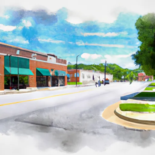
Bethpage is a small town located in Sumner County, Tennessee. The climate in Bethpage is generally mild with hot summers and cool winters. The town is surrounded by farmland, and its hydrology constituents consist of a few small creeks and ponds. Outdoor recreation opportunities in Bethpage include hiking, fishing, and hunting in the nearby parks and forests. The nearby Old Hickory Lake is a popular spot for boating, swimming, and fishing. The town is also home to several community events throughout the year, including a fall festival and a Christmas parade. Bethpage is a quiet and peaceful community, perfect for those seeking a small-town atmosphere.
What is the Eden Index?
The Snoflo Eden Index serves as a comprehensive rating system for regions, evaluating their desirability through a holistic assessment of climate health, outdoor recreation opportunities, and natural disaster risk, acknowledging the profound impact of these factors on livability and well-being.
Climate Health Indicator (CHI): 7.7
Bethpage receives approximately
1353mm of rain per year,
with humidity levels near 84%
and air temperatures averaging around
15°C.
Bethpage has a plant hardyness factor of
7, meaning
plants and agriculture in this region tend to thrive during the non-winter months.
By considering the ideal temperature range, reliable water supplies, clean air, and stable seasonal rain or snowpacks, the Climate Health Indicator (CHI) underscores the significance of a healthy climate as the foundation for quality living.
A healthy climate is paramount for ensuring a high quality of life and livability in a region, fostering both physical well-being and environmental harmony. This can be characterized by ideal temperatures, reliable access to water supplies, clean air, and consistent seasonal rain or snowpacks.
Weather Forecast
Streamflow Conditions
Lower Cumberland
Area Rivers
Lower Cumberland
Snowpack Depths
Lower Cumberland
Reservoir Storage Capacity
Lower Cumberland
Groundwater Levels
Recreational Opportunity Index (ROI): 3.1
The Recreational Opportunity Index (ROI) recognizes the value of outdoor recreational options, such as parks, hiking trails, camping sites, and fishing spots, while acknowledging that climate plays a pivotal role in ensuring the comfort and consistency of these experiences.
Access to outdoor recreational opportunities, encompassing activities such as parks, hiking, camping, and fishing, is crucial for overall well-being, and the climate plays a pivotal role in enabling and enhancing these experiences, ensuring that individuals can engage in nature-based activities comfortably and consistently.
Camping Areas
| Campground | Campsites | Reservations | Toilets | Showers | Elevation |
|---|---|---|---|---|---|
| Cathedral Caverns State Park | None | 643 ft | |||
| Marshall County Park | None | 598 ft | |||
| Goose Pond Colony | None | 618 ft | |||
| Sharon Johnston Park | 33 | 771 ft | |||
| Tims Ford State Park | 52 | 936 ft | |||
| Barton Springs - Normandy Lake | 67 | 885 ft | |||
| Lake Guntersville State Park | 366 | 630 ft | |||
| Old Stone Fort State Park | 51 | 1,005 ft | |||
| Cedar Point - Normandy Lake | None | 882 ft | |||
| Monte Sano State Park | 104 | 1,608 ft |
Nearby Ski Areas
Catastrophe Safeguard Index (CSI):
The Catastrophe Safeguard Index (CSI) recognizes that natural disaster risk, encompassing floods, fires, hurricanes, and tornadoes, can drastically affect safety and the overall appeal of an area.
The level of natural disaster risk in a region significantly affects safety and the overall livability, with climate change amplifying these risks by potentially increasing the frequency and intensity of events like floods, fires, hurricanes, and tornadoes, thereby posing substantial challenges to community resilience and well-being.
Community Resilience Indicator (CRI): 0.9
The Community Resilience Indicator (CRI) recognizes that education, healthcare, and socioeconomics are crucial to the well-being of a region. The CRI acknowledges the profound impact of these elements on residents' overall quality of life. By evaluating educational resources, healthcare accessibility, and economic inclusivity, the index captures the essential aspects that contribute to a thriving community, fostering resident satisfaction, equity, and social cohesion.