

-
 Snoflo Premium
Get unlimited access to all our content
With no Ad interruptions! - Start Your Free Trial Login with existing account
Oakland
Eden Index
Climate
8.3
•
Recreation
7.1
•
Community
•
Safeguard
5.8/10
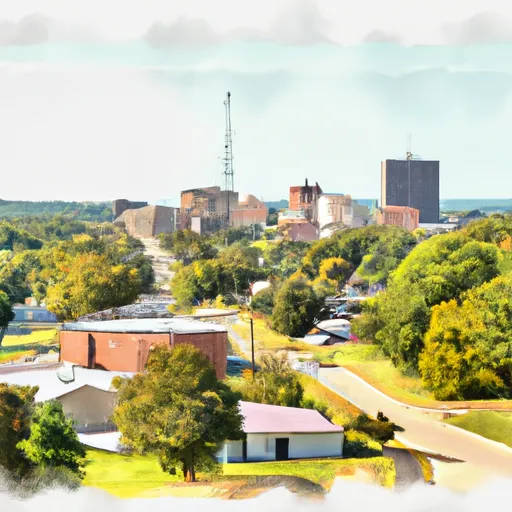
Located in Marion County, Arkansas, Oakland is a small town with a pleasant climate and abundant outdoor recreation opportunities. The region experiences a humid subtropical climate, characterized by hot, humid summers and mild winters. Oakland is surrounded by the lush Ozark Mountains and is home to beautiful lakes and rivers. The hydrology constituents in the area include the nearby magnificent White River, famous for its excellent fishing opportunities, as well as Bull Shoals Lake, renowned for boating, swimming, and water sports. Outdoor enthusiasts can enjoy activities such as hiking, camping, and wildlife watching in the nearby Buffalo National River, which offers breathtaking scenic views and opportunities for canoeing and kayaking. Oakland, Arkansas, is a haven for nature lovers and adventure seekers alike.
What is the Eden Index?
The Snoflo Eden Index serves as a comprehensive rating system for regions, evaluating their desirability through a holistic assessment of climate health, outdoor recreation opportunities, and natural disaster risk, acknowledging the profound impact of these factors on livability and well-being.
Climate Health Indicator (CHI): 8.3
Oakland receives approximately
1137mm of rain per year,
with humidity levels near 81%
and air temperatures averaging around
14°C.
Oakland has a plant hardyness factor of
6, meaning
plants and agriculture in this region thrive during a short period during spring and early summer. Most
plants will die off during the colder winter months.
By considering the ideal temperature range, reliable water supplies, clean air, and stable seasonal rain or snowpacks, the Climate Health Indicator (CHI) underscores the significance of a healthy climate as the foundation for quality living.
A healthy climate is paramount for ensuring a high quality of life and livability in a region, fostering both physical well-being and environmental harmony. This can be characterized by ideal temperatures, reliable access to water supplies, clean air, and consistent seasonal rain or snowpacks.
Weather Forecast
Streamflow Conditions
Upper White
Area Rivers
Upper White
Snowpack Depths
Upper White
Reservoir Storage Capacity
Upper White
Groundwater Levels
Recreational Opportunity Index (ROI): 7.1
The Recreational Opportunity Index (ROI) recognizes the value of outdoor recreational options, such as parks, hiking trails, camping sites, and fishing spots, while acknowledging that climate plays a pivotal role in ensuring the comfort and consistency of these experiences.
Access to outdoor recreational opportunities, encompassing activities such as parks, hiking, camping, and fishing, is crucial for overall well-being, and the climate plays a pivotal role in enabling and enhancing these experiences, ensuring that individuals can engage in nature-based activities comfortably and consistently.
Camping Areas
| Campground | Campsites | Reservations | Toilets | Showers | Elevation |
|---|---|---|---|---|---|
| Highway 472 Camp | 15 | 154 ft | |||
| Old Lock and Dam 8 | 5 | 91 ft | |||
| Gum Springs Complex | 30 | 264 ft | |||
| Lincoln Parish Park | None | 306 ft | |||
| Corney Lake Complex | 25 | 121 ft | |||
| Pearson Camp Complex | 25 | 154 ft | |||
| Jimmie Davis State Park | None | 232 ft | |||
| Lake DArbonne State Park | None | 191 ft | |||
| Saddle Bayou Camp Complex | 15 | 123 ft | |||
| Bankston Camp Complex | 15 | 218 ft |
Nearby Ski Areas
Catastrophe Safeguard Index (CSI):
The Catastrophe Safeguard Index (CSI) recognizes that natural disaster risk, encompassing floods, fires, hurricanes, and tornadoes, can drastically affect safety and the overall appeal of an area.
The level of natural disaster risk in a region significantly affects safety and the overall livability, with climate change amplifying these risks by potentially increasing the frequency and intensity of events like floods, fires, hurricanes, and tornadoes, thereby posing substantial challenges to community resilience and well-being.
Community Resilience Indicator (CRI):
The Community Resilience Indicator (CRI) recognizes that education, healthcare, and socioeconomics are crucial to the well-being of a region. The CRI acknowledges the profound impact of these elements on residents' overall quality of life. By evaluating educational resources, healthcare accessibility, and economic inclusivity, the index captures the essential aspects that contribute to a thriving community, fostering resident satisfaction, equity, and social cohesion.