

-
 Snoflo Premium
Get unlimited access to all our content
With no Ad interruptions! - Start Your Free Trial Login with existing account
Salina
Eden Index
Climate
8.3
•
Recreation
2.9
•
Community
2.1
•
Safeguard
4.8/10
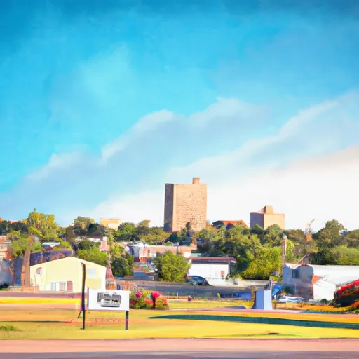
Salina, Oklahoma is a charming town located in Mayes County, within the northeastern region of the state. The climate in Salina is considered to be humid subtropical, characterized by hot summers and mild winters. Summers are typically hot and humid, with temperatures reaching the mid-90s (Fahrenheit), while winters are cool, with average temperatures dropping to the mid-30s.
One prominent feature of Salina is its proximity to Lake Hudson, which borders the town's eastern side. The lake is a significant hydrological constituent, providing ample recreational opportunities for residents and visitors. Fishing, boating, water skiing, and swimming are popular activities on the lake.
Salina also boasts the Salina State Fishing Lake, perfect for anglers seeking a serene and peaceful fishing experience. Additionally, the nearby Salina Waterfall offers a picturesque setting for outdoor enthusiasts, with hiking trails providing opportunities for exploration.
Nature lovers can explore the nearby Spavinaw Hills Wilderness Area, renowned for its scenic beauty, diverse wildlife, and hiking trails. This area provides an excellent opportunity for outdoor recreation, including camping and bird-watching.
In conclusion, Salina, Oklahoma offers a pleasant climate, proximity to water bodies like Lake Hudson, and various opportunities for outdoor recreation, making it an appealing destination for nature enthusiasts and water sports lovers alike.
What is the Eden Index?
The Snoflo Eden Index serves as a comprehensive rating system for regions, evaluating their desirability through a holistic assessment of climate health, outdoor recreation opportunities, and natural disaster risk, acknowledging the profound impact of these factors on livability and well-being.
Climate Health Indicator (CHI): 8.3
Salina receives approximately
1120mm of rain per year,
with humidity levels near 81%
and air temperatures averaging around
16°C.
Salina has a plant hardyness factor of
7, meaning
plants and agriculture in this region tend to thrive during the non-winter months.
By considering the ideal temperature range, reliable water supplies, clean air, and stable seasonal rain or snowpacks, the Climate Health Indicator (CHI) underscores the significance of a healthy climate as the foundation for quality living.
A healthy climate is paramount for ensuring a high quality of life and livability in a region, fostering both physical well-being and environmental harmony. This can be characterized by ideal temperatures, reliable access to water supplies, clean air, and consistent seasonal rain or snowpacks.
Weather Forecast
Streamflow Conditions
Neosho
Area Rivers
Neosho
Snowpack Depths
Neosho
Reservoir Storage Capacity
Neosho
Groundwater Levels
Recreational Opportunity Index (ROI): 2.9
The Recreational Opportunity Index (ROI) recognizes the value of outdoor recreational options, such as parks, hiking trails, camping sites, and fishing spots, while acknowledging that climate plays a pivotal role in ensuring the comfort and consistency of these experiences.
Access to outdoor recreational opportunities, encompassing activities such as parks, hiking, camping, and fishing, is crucial for overall well-being, and the climate plays a pivotal role in enabling and enhancing these experiences, ensuring that individuals can engage in nature-based activities comfortably and consistently.
Camping Areas
| Campground | Campsites | Reservations | Toilets | Showers | Elevation |
|---|---|---|---|---|---|
| Turkey Creek - Pine Creek Lake | 31 | 458 ft | |||
| Gore Landing | 22 | 464 ft | |||
| Talimena State Park | None | 1,064 ft | |||
| Lost Rapids - Pine Creek Lake | None | 492 ft | |||
| Pine Creek Cove - Pine Creek Lake | None | 462 ft | |||
| Brewers Bend - Webbers Falls Lake | None | 529 ft | |||
| Clayton Lake State Park | None | 738 ft | |||
| Raymond Gary State Park | None | 480 ft | |||
| John Wells Park | None | 686 ft | |||
| Little River - Pine Creek Lake | None | 537 ft |
Nearby Fishing
Catastrophe Safeguard Index (CSI):
The Catastrophe Safeguard Index (CSI) recognizes that natural disaster risk, encompassing floods, fires, hurricanes, and tornadoes, can drastically affect safety and the overall appeal of an area.
The level of natural disaster risk in a region significantly affects safety and the overall livability, with climate change amplifying these risks by potentially increasing the frequency and intensity of events like floods, fires, hurricanes, and tornadoes, thereby posing substantial challenges to community resilience and well-being.
Community Resilience Indicator (CRI): 2.1
The Community Resilience Indicator (CRI) recognizes that education, healthcare, and socioeconomics are crucial to the well-being of a region. The CRI acknowledges the profound impact of these elements on residents' overall quality of life. By evaluating educational resources, healthcare accessibility, and economic inclusivity, the index captures the essential aspects that contribute to a thriving community, fostering resident satisfaction, equity, and social cohesion.