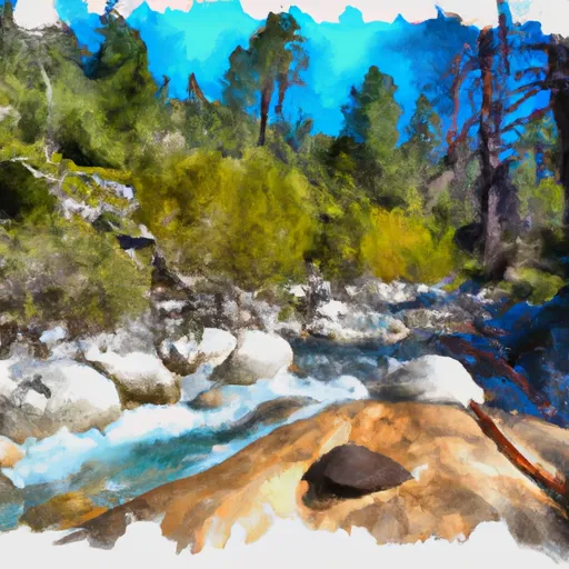
Headwaters To Middle Fork Feather Wsr River Run
Community Reviews
Been here? Share the conditions.
Reviews, ratings & photos are added in the free Snoflo iOS app — rate a spot, tag the conditions, and your visit is verified by location. Add or manage your reviews from the app.
Headwaters To Middle Fork Feather Wsr
The river is rated as a Class IV-V, which means it is challenging and requires advanced paddling skills. The segment mileage for this river run is approximately 21 miles, with the put-in at the headwaters near Lake Almanor and the take-out at the Middle Fork Feather River.
There are many specific river rapids and obstacles on this river run, including the Class V Bald Rock Canyon, which has a series of steep drops and tight turns. Other notable rapids include the Class IV Hell Hole and the Class III+ Belden Falls.
There are specific regulations in place for the Headwaters to Middle Fork Feather WSR, including a daily limit of 60 people and a permit system for commercial outfitters. Additionally, visitors are required to follow Leave No Trace principles, carry out all trash and human waste, and respect the natural and cultural resources of the area.
Plan your run down to the hour
Same weather feed Snoflo's iOS app uses -- updated continuously from NOAA / yr.no. Watch the precipitation column on the meteogram; rain ahead of a run typically lifts flows 12-48 hours later depending on the basin.
Next 5 days, hour by hour
Temperature line with weather symbols on top, snow + rain accumulation as columns, humidity as a dotted line.
5-day forecast table
Every 3 hours, broken out across temperature, snow, rain, humidity, and wind. Each cell is colour-coded relative to the column min/max.
| Time | Condition | Temp (°F) | Snow (in) | Rain (in) | Humidity (%) | Wind (mps) | Wind dir |
|---|---|---|---|---|---|---|---|
| Loading detailed forecast… | |||||||
15-day temperature & precipitation
Daily temperatures, snow, and rain projected over the next two weeks -- the upstream story that drives next week's flows.
Regional streamflow levels
USGS streamgauges around Headwaters To Middle Fork Feather Wsr -- useful for spotting upstream pulses and gauging which tributary is contributing what.
| Streamgauge | Discharge | View |
|---|---|---|
| Spanish C A Quincy Ca | 15 cfs | → |
| Spanish C Ab Blackhawk C At Keddie Ca | 28 cfs | → |
| N Yuba R Bl Goodyears Bar Ca | 157 cfs | → |
| Butte C Nr Chico Ca | 170 cfs | → |
| Little Truckee R Bl Div Dam Nr Sierraville Ca | 3 cfs | → |
| Independence C Nr Truckee Ca | 6 cfs | → |
Plan a longer trip
The closest boat launches, other paddle runs, and campgrounds so a day on the water can grow into a full weekend.
Boat launches
- Plumas County
- Peninsula Road, Strawberry Valley
- Little Grass Valley (Black Rock Tent Camp)
- Bucks Lakeshore Resort
- Bucks Lake Marina
- Oroville-Quincy Road 17000-17046, Meadow Valley
Other river runs
- Headwaters To Chicago Ravine
- Chicago Ravine To Confluence With Middle Fork Feather Wsr
- Headwaters To Confluence With Nelson Creek
- Confluence Of Morrow Creek And Third Water Creek To Confluence With Middle Fork Feather River
- Confluence With East And West Branches Of Nelson Creek To Confluence With Middle Fork Feather Wsr
Campgrounds
Fishing spots
Parks
Whitewater safety
- Check the flow before you run
- Use the linked-gauge card and Regional Flow panel above. Class ratings change with flow -- a Class III at low water can become Class IV+ at high water.
- Know your skill ceiling
- Pick runs comfortably below your ceiling. Cold-water and big-water runs raise the consequences of any mistake.
- Wear the right gear
- Helmet, PFD, drysuit / wetsuit when water is below 60°F. Throw bag, knife, and whistle on your person, not in the boat.
- Scout, set safety, and run with a team
- Scout new rapids on foot, set safety with throw bags above the consequence pool, and run with at least one other competent paddler.
- Respect the river
- Strainers, undercuts, low-head dams, and wood can kill at any class rating. When in doubt, portage.
Set push alerts in the Snoflo app
Save Headwaters To Middle Fork Feather Wsr as a favorite, set a discharge threshold (e.g. "alert me when flow hits 600 cfs"), and the iOS app pushes the moment the linked gauge crosses.
About Headwaters To Middle Fork Feather Wsr
What's the optimal flow for Headwaters To Middle Fork Feather Wsr?
The optimal flow depends on the section and the craft. Check the Run Details panel for the linked gauge and current status.
How fresh is the cfs reading on this page?
The linked USGS streamgauge reports continuously (every 15 minutes); Snoflo refreshes throughout the day. Hover the streamflow sparkline to read individual datapoints.
What's the whitewater class?
See the Run Details panel for the class rating Snoflo tracks for this run. Class ratings change with flow -- a Class III at low water can become Class IV in high water.
Where do I put in / take out?
Tap Directions in the hero above to open driving directions to the put-in. For shuttle planning, check the Nearby Boat Launches panel and the river run operator's site.
Can I get alerts when flows hit the optimal range?
Yes -- alerts are managed in the Snoflo iOS app. Favorite this run, set a discharge threshold, and you'll get a push the moment the gauge crosses.
Other runs near here
Snoflo-tracked paddle runs within driving distance of Headwaters To Middle Fork Feather Wsr.