South Fork American River River Run
Community Reviews
Been here? Share the conditions.
Reviews, ratings & photos are added in the free Snoflo iOS app — rate a spot, tag the conditions, and your visit is verified by location. Add or manage your reviews from the app.
South Fork American River
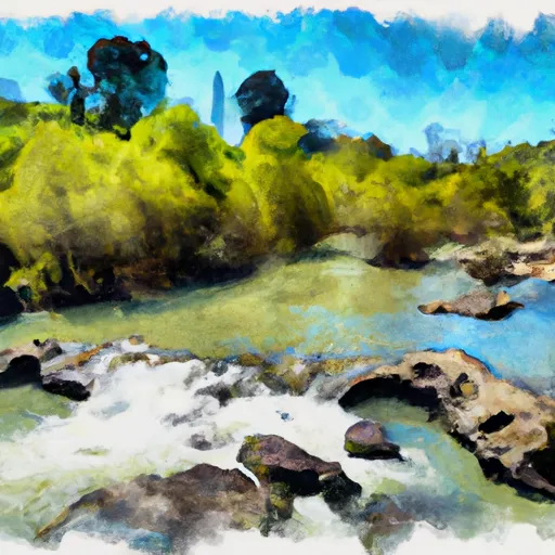
The river segment that is most commonly run is 21 miles long, starting at Chili Bar and ending at Folsom Lake. This section of the river features several notable rapids, including Meatgrinder, Troublemaker, and Satan's Cesspool. These rapids are known for their technical drops and challenging maneuvers.
To ensure safety and protect the environment, there are specific regulations in place for the South Fork American River. These include a limit on the number of commercial outfitters allowed to operate on the river, as well as requirements for personal flotation devices and other safety equipment. Additionally, there are restrictions on camping and fires along the riverbank to prevent damage to the ecosystem.
Overall, the South Fork American River offers a thrilling whitewater experience for skilled paddlers. With its challenging rapids and scenic surroundings, it is a popular destination for river enthusiasts from around the world.
Plan your run down to the hour
Same weather feed Snoflo's iOS app uses -- updated continuously from NOAA / yr.no. Watch the precipitation column on the meteogram; rain ahead of a run typically lifts flows 12-48 hours later depending on the basin.
Next 5 days, hour by hour
Temperature line with weather symbols on top, snow + rain accumulation as columns, humidity as a dotted line.
5-day forecast table
Every 3 hours, broken out across temperature, snow, rain, humidity, and wind. Each cell is colour-coded relative to the column min/max.
| Time | Condition | Temp (°F) | Snow (in) | Rain (in) | Humidity (%) | Wind (mps) | Wind dir |
|---|---|---|---|---|---|---|---|
| Loading detailed forecast… | |||||||
15-day temperature & precipitation
Daily temperatures, snow, and rain projected over the next two weeks -- the upstream story that drives next week's flows.
Regional streamflow levels
USGS streamgauges around South Fork American River -- useful for spotting upstream pulses and gauging which tributary is contributing what.
| Streamgauge | Discharge | View |
|---|---|---|
| Deer C Nr Cameron Park Ca | 8 cfs | → |
| Pilot C Bl Mutton Canyon Nr Georgetown Ca | 2 cfs | → |
| Nf American R A North Fork Dam Ca | 71 cfs | → |
| Pilot C Ab Stumpy Meadows Res Ca | 3 cfs | → |
| Cosumnes R A Michigan Bar Ca | 57 cfs | → |
| American R A Fair Oaks Ca | 4,430 cfs | → |
Plan a longer trip
The closest boat launches, other paddle runs, and campgrounds so a day on the water can grow into a full weekend.
Boat launches
- Rock Creek Road El Dorado County
- River Trail El Dorado County
- Forebay Road El Dorado County
- Poho Ridge El Dorado County
- Sly Park Road, Pollock Pines
- Rattlesnake Road Placer County
Other river runs
- Chili Bar
- Coloma To Greenwood - (C To G)
- The Gorge
- Greenwood To Mammoth Bar
- Big Grizzly Canyon To Oxbow Reservoir
Campgrounds
- Finnon Lake
- Mother Lode River Center
- Koa Placerville
- Georgetown Airport Campground
- Dru Barner
- Dru Barner Campground
Fishing spots
- Folsom Lake
- Stumpy Meadows Lake
- Lake Clementine
- Pg&E Rock Creek Lake Fishing Access
- Lake Combie
- Natoma Lake
Whitewater safety
- Check the flow before you run
- Use the linked-gauge card and Regional Flow panel above. Class ratings change with flow -- a Class III at low water can become Class IV+ at high water.
- Know your skill ceiling
- Pick runs comfortably below your ceiling. Cold-water and big-water runs raise the consequences of any mistake.
- Wear the right gear
- Helmet, PFD, drysuit / wetsuit when water is below 60°F. Throw bag, knife, and whistle on your person, not in the boat.
- Scout, set safety, and run with a team
- Scout new rapids on foot, set safety with throw bags above the consequence pool, and run with at least one other competent paddler.
- Respect the river
- Strainers, undercuts, low-head dams, and wood can kill at any class rating. When in doubt, portage.
Set push alerts in the Snoflo app
Save South Fork American River as a favorite, set a discharge threshold (e.g. "alert me when flow hits 600 cfs"), and the iOS app pushes the moment the linked gauge crosses.
About South Fork American River
What's the optimal flow for South Fork American River?
The optimal flow depends on the section and the craft. Check the Run Details panel for the linked gauge and current status.
How fresh is the cfs reading on this page?
The linked USGS streamgauge reports continuously (every 15 minutes); Snoflo refreshes throughout the day. Hover the streamflow sparkline to read individual datapoints.
What's the whitewater class?
See the Run Details panel for the class rating Snoflo tracks for this run. Class ratings change with flow -- a Class III at low water can become Class IV in high water.
Where do I put in / take out?
Tap Directions in the hero above to open driving directions to the put-in. For shuttle planning, check the Nearby Boat Launches panel and the river run operator's site.
Can I get alerts when flows hit the optimal range?
Yes -- alerts are managed in the Snoflo iOS app. Favorite this run, set a discharge threshold, and you'll get a push the moment the gauge crosses.
Other runs near here
Snoflo-tracked paddle runs within driving distance of South Fork American River.