Sand Creek dam

Sand Creek
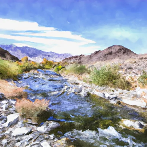
Sand Creek, also known as Sand Creek Reservoir, is a flood risk reduction and water supply dam located in Fresno County, California, near the city of Orange Cove. Built in 1980, this earth-type dam stands at a height of 60 feet and has a hydraulic height of 53 feet. With a storage capacity of 1050 acre-feet, the dam serves the primary purpose of flood risk reduction while also supporting water supply needs in the region. The reservoir covers a surface area of 55 acres and has a drainage area of 26.3 square miles, making it a significant water resource for the area.
Managed by the local government, Sand Creek Dam is regulated, permitted, inspected, and enforced by the California Department of Water Resources (DWR) and Safety of Dams agency. The dam has a high hazard potential but is currently assessed to be in satisfactory condition, with the last assessment conducted in September 2017. The dam underwent its last inspection in April 2020, with an inspection frequency of one year. In case of emergencies, the dam's Emergency Action Plan (EAP) status is currently unknown, but the risk management measures and guidelines are put in place to ensure the safety and security of the surrounding community.
Despite being a relatively small dam, Sand Creek plays a crucial role in mitigating flood risks and providing water supply to the local area. With its strategic location along the Sand Creek stream and its modern design, the dam stands as a vital infrastructure for water resource management and climate resilience in Fresno County. As water resource and climate enthusiasts, understanding the significance and functionality of dams like Sand Creek is essential for safeguarding communities and ecosystems against the impacts of changing climate patterns and water availability.
Plan around the weather
Same NOAA / yr.no feed Snoflo's iOS app uses. Watch the precipitation column on the meteogram -- rain on the basin upstream typically lifts inflow 24-72 hours later.
Next 5 days, hour by hour
Temperature line with weather symbols on top, snow + rain accumulation as columns, humidity as a dotted line.
5-day forecast table
Every 3 hours, broken out across temperature, snow, rain, humidity, and wind. Each cell is colour-coded relative to the column min/max.
| Time | Condition | Temp (°F) | Snow (in) | Rain (in) | Humidity (%) | Wind (mps) | Wind dir |
|---|---|---|---|---|---|---|---|
| Loading detailed forecast… | |||||||
15-day temperature & precipitation
Daily temperatures, snow, and rain projected over the next two weeks.
Nearby streamflow gauges
USGS streamgauges around Sand Creek -- inflows here typically show up in storage 24-72 hours later.
| Streamgauge | Discharge | View |
|---|---|---|
| Marble Fork Kaweah R Ab Horse C Nr Lodgepole Ca | 3 cfs | → |
| San Joaquin R Bl Friant Ca | 314 cfs | → |
| Sf Tule R Nr Reservation Bndry Nr Porterville Ca | 12 cfs | → |
| Sf Tule R Nr Cholollo Campground Nr Porterville Ca | 9 cfs | → |
| Nf Willow C Nr Sugar Pine Ca | 416 cfs | → |
| Deer C Nr Fountain Springs Ca | 8 cfs | → |
Make a day of it
Boat launches, lakeside camping, fishing access, and other reservoirs near Sand Creek.
Boat launches
See all →


Campgrounds
See all →


Fishing spots
See all →


River runs
See all →


About Sand Creek
Where does the data for Sand Creek come from?
Structural and regulatory data come from the U.S. Army Corps of Engineers' National Inventory of Dams (NID). Weather forecast comes from NOAA / yr.no -- the same feed Snoflo's iOS app uses.
How often is the report updated?
NID structural data refreshes annually as the Corps publishes updated assessments. The weather forecast refreshes throughout the day.
What does the High hazard rating mean?
The Corps of Engineers' hazard potential classification grades probable consequences if the dam fails: High = probable loss of human life; Significant = no probable loss of human life but possible economic loss / environmental damage; Low = no probable loss of human life, only minor economic / environmental losses. See the Dam Data Reference card below for the full definitions.
What's "% of normal"?
The current storage value compared to the historical average storage on this calendar day. 100% = right on average; values above 100% mean above-normal storage (wet year); values below mean below-normal (dry year or drought).
Can I get alerts when storage crosses a threshold?
Yes -- alerts are managed in the Snoflo iOS app. Favorite this dam, set a threshold, and you'll get a push the moment conditions cross.
Dam data reference
Condition Assessment
- Satisfactory
- No existing or potential dam safety deficiencies are recognized. Acceptable performance is expected under all loading conditions (static, hydrologic, seismic) in accordance with the minimum applicable state or federal regulatory criteria or tolerable risk guidelines.
- Fair
- No existing dam safety deficiencies are recognized for normal operating conditions. Rare or extreme hydrologic and/or seismic events may result in a dam safety deficiency. Risk may be in the range to take further action.
- Poor
- A dam safety deficiency is recognized for normal operating conditions which may realistically occur. Remedial action is necessary. POOR may also be used when uncertainties exist as to critical analysis parameters which identify a potential dam safety deficiency.
- Unsatisfactory
- A dam safety deficiency is recognized that requires immediate or emergency remedial action for problem resolution.
- Not Rated
- The dam has not been inspected, is not under state or federal jurisdiction, or has been inspected but, for whatever reason, has not been rated.
Hazard Potential Classification
- High
- Dams assigned the high hazard potential classification are those where failure or mis-operation will probably cause loss of human life.
- Significant
- Dams assigned the significant hazard potential classification are those dams where failure or mis-operation results in no probable loss of human life but can cause economic loss, environmental damage, disruption of lifeline facilities, or impact other concerns. Significant hazard potential classification dams are often located in predominantly rural or agricultural areas but could be in areas with population and significant infrastructure.
- Low
- Dams assigned the low hazard potential classification are those where failure or mis-operation results in no probable loss of human life and low economic and/or environmental losses. Losses are principally limited to the owner's property.
- Undetermined
- Dams for which a downstream hazard potential has not been designated or is not provided.