Mission Dam

Mission
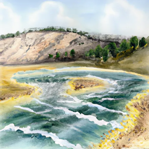
Mission is a federal-owned irrigation structure located in St. Ignatius, Montana, along Mission Creek. Managed by the Bureau of Indian Affairs, this earth dam stands at 83 feet tall and spans 1848 feet in length, with a storage capacity of 7000 acre-feet. Completed in 1935, Mission serves primarily for irrigation purposes, with additional recreational benefits.
Despite its age, Mission has a high hazard potential and a very high risk assessment rating. The dam has not undergone recent condition assessments, but emergency action plans have been prepared and updated. The last inspection took place in July 2011, with a recommended inspection frequency of every 5 years. With its controlled spillway type and location in a high-risk area, Mission requires careful monitoring and management to ensure public safety and water resource sustainability.
Enthusiasts of water resources and climate will find Mission to be a fascinating case study in dam management and risk assessment. With its historical significance, critical irrigation function, and high hazard potential, Mission represents both the challenges and opportunities in maintaining infrastructure for water supply in a changing climate. As climate impacts continue to pose threats to water resources, the management and maintenance of structures like Mission will be crucial for ensuring the resilience of water systems in the future.
Plan around the weather
Same NOAA / yr.no feed Snoflo's iOS app uses. Watch the precipitation column on the meteogram -- rain on the basin upstream typically lifts inflow 24-72 hours later.
Next 5 days, hour by hour
Temperature line with weather symbols on top, snow + rain accumulation as columns, humidity as a dotted line.
5-day forecast table
Every 3 hours, broken out across temperature, snow, rain, humidity, and wind. Each cell is colour-coded relative to the column min/max.
| Time | Condition | Temp (°F) | Snow (in) | Rain (in) | Humidity (%) | Wind (mps) | Wind dir |
|---|---|---|---|---|---|---|---|
| Loading detailed forecast… | |||||||
15-day temperature & precipitation
Daily temperatures, snow, and rain projected over the next two weeks.
Nearby streamflow gauges
USGS streamgauges around Mission -- inflows here typically show up in storage 24-72 hours later.
| Streamgauge | Discharge | View |
|---|---|---|
| Mission Cr Ab Reservoir Nr St Ignatius Mt | 111 cfs | → |
| South Fork Jocko River Near Arlee Mt | 54 cfs | → |
| South Crow Creek Near Ronan Mt | 9 cfs | → |
| Flathead River At Perma Mt | 9,240 cfs | → |
| Flathead River Near Polson Mt | 8,840 cfs | → |
| Clark Fork Above Missoula Mt | 2,060 cfs | → |
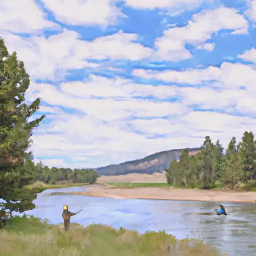
Make a day of it
Boat launches, lakeside camping, fishing access, and other reservoirs near Mission.
Boat launches
See all →


Campgrounds
See all →


Fishing spots
See all →


River runs
See all →


More reservoirs
See all →
About Mission
Where does the data for Mission come from?
Structural and regulatory data come from the U.S. Army Corps of Engineers' National Inventory of Dams (NID). Weather forecast comes from NOAA / yr.no -- the same feed Snoflo's iOS app uses.
How often is the report updated?
NID structural data refreshes annually as the Corps publishes updated assessments. The weather forecast refreshes throughout the day.
What does the High hazard rating mean?
The Corps of Engineers' hazard potential classification grades probable consequences if the dam fails: High = probable loss of human life; Significant = no probable loss of human life but possible economic loss / environmental damage; Low = no probable loss of human life, only minor economic / environmental losses. See the Dam Data Reference card below for the full definitions.
What's "% of normal"?
The current storage value compared to the historical average storage on this calendar day. 100% = right on average; values above 100% mean above-normal storage (wet year); values below mean below-normal (dry year or drought).
Can I get alerts when storage crosses a threshold?
Yes -- alerts are managed in the Snoflo iOS app. Favorite this dam, set a threshold, and you'll get a push the moment conditions cross.
Dam data reference
Condition Assessment
- Satisfactory
- No existing or potential dam safety deficiencies are recognized. Acceptable performance is expected under all loading conditions (static, hydrologic, seismic) in accordance with the minimum applicable state or federal regulatory criteria or tolerable risk guidelines.
- Fair
- No existing dam safety deficiencies are recognized for normal operating conditions. Rare or extreme hydrologic and/or seismic events may result in a dam safety deficiency. Risk may be in the range to take further action.
- Poor
- A dam safety deficiency is recognized for normal operating conditions which may realistically occur. Remedial action is necessary. POOR may also be used when uncertainties exist as to critical analysis parameters which identify a potential dam safety deficiency.
- Unsatisfactory
- A dam safety deficiency is recognized that requires immediate or emergency remedial action for problem resolution.
- Not Rated
- The dam has not been inspected, is not under state or federal jurisdiction, or has been inspected but, for whatever reason, has not been rated.
Hazard Potential Classification
- High
- Dams assigned the high hazard potential classification are those where failure or mis-operation will probably cause loss of human life.
- Significant
- Dams assigned the significant hazard potential classification are those dams where failure or mis-operation results in no probable loss of human life but can cause economic loss, environmental damage, disruption of lifeline facilities, or impact other concerns. Significant hazard potential classification dams are often located in predominantly rural or agricultural areas but could be in areas with population and significant infrastructure.
- Low
- Dams assigned the low hazard potential classification are those where failure or mis-operation results in no probable loss of human life and low economic and/or environmental losses. Losses are principally limited to the owner's property.
- Undetermined
- Dams for which a downstream hazard potential has not been designated or is not provided.