Goodman Pond Dam dam

Goodman Pond Dam
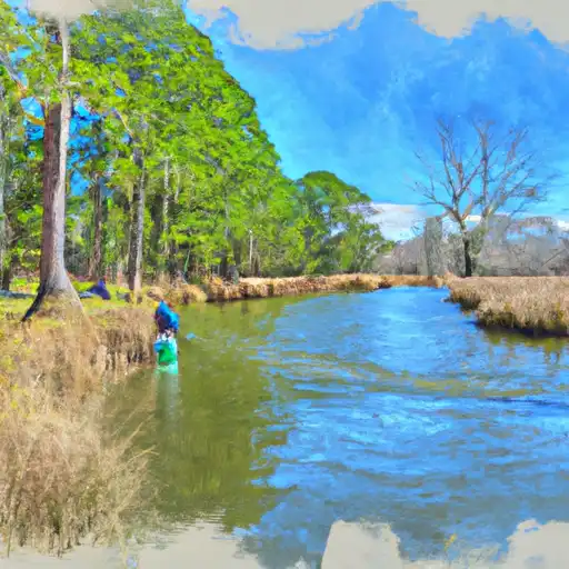
Goodman Pond Dam, located in Burke, North Carolina, is a private-owned structure primarily used for recreational purposes. The dam, with a hydraulic height of 11.5 feet and a structural height of 16 feet, creates a reservoir with a storage capacity of 41 acre-feet. It is situated along the Irish Creek, making it a popular spot for fishing, boating, and other water-related activities in the area.
Despite its recreational appeal, Goodman Pond Dam poses a significant hazard potential due to its poor condition assessment as of January 2015. The dam lacks recent inspection and maintenance records, raising concerns about its structural integrity and ability to withstand heavy rainfall or natural disasters. It is essential for stakeholders to prioritize the rehabilitation and upkeep of the dam to ensure public safety and mitigate the risk of potential flooding or dam failure.
In light of the dam's condition and hazard potential, water resource and climate enthusiasts should advocate for increased oversight, maintenance, and emergency preparedness measures for Goodman Pond Dam. Collaborative efforts between private owners, state agencies, and the community are crucial in safeguarding the dam, preserving its recreational benefits, and protecting the surrounding environment from potential water-related hazards. By addressing the dam's poor condition and implementing risk management strategies, stakeholders can enhance the resilience of the structure and promote sustainable water resource management in the region.
Plan around the weather
Same NOAA / yr.no feed Snoflo's iOS app uses. Watch the precipitation column on the meteogram -- rain on the basin upstream typically lifts inflow 24-72 hours later.
Next 5 days, hour by hour
Temperature line with weather symbols on top, snow + rain accumulation as columns, humidity as a dotted line.
5-day forecast table
Every 3 hours, broken out across temperature, snow, rain, humidity, and wind. Each cell is colour-coded relative to the column min/max.
| Time | Condition | Temp (°F) | Snow (in) | Rain (in) | Humidity (%) | Wind (mps) | Wind dir |
|---|---|---|---|---|---|---|---|
| Loading detailed forecast… | |||||||
15-day temperature & precipitation
Daily temperatures, snow, and rain projected over the next two weeks.
Nearby streamflow gauges
USGS streamgauges around Goodman Pond Dam -- inflows here typically show up in storage 24-72 hours later.
| Streamgauge | Discharge | View |
|---|---|---|
| Johns River At Arneys Store | 218 cfs | → |
| Linville River Near Nebo | 173 cfs | → |
| Yadkin River At Patterson | 15 cfs | → |
| Jacob Fork At Ramsey | 15 cfs | → |
| Catawba R Nr Pleasant Gardens | 145 cfs | → |
| First Broad River Near Casar | 33 cfs | → |
Make a day of it
Boat launches, lakeside camping, fishing access, and other reservoirs near Goodman Pond Dam.
Boat launches
See all →


Campgrounds
See all →


Fishing spots
See all →


River runs
See all →


About Goodman Pond Dam
Where does the data for Goodman Pond Dam come from?
Structural and regulatory data come from the U.S. Army Corps of Engineers' National Inventory of Dams (NID). Weather forecast comes from NOAA / yr.no -- the same feed Snoflo's iOS app uses.
How often is the report updated?
NID structural data refreshes annually as the Corps publishes updated assessments. The weather forecast refreshes throughout the day.
What does the Significant hazard rating mean?
The Corps of Engineers' hazard potential classification grades probable consequences if the dam fails: High = probable loss of human life; Significant = no probable loss of human life but possible economic loss / environmental damage; Low = no probable loss of human life, only minor economic / environmental losses. See the Dam Data Reference card below for the full definitions.
What's "% of normal"?
The current storage value compared to the historical average storage on this calendar day. 100% = right on average; values above 100% mean above-normal storage (wet year); values below mean below-normal (dry year or drought).
Can I get alerts when storage crosses a threshold?
Yes -- alerts are managed in the Snoflo iOS app. Favorite this dam, set a threshold, and you'll get a push the moment conditions cross.
Dam data reference
Condition Assessment
- Satisfactory
- No existing or potential dam safety deficiencies are recognized. Acceptable performance is expected under all loading conditions (static, hydrologic, seismic) in accordance with the minimum applicable state or federal regulatory criteria or tolerable risk guidelines.
- Fair
- No existing dam safety deficiencies are recognized for normal operating conditions. Rare or extreme hydrologic and/or seismic events may result in a dam safety deficiency. Risk may be in the range to take further action.
- Poor
- A dam safety deficiency is recognized for normal operating conditions which may realistically occur. Remedial action is necessary. POOR may also be used when uncertainties exist as to critical analysis parameters which identify a potential dam safety deficiency.
- Unsatisfactory
- A dam safety deficiency is recognized that requires immediate or emergency remedial action for problem resolution.
- Not Rated
- The dam has not been inspected, is not under state or federal jurisdiction, or has been inspected but, for whatever reason, has not been rated.
Hazard Potential Classification
- High
- Dams assigned the high hazard potential classification are those where failure or mis-operation will probably cause loss of human life.
- Significant
- Dams assigned the significant hazard potential classification are those dams where failure or mis-operation results in no probable loss of human life but can cause economic loss, environmental damage, disruption of lifeline facilities, or impact other concerns. Significant hazard potential classification dams are often located in predominantly rural or agricultural areas but could be in areas with population and significant infrastructure.
- Low
- Dams assigned the low hazard potential classification are those where failure or mis-operation results in no probable loss of human life and low economic and/or environmental losses. Losses are principally limited to the owner's property.
- Undetermined
- Dams for which a downstream hazard potential has not been designated or is not provided.