Boy Scout Pond - Maple Dell Dam

Boy Scout Pond - Maple Dell
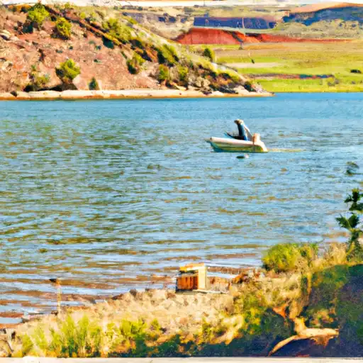
Boy Scout Pond at Maple Dell is a private water resource located in Payson, Utah, offering a serene recreational oasis for outdoor enthusiasts. Managed by the Utah Division of Water Rights, this pond is regulated and inspected regularly to ensure safety and compliance with state guidelines. Situated along Coal Pit Creek, this Earth-type dam boasts a hydraulic height of 10.6 feet and a structural height of 12.2 feet, providing a tranquil spot for fishing, picnicking, and exploring nature.
With a storage capacity of 15 acre-feet and a drainage area of 0.9 square miles, Boy Scout Pond is a significant water feature in the Utah landscape. While the exact year of completion is unknown, the dam remains a popular destination for locals and visitors alike. Despite a hazard potential deemed "significant," the condition assessment of the pond is currently not rated. With its striking natural surroundings and recreational opportunities, Boy Scout Pond at Maple Dell is a must-visit destination for water resource and climate enthusiasts looking to connect with nature in the heart of Utah's scenic beauty.
Plan around the weather
Same NOAA / yr.no feed Snoflo's iOS app uses. Watch the precipitation column on the meteogram -- rain on the basin upstream typically lifts inflow 24-72 hours later.
Next 5 days, hour by hour
Temperature line with weather symbols on top, snow + rain accumulation as columns, humidity as a dotted line.
5-day forecast table
Every 3 hours, broken out across temperature, snow, rain, humidity, and wind. Each cell is colour-coded relative to the column min/max.
| Time | Condition | Temp (°F) | Snow (in) | Rain (in) | Humidity (%) | Wind (mps) | Wind dir |
|---|---|---|---|---|---|---|---|
| Loading detailed forecast… | |||||||
15-day temperature & precipitation
Daily temperatures, snow, and rain projected over the next two weeks.
Nearby streamflow gauges
USGS streamgauges around Boy Scout Pond - Maple Dell -- inflows here typically show up in storage 24-72 hours later.
| Streamgauge | Discharge | View |
|---|---|---|
| Summit Creek Abv Summit Cr Canal Nr Santaquin Ut | 3 cfs | → |
| Spanish Fork At Castilla | 332 cfs | → |
| Hobble Creek At 1650 West At Springville | 16 cfs | → |
| Currant Creek Near Mona | 1 cfs | → |
| Salt Crk Blw Nephi Powerplant Div | 5 cfs | → |
| Diamond Fork Above Red Hollow | 39 cfs | → |


About Boy Scout Pond - Maple Dell
Where does the data for Boy Scout Pond - Maple Dell come from?
Structural and regulatory data come from the U.S. Army Corps of Engineers' National Inventory of Dams (NID). Weather forecast comes from NOAA / yr.no -- the same feed Snoflo's iOS app uses.
How often is the report updated?
NID structural data refreshes annually as the Corps publishes updated assessments. The weather forecast refreshes throughout the day.
What does the Significant hazard rating mean?
The Corps of Engineers' hazard potential classification grades probable consequences if the dam fails: High = probable loss of human life; Significant = no probable loss of human life but possible economic loss / environmental damage; Low = no probable loss of human life, only minor economic / environmental losses. See the Dam Data Reference card below for the full definitions.
What's "% of normal"?
The current storage value compared to the historical average storage on this calendar day. 100% = right on average; values above 100% mean above-normal storage (wet year); values below mean below-normal (dry year or drought).
Can I get alerts when storage crosses a threshold?
Yes -- alerts are managed in the Snoflo iOS app. Favorite this dam, set a threshold, and you'll get a push the moment conditions cross.
Dam data reference
Condition Assessment
- Satisfactory
- No existing or potential dam safety deficiencies are recognized. Acceptable performance is expected under all loading conditions (static, hydrologic, seismic) in accordance with the minimum applicable state or federal regulatory criteria or tolerable risk guidelines.
- Fair
- No existing dam safety deficiencies are recognized for normal operating conditions. Rare or extreme hydrologic and/or seismic events may result in a dam safety deficiency. Risk may be in the range to take further action.
- Poor
- A dam safety deficiency is recognized for normal operating conditions which may realistically occur. Remedial action is necessary. POOR may also be used when uncertainties exist as to critical analysis parameters which identify a potential dam safety deficiency.
- Unsatisfactory
- A dam safety deficiency is recognized that requires immediate or emergency remedial action for problem resolution.
- Not Rated
- The dam has not been inspected, is not under state or federal jurisdiction, or has been inspected but, for whatever reason, has not been rated.
Hazard Potential Classification
- High
- Dams assigned the high hazard potential classification are those where failure or mis-operation will probably cause loss of human life.
- Significant
- Dams assigned the significant hazard potential classification are those dams where failure or mis-operation results in no probable loss of human life but can cause economic loss, environmental damage, disruption of lifeline facilities, or impact other concerns. Significant hazard potential classification dams are often located in predominantly rural or agricultural areas but could be in areas with population and significant infrastructure.
- Low
- Dams assigned the low hazard potential classification are those where failure or mis-operation results in no probable loss of human life and low economic and/or environmental losses. Losses are principally limited to the owner's property.
- Undetermined
- Dams for which a downstream hazard potential has not been designated or is not provided.