Michigan Snowpack & Snow Report
As of Jul 31, 2026, Michigan's snowpack is at 18% of normal across 0 SNOTEL stations — the deepest is 1" at Herman. Live SNOTEL snow depth, snowfall, snow-water equivalent, and 5-day forecasts for every mountain in Michigan.
Michigan's snowpack is at 18% of normal for today's date — well below the 70% drought-stress threshold. The deepest station is Herman with 1" on the ground (seasonal average 8"). Herman is the coldest right now at 40°F.
The Michigan snowpack is monitored by the USDA NRCS SNOTEL network — automated stations sitting on the mountain that report snow depth, snow water equivalent (SWE), and air temperature every hour. Snoflo joins those live readings to a 5-day NOAA forecast for each station so you can see what's on the ground and what's coming.
Use the SNOTEL inventory below to find the closest station to where you're headed. Percent of normal tells you how today's snowpack compares to the historical average for the same date — below 70% is drought-stressed; above 130% is a fat year. Snow water content (SWC) indicates how wet and dense the snowpack is — useful for water-supply planning and avalanche stability assessment.
For backcountry travel always cross-reference with your regional avalanche center at avalanche.org.
State-wide snowpack overview
Today's standouts across the Michigan SNOTEL network -- the deepest snowpack, coldest mountain, biggest expected snowfall, and how the state sits versus normal.
Percent of normal
100% is the historical norm for today's date. Below 70% is drought-stressed; above 130% is a fat year.
Deepest snowpack
vs 8" seasonal average
Coldest station
Elevation 1,837 ft
Michigan snowpack monitoring sites
Showing the top 10 deepest SNOTEL stations in Michigan — -10 more hidden. Tap any station for its full history.
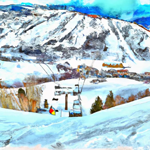
Michigan ski-area meteograms
Per-resort interactive weather forecasts for the next 15 days — temperature curve, precipitation bars, weather symbols, and humidity at every Michigan ski area Snoflo tracks.
-
 Alpine Valley
→
Alpine Valley
→
-
 Apple Mountain
→
Apple Mountain
→
-
 Big Powderhorn Mountain
→
Big Powderhorn Mountain
→
-
 Bittersweet Ski Area
→
Bittersweet Ski Area
→
-
 Blackjack Ski Resort
→
Blackjack Ski Resort
→
-
 Boyne Highlands
→
Boyne Highlands
→
-
 Boyne Mountain
→
Boyne Mountain
→
-
 Cannonsburg Ski Area
→
Cannonsburg Ski Area
→
-
 Challenge Mountain
→
Challenge Mountain
→
-
 Crystal Mountain
→
Crystal Mountain
→
-
 Gladstone Sports Park
→
Gladstone Sports Park
→
-
 Hickory Hills
→
Hickory Hills
→
-
 Indianhead Mountain Resort
→
Indianhead Mountain Resort
→
-
 Marquette Mountain
→
Marquette Mountain
→
-
 Missaukee Mountain
→
Missaukee Mountain
→
-
 Mont Ripley
→
Mont Ripley
→
-
 Mount Bohemia
→
Mount Bohemia
→
-
 Mt. Brighton
→
Mt. Brighton
→
-
 Mt Holiday Ski Area
→
Mt Holiday Ski Area
→
-
 Mt. Holly Ski Area
→
Mt. Holly Ski Area
→
-
 Mt. Zion Ski Area
→
Mt. Zion Ski Area
→
-
 Mulligan's Hollow Ski Bowl
→
Mulligan's Hollow Ski Bowl
→
-
 Norway Mountain
→
Norway Mountain
→
-
 Nubs Nob Ski Area
→
Nubs Nob Ski Area
→
-
 Pine Mountain Resort
→
Pine Mountain Resort
→
-
 Shanty Creek Resorts
→
Shanty Creek Resorts
→
-
 Ski Brule
→
Ski Brule
→
-
 Snow Snake Mountain
→
Snow Snake Mountain
→
-
 Swiss Valley Ski Lodge
→
Swiss Valley Ski Lodge
→
-
 Timber Ridge Ski Area
→
Timber Ridge Ski Area
→
-
 Treetops Sylvan Resort
→
Treetops Sylvan Resort
→
About Michigan snowpack
What is Michigan's snowpack right now?
As of July 31, 2026, Michigan's snowpack is at 18% of normal across 0 SNOTEL stations, and the deepest station is Herman with 1" on the ground. The full SNOTEL table is below.
Where is the deepest snow in Michigan right now?
As of July 31, 2026, the deepest snowpack in Michigan is 1" at Herman. See the SNOTEL station table for the full ranking by depth and snow-water equivalent.
Is Michigan's snowpack above or below normal?
Compare the statewide percent-of-normal on this page: 100% is right at the historical average for the date, below 70% is drought-stressed, and above 130% is a well-above-normal year. Each SNOTEL station also shows its own percent of normal.
Where does the Michigan snowpack data come from?
The USDA NRCS SNOTEL network (SNOpack TELemetry) -- automated mountain stations that continuously measure snow depth, snow water equivalent, precipitation, and air temperature. Snoflo aggregates the live readings and joins them to a 5-day NOAA forecast for each station.
What is Snow Water Equivalent (SWE)?
The depth of water you'd get if you melted the entire snowpack. A 30-inch snowpack with 8 inches of SWE is wetter and denser than one with 5 inches -- useful for water-supply forecasting and avalanche assessment. The "SWC %" column shows the ratio.
What does Percent Normal mean?
Current snowpack as a percentage of the historical average for the same date at that station. 100% is right at the historical norm. Below 70% indicates drought-stressed snowpack; above 130% is a fat year.
How fresh is the Michigan data?
SNOTEL stations transmit hourly; Snoflo re-pulls throughout the day. The 5-day forecasts regenerate from NOAA NOHRSC analysis fields and NWS forecast guidance.
Why are SNOTEL stations only in some states?
The NRCS SNOTEL network is concentrated in the western mountain U.S. -- where the snowpack drives federal water supply forecasts for irrigation, hydropower, and municipal water. Eastern snowpack is measured by other networks (CoCoRaHS, NWS) which Snoflo includes elsewhere.
Is this a substitute for the local avalanche center?
No. For backcountry travel always consult your regional avalanche forecast at avalanche.org. Snoflo is informational data only.