

-
 Snoflo Premium
Get unlimited access to all our content
With no Ad interruptions! - Start Your Free Trial Login with existing account
Hector
Eden Index
Climate
8.0
•
Recreation
5.0
•
Community
1.3
•
Safeguard
5.3/10
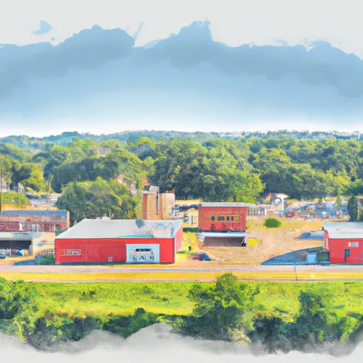
Hector, Arkansas is a small town located in Pope County with a population of approximately 500 people. The climate in Hector is characterized by hot, humid summers and mild winters. The town is primarily located in the Illinois Bayou watershed, a tributary of the Arkansas River, which supports a diverse range of aquatic life. Outdoor recreation opportunities in Hector include fishing, kayaking, and hiking. The nearby Ozark National Forest offers miles of trails for hiking and camping, as well as scenic drives through the mountains. The Illinois Bayou is a popular spot for fishing, with species such as bass, crappie, and catfish available. Overall, Hector offers a peaceful, rural atmosphere with plenty of opportunities for outdoor recreation.
What is the Eden Index?
The Snoflo Eden Index serves as a comprehensive rating system for regions, evaluating their desirability through a holistic assessment of climate health, outdoor recreation opportunities, and natural disaster risk, acknowledging the profound impact of these factors on livability and well-being.
Climate Health Indicator (CHI): 8.0
Hector receives approximately
1263mm of rain per year,
with humidity levels near 81%
and air temperatures averaging around
15°C.
Hector has a plant hardyness factor of
7, meaning
plants and agriculture in this region tend to thrive during the non-winter months.
By considering the ideal temperature range, reliable water supplies, clean air, and stable seasonal rain or snowpacks, the Climate Health Indicator (CHI) underscores the significance of a healthy climate as the foundation for quality living.
A healthy climate is paramount for ensuring a high quality of life and livability in a region, fostering both physical well-being and environmental harmony. This can be characterized by ideal temperatures, reliable access to water supplies, clean air, and consistent seasonal rain or snowpacks.
Weather Forecast
Streamflow Conditions
Lower Arkansas-Fourche La Fave
Area Rivers
Lower Arkansas-Fourche La Fave
Snowpack Depths
Lower Arkansas-Fourche La Fave
Reservoir Storage Capacity
Lower Arkansas-Fourche La Fave
Groundwater Levels
Recreational Opportunity Index (ROI): 5.0
The Recreational Opportunity Index (ROI) recognizes the value of outdoor recreational options, such as parks, hiking trails, camping sites, and fishing spots, while acknowledging that climate plays a pivotal role in ensuring the comfort and consistency of these experiences.
Access to outdoor recreational opportunities, encompassing activities such as parks, hiking, camping, and fishing, is crucial for overall well-being, and the climate plays a pivotal role in enabling and enhancing these experiences, ensuring that individuals can engage in nature-based activities comfortably and consistently.
Camping Areas
| Campground | Campsites | Reservations | Toilets | Showers | Elevation |
|---|---|---|---|---|---|
| Gum Springs Complex | 30 | 264 ft | |||
| Red Bluff Camp Complex | 10 | 205 ft | |||
| Coyote Camp Complex | 13 | 367 ft | |||
| Lake Claiborne State Park | None | 337 ft | |||
| Kisatchie Bayou Complex | 30 | 167 ft | |||
| Lotus Camp | 20 | 215 ft | |||
| Turkey Trot Complex | 25 | 261 ft | |||
| Cloud Crossing Complex | 13 | 130 ft | |||
| Custis Camp Complex | 10 | 302 ft | |||
| Oak Camp Complex | 23 | 300 ft |
Nearby Ski Areas
Catastrophe Safeguard Index (CSI):
The Catastrophe Safeguard Index (CSI) recognizes that natural disaster risk, encompassing floods, fires, hurricanes, and tornadoes, can drastically affect safety and the overall appeal of an area.
The level of natural disaster risk in a region significantly affects safety and the overall livability, with climate change amplifying these risks by potentially increasing the frequency and intensity of events like floods, fires, hurricanes, and tornadoes, thereby posing substantial challenges to community resilience and well-being.
Community Resilience Indicator (CRI): 1.3
The Community Resilience Indicator (CRI) recognizes that education, healthcare, and socioeconomics are crucial to the well-being of a region. The CRI acknowledges the profound impact of these elements on residents' overall quality of life. By evaluating educational resources, healthcare accessibility, and economic inclusivity, the index captures the essential aspects that contribute to a thriving community, fostering resident satisfaction, equity, and social cohesion.