Little Hyatt Dam dam

Little Hyatt Dam
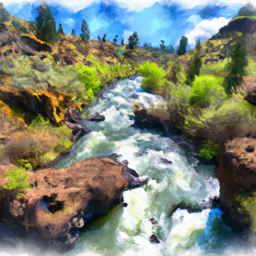
Little Hyatt Dam, also known as Little Hyatt Reservoir, is a captivating federal-owned structure located in Jackson, Oregon, along the Keene Creek. Managed by the Bureau of Land Management, this arch-type dam stands at a hydraulic height of 18 feet and has a structural height of 18 feet, with a length of 77 feet. The reservoir has a storage capacity of 59 acre-feet and covers a surface area of 10.9 acres, making it a popular destination for recreational activities.
Despite its low hazard potential, the dam is rated as having a poor condition assessment, with the last inspection conducted in July 2020. It has a moderate risk assessment rating of 3, indicating some level of vulnerability. The dam has not been modified in recent years, with the last modification dating back to 2008 when the foundation was addressed. With no outlet gates and an uncontrolled spillway, the dam relies on natural overflow mechanisms for water management.
Water resource and climate enthusiasts would find Little Hyatt Dam an intriguing structure to study due to its unique design and location. Situated in a remote area with no nearby towns, the dam feeds water into the Copco Reservoir in California, providing essential water resources for the region. While the dam serves primarily for recreation, its condition and risk assessments highlight the importance of regular maintenance and monitoring to ensure the safety and functionality of this vital water infrastructure.
Plan around the weather
Same NOAA / yr.no feed Snoflo's iOS app uses. Watch the precipitation column on the meteogram -- rain on the basin upstream typically lifts inflow 24-72 hours later.
Next 5 days, hour by hour
Temperature line with weather symbols on top, snow + rain accumulation as columns, humidity as a dotted line.
5-day forecast table
Every 3 hours, broken out across temperature, snow, rain, humidity, and wind. Each cell is colour-coded relative to the column min/max.
| Time | Condition | Temp (°F) | Snow (in) | Rain (in) | Humidity (%) | Wind (mps) | Wind dir |
|---|---|---|---|---|---|---|---|
| Loading detailed forecast… | |||||||
15-day temperature & precipitation
Daily temperatures, snow, and rain projected over the next two weeks.
Nearby streamflow gauges
USGS streamgauges around Little Hyatt Dam -- inflows here typically show up in storage 24-72 hours later.
| Streamgauge | Discharge | View |
|---|---|---|
| East Fork Ashland Creek Near Ashland | 2 cfs | → |
| West Fork Ashland Creek Near Ashland | 2 cfs | → |
| Bear Creek Blw Ashland Creek At Ashland | 58 cfs | → |
| Klamath R Bl Iron Gate Dam Ca | 885 cfs | → |
| Klamath River Blw John C.Boyle Pwrplnt | 860 cfs | → |
| Bear Creek At Medford | 28 cfs | → |


About Little Hyatt Dam
Where does the data for Little Hyatt Dam come from?
Structural and regulatory data come from the U.S. Army Corps of Engineers' National Inventory of Dams (NID). Weather forecast comes from NOAA / yr.no -- the same feed Snoflo's iOS app uses.
How often is the report updated?
NID structural data refreshes annually as the Corps publishes updated assessments. The weather forecast refreshes throughout the day.
What does the Low hazard rating mean?
The Corps of Engineers' hazard potential classification grades probable consequences if the dam fails: High = probable loss of human life; Significant = no probable loss of human life but possible economic loss / environmental damage; Low = no probable loss of human life, only minor economic / environmental losses. See the Dam Data Reference card below for the full definitions.
What's "% of normal"?
The current storage value compared to the historical average storage on this calendar day. 100% = right on average; values above 100% mean above-normal storage (wet year); values below mean below-normal (dry year or drought).
Can I get alerts when storage crosses a threshold?
Yes -- alerts are managed in the Snoflo iOS app. Favorite this dam, set a threshold, and you'll get a push the moment conditions cross.
Dam data reference
Condition Assessment
- Satisfactory
- No existing or potential dam safety deficiencies are recognized. Acceptable performance is expected under all loading conditions (static, hydrologic, seismic) in accordance with the minimum applicable state or federal regulatory criteria or tolerable risk guidelines.
- Fair
- No existing dam safety deficiencies are recognized for normal operating conditions. Rare or extreme hydrologic and/or seismic events may result in a dam safety deficiency. Risk may be in the range to take further action.
- Poor
- A dam safety deficiency is recognized for normal operating conditions which may realistically occur. Remedial action is necessary. POOR may also be used when uncertainties exist as to critical analysis parameters which identify a potential dam safety deficiency.
- Unsatisfactory
- A dam safety deficiency is recognized that requires immediate or emergency remedial action for problem resolution.
- Not Rated
- The dam has not been inspected, is not under state or federal jurisdiction, or has been inspected but, for whatever reason, has not been rated.
Hazard Potential Classification
- High
- Dams assigned the high hazard potential classification are those where failure or mis-operation will probably cause loss of human life.
- Significant
- Dams assigned the significant hazard potential classification are those dams where failure or mis-operation results in no probable loss of human life but can cause economic loss, environmental damage, disruption of lifeline facilities, or impact other concerns. Significant hazard potential classification dams are often located in predominantly rural or agricultural areas but could be in areas with population and significant infrastructure.
- Low
- Dams assigned the low hazard potential classification are those where failure or mis-operation results in no probable loss of human life and low economic and/or environmental losses. Losses are principally limited to the owner's property.
- Undetermined
- Dams for which a downstream hazard potential has not been designated or is not provided.