Pishkun Dike 5 Dam

Pishkun Dike 5
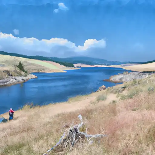
Pishkun Dike 5, located in Choteau, Montana, is a federal-owned earth dam constructed in 1931 by the Bureau of Reclamation for irrigation purposes along Deep Creek TR. Standing at a height of 11 feet and spanning 310 feet in length, this dam provides a storage capacity of 46,670 acre-feet and covers a surface area of 1,550 acres. With a high hazard potential rating and a risk assessment of 2 out of 5, it is crucial for water resource and climate enthusiasts to monitor the condition and safety of this vital infrastructure.
The dam is part of a network of seven associated structures and is regulated, inspected, and operated by the Bureau of Reclamation. Despite its age, the condition assessment of Pishkun Dike 5 is currently unavailable, emphasizing the need for regular inspection and maintenance to ensure its integrity and mitigate potential risks. With the absence of a spillway and locks, proper risk management measures must be in place to address any emergency situations that may arise.
In the event of an emergency, it is essential for the Bureau of Reclamation to have an Emergency Action Plan (EAP) in place, with the last revision dating back to November 2014. As efforts continue to meet guidelines and prepare inundation maps, stakeholders must remain vigilant in monitoring the dam's safety and compliance with regulatory standards to protect the surrounding communities and water resources.
Plan around the weather
Same NOAA / yr.no feed Snoflo's iOS app uses. Watch the precipitation column on the meteogram -- rain on the basin upstream typically lifts inflow 24-72 hours later.
Next 5 days, hour by hour
Temperature line with weather symbols on top, snow + rain accumulation as columns, humidity as a dotted line.
5-day forecast table
Every 3 hours, broken out across temperature, snow, rain, humidity, and wind. Each cell is colour-coded relative to the column min/max.
| Time | Condition | Temp (°F) | Snow (in) | Rain (in) | Humidity (%) | Wind (mps) | Wind dir |
|---|---|---|---|---|---|---|---|
| Loading detailed forecast… | |||||||
15-day temperature & precipitation
Daily temperatures, snow, and rain projected over the next two weeks.
Nearby streamflow gauges
USGS streamgauges around Pishkun Dike 5 -- inflows here typically show up in storage 24-72 hours later.
| Streamgauge | Discharge | View |
|---|---|---|
| Sun River Bl Diversion Dam Nr Augusta Mt | 109 cfs | → |
| Sun River Bl Willow Cr Nr Augusta Mt | 242 cfs | → |
| Teton River Bl South Fork Nr Choteau Mt | 145 cfs | → |
| North Fork Sun River Near Augusta Mt | 203 cfs | → |
| South Fork Sun River Near Augusta Mt | 185 cfs | → |
| Sun River At Simms Mt | 95 cfs | → |
Make a day of it
Boat launches, lakeside camping, fishing access, and other reservoirs near Pishkun Dike 5.
Boat launches
See all →


Campgrounds
See all →


Fishing spots
See all →


River runs
See all →


About Pishkun Dike 5
Where does the data for Pishkun Dike 5 come from?
Structural and regulatory data come from the U.S. Army Corps of Engineers' National Inventory of Dams (NID). Weather forecast comes from NOAA / yr.no -- the same feed Snoflo's iOS app uses.
How often is the report updated?
NID structural data refreshes annually as the Corps publishes updated assessments. The weather forecast refreshes throughout the day.
What does the High hazard rating mean?
The Corps of Engineers' hazard potential classification grades probable consequences if the dam fails: High = probable loss of human life; Significant = no probable loss of human life but possible economic loss / environmental damage; Low = no probable loss of human life, only minor economic / environmental losses. See the Dam Data Reference card below for the full definitions.
What's "% of normal"?
The current storage value compared to the historical average storage on this calendar day. 100% = right on average; values above 100% mean above-normal storage (wet year); values below mean below-normal (dry year or drought).
Can I get alerts when storage crosses a threshold?
Yes -- alerts are managed in the Snoflo iOS app. Favorite this dam, set a threshold, and you'll get a push the moment conditions cross.
Dam data reference
Condition Assessment
- Satisfactory
- No existing or potential dam safety deficiencies are recognized. Acceptable performance is expected under all loading conditions (static, hydrologic, seismic) in accordance with the minimum applicable state or federal regulatory criteria or tolerable risk guidelines.
- Fair
- No existing dam safety deficiencies are recognized for normal operating conditions. Rare or extreme hydrologic and/or seismic events may result in a dam safety deficiency. Risk may be in the range to take further action.
- Poor
- A dam safety deficiency is recognized for normal operating conditions which may realistically occur. Remedial action is necessary. POOR may also be used when uncertainties exist as to critical analysis parameters which identify a potential dam safety deficiency.
- Unsatisfactory
- A dam safety deficiency is recognized that requires immediate or emergency remedial action for problem resolution.
- Not Rated
- The dam has not been inspected, is not under state or federal jurisdiction, or has been inspected but, for whatever reason, has not been rated.
Hazard Potential Classification
- High
- Dams assigned the high hazard potential classification are those where failure or mis-operation will probably cause loss of human life.
- Significant
- Dams assigned the significant hazard potential classification are those dams where failure or mis-operation results in no probable loss of human life but can cause economic loss, environmental damage, disruption of lifeline facilities, or impact other concerns. Significant hazard potential classification dams are often located in predominantly rural or agricultural areas but could be in areas with population and significant infrastructure.
- Low
- Dams assigned the low hazard potential classification are those where failure or mis-operation results in no probable loss of human life and low economic and/or environmental losses. Losses are principally limited to the owner's property.
- Undetermined
- Dams for which a downstream hazard potential has not been designated or is not provided.