

-
 Snoflo Premium
Get unlimited access to all our content
With no Ad interruptions! - Start Your Free Trial Login with existing account
Mayflower
Eden Index
Climate
8.0
•
Recreation
5.4
•
Community
2.3
•
Safeguard
5.6/10
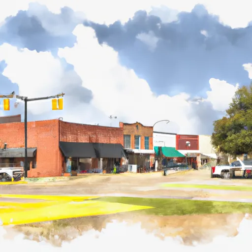
Mayflower, Arkansas is a small town located in Faulkner County in the central part of the state. Known for its natural beauty, Mayflower experiences a humid subtropical climate, characterized by hot and humid summers and mild winters. Average high temperatures range from the mid-80s Fahrenheit in summer to the mid-50s in winter.
Situated near Lake Conway and several other water bodies, Mayflower benefits from a diverse hydrology system. Lake Conway, the largest man-made game and fish commission lake in the United States, offers excellent fishing opportunities for bass, bream, and catfish enthusiasts. The nearby Arkansas River is ideal for boating, kayaking, and other water-based activities, while the wetlands and bayous in the area provide habitat for a variety of bird species, making it a popular destination for birdwatching.
In addition to its abundant water resources, Mayflower offers various outdoor recreation opportunities. The town boasts several parks and trails, including the Veterans Memorial Park, which features walking paths, playgrounds, and picnic areas. The Halter Wildlife Management Area, adjacent to Mayflower, offers hunting, fishing, and wildlife viewing opportunities. With its stunning natural surroundings and diverse outdoor activities, Mayflower, Arkansas, is an attractive destination for nature lovers and outdoor enthusiasts.
What is the Eden Index?
The Snoflo Eden Index serves as a comprehensive rating system for regions, evaluating their desirability through a holistic assessment of climate health, outdoor recreation opportunities, and natural disaster risk, acknowledging the profound impact of these factors on livability and well-being.
Climate Health Indicator (CHI): 8.0
Mayflower receives approximately
1258mm of rain per year,
with humidity levels near 84%
and air temperatures averaging around
17°C.
Mayflower has a plant hardyness factor of
7, meaning
plants and agriculture in this region tend to thrive during the non-winter months.
By considering the ideal temperature range, reliable water supplies, clean air, and stable seasonal rain or snowpacks, the Climate Health Indicator (CHI) underscores the significance of a healthy climate as the foundation for quality living.
A healthy climate is paramount for ensuring a high quality of life and livability in a region, fostering both physical well-being and environmental harmony. This can be characterized by ideal temperatures, reliable access to water supplies, clean air, and consistent seasonal rain or snowpacks.
Weather Forecast
Streamflow Conditions
Lower Arkansas-Fourche La Fave
Area Rivers
Lower Arkansas-Fourche La Fave
Snowpack Depths
Lower Arkansas-Fourche La Fave
Reservoir Storage Capacity
Lower Arkansas-Fourche La Fave
Groundwater Levels
Recreational Opportunity Index (ROI): 5.4
The Recreational Opportunity Index (ROI) recognizes the value of outdoor recreational options, such as parks, hiking trails, camping sites, and fishing spots, while acknowledging that climate plays a pivotal role in ensuring the comfort and consistency of these experiences.
Access to outdoor recreational opportunities, encompassing activities such as parks, hiking, camping, and fishing, is crucial for overall well-being, and the climate plays a pivotal role in enabling and enhancing these experiences, ensuring that individuals can engage in nature-based activities comfortably and consistently.
Camping Areas
| Campground | Campsites | Reservations | Toilets | Showers | Elevation |
|---|---|---|---|---|---|
| Evangeline Camp Complex | 14 | 158 ft | |||
| Chicot State Park | None | 78 ft | |||
| Crooked Creek Rec Area | None | 103 ft | |||
| Rayne RV Park Gossen Memorial Park | 737 | 27 ft | |||
| Stuart | 8 | 153 ft | |||
| Twin Lakes Military - Camp Beauregard | None | 95 ft | |||
| Indian Creek Recreation Area | None | 105 ft | |||
| Loran Site Complex | 30 | 230 ft | |||
| Kincaid Complex | 272 | 164 ft | |||
| Rapides Coliseum | None | 78 ft |
Nearby Ski Areas
Catastrophe Safeguard Index (CSI):
The Catastrophe Safeguard Index (CSI) recognizes that natural disaster risk, encompassing floods, fires, hurricanes, and tornadoes, can drastically affect safety and the overall appeal of an area.
The level of natural disaster risk in a region significantly affects safety and the overall livability, with climate change amplifying these risks by potentially increasing the frequency and intensity of events like floods, fires, hurricanes, and tornadoes, thereby posing substantial challenges to community resilience and well-being.
Community Resilience Indicator (CRI): 2.3
The Community Resilience Indicator (CRI) recognizes that education, healthcare, and socioeconomics are crucial to the well-being of a region. The CRI acknowledges the profound impact of these elements on residents' overall quality of life. By evaluating educational resources, healthcare accessibility, and economic inclusivity, the index captures the essential aspects that contribute to a thriving community, fostering resident satisfaction, equity, and social cohesion.