

-
 Snoflo Premium
Get unlimited access to all our content
With no Ad interruptions! - Start Your Free Trial Login with existing account
Northport
Eden Index
Climate
7.0
•
Recreation
3.8
•
Community
1.2
•
Safeguard
4.4/10
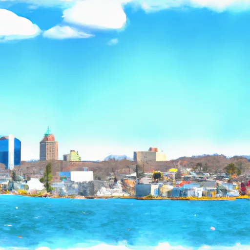
Northport, Michigan is a charming village situated on the northern tip of the Leelanau Peninsula. The climate in Northport is classified as humid continental, with warm summers and cold winters. The area is influenced by the nearby waters of Lake Michigan, resulting in slightly milder temperatures and a higher annual precipitation compared to inland regions. As for hydrology, Northport boasts stunning views of Lake Michigan, which provides ample opportunities for boating, fishing, and swimming. The region is also home to several inland lakes and rivers, offering additional options for water-based activities. Outdoor enthusiasts can explore the picturesque countryside through hiking, biking, and golfing, while the nearby Sleeping Bear Dunes National Lakeshore beckons visitors with its towering sand dunes and scenic trails.
What is the Eden Index?
The Snoflo Eden Index serves as a comprehensive rating system for regions, evaluating their desirability through a holistic assessment of climate health, outdoor recreation opportunities, and natural disaster risk, acknowledging the profound impact of these factors on livability and well-being.
Climate Health Indicator (CHI): 7.0
Northport receives approximately
810mm of rain per year,
with humidity levels near 80%
and air temperatures averaging around
8°C.
Northport has a plant hardyness factor of
6, meaning
plants and agriculture in this region thrive during a short period during spring and early summer. Most
plants will die off during the colder winter months.
By considering the ideal temperature range, reliable water supplies, clean air, and stable seasonal rain or snowpacks, the Climate Health Indicator (CHI) underscores the significance of a healthy climate as the foundation for quality living.
A healthy climate is paramount for ensuring a high quality of life and livability in a region, fostering both physical well-being and environmental harmony. This can be characterized by ideal temperatures, reliable access to water supplies, clean air, and consistent seasonal rain or snowpacks.
Weather Forecast
Streamflow Conditions
Northeastern Lake Michigan
Area Rivers
Northeastern Lake Michigan
Snowpack Depths
Northeastern Lake Michigan
Reservoir Storage Capacity
Northeastern Lake Michigan
Groundwater Levels
Recreational Opportunity Index (ROI): 3.8
The Recreational Opportunity Index (ROI) recognizes the value of outdoor recreational options, such as parks, hiking trails, camping sites, and fishing spots, while acknowledging that climate plays a pivotal role in ensuring the comfort and consistency of these experiences.
Access to outdoor recreational opportunities, encompassing activities such as parks, hiking, camping, and fishing, is crucial for overall well-being, and the climate plays a pivotal role in enabling and enhancing these experiences, ensuring that individuals can engage in nature-based activities comfortably and consistently.
Camping Areas
| Campground | Campsites | Reservations | Toilets | Showers | Elevation |
|---|---|---|---|---|---|
| Headquarters Lake - State Forest | 8 | 740 ft | |||
| Pretty Lake - State Forest | 27 | 761 ft | |||
| Perch Lake - State Forest | 25 | 735 ft | |||
| Holland Lake - State Forest | 15 | 760 ft | |||
| Mouth of Two Hearted River - State Forest | 39 | 615 ft | |||
| Blind Sucker 1 - State Forest | 13 | 634 ft | |||
| High Bridge - State Forest | 7 | 720 ft | |||
| Blind Sucker 2 - State Forest | 32 | 635 ft | |||
| Lake Superior - State Forest | 18 | 627 ft | |||
| Muskallonge Lake State Park | 170 | 644 ft |
Nearby Ski Areas
Catastrophe Safeguard Index (CSI):
The Catastrophe Safeguard Index (CSI) recognizes that natural disaster risk, encompassing floods, fires, hurricanes, and tornadoes, can drastically affect safety and the overall appeal of an area.
The level of natural disaster risk in a region significantly affects safety and the overall livability, with climate change amplifying these risks by potentially increasing the frequency and intensity of events like floods, fires, hurricanes, and tornadoes, thereby posing substantial challenges to community resilience and well-being.
Community Resilience Indicator (CRI): 1.2
The Community Resilience Indicator (CRI) recognizes that education, healthcare, and socioeconomics are crucial to the well-being of a region. The CRI acknowledges the profound impact of these elements on residents' overall quality of life. By evaluating educational resources, healthcare accessibility, and economic inclusivity, the index captures the essential aspects that contribute to a thriving community, fostering resident satisfaction, equity, and social cohesion.