

-
 Snoflo Premium
Get unlimited access to all our content
With no Ad interruptions! - Start Your Free Trial Login with existing account
Reed-City
Eden Index
Climate
6.5
•
Recreation
4.3
•
Community
2.0
•
Safeguard
4.6/10
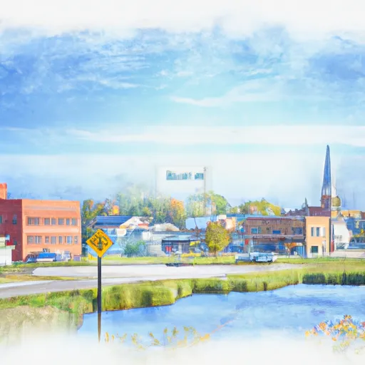
Reed City is a charming small town located in the heart of Michigan, with a population of approximately 2,400 residents. The town experiences a humid continental climate, characterized by warm summers and cold winters. Average temperatures range from 20°F (-7°C) in winter to 80°F (27°C) in summer. Precipitation is spread throughout the year, with an average of 37 inches of rainfall and 56 inches of snowfall annually.
Hydrologically, Reed City benefits from being situated near the Hersey and Muskegon rivers. These waterways offer excellent opportunities for fishing, canoeing, kayaking, and wildlife observation. Anglers can try their luck catching a variety of fish species such as trout, bass, walleye, and panfish. The rivers also provide picturesque settings for a relaxing day on the water.
Outdoor enthusiasts will find numerous recreational opportunities in the area. The Pere Marquette State Forest, located just a short drive away, offers miles of hiking and biking trails, as well as hunting and camping options. Additionally, nearby lakes and parks provide opportunities for boating, swimming, picnicking, and enjoying nature. Reed City's location in the beautiful Michigan countryside ensures there is no shortage of outdoor activities for residents and visitors to enjoy.
What is the Eden Index?
The Snoflo Eden Index serves as a comprehensive rating system for regions, evaluating their desirability through a holistic assessment of climate health, outdoor recreation opportunities, and natural disaster risk, acknowledging the profound impact of these factors on livability and well-being.
Climate Health Indicator (CHI): 6.5
Reed-City receives approximately
874mm of rain per year,
with humidity levels near 82%
and air temperatures averaging around
7°C.
Reed-City has a plant hardyness factor of
5, meaning
plants and agriculture in this region thrive during a short period during spring and early summer. Most
plants will die off during the colder winter months.
By considering the ideal temperature range, reliable water supplies, clean air, and stable seasonal rain or snowpacks, the Climate Health Indicator (CHI) underscores the significance of a healthy climate as the foundation for quality living.
A healthy climate is paramount for ensuring a high quality of life and livability in a region, fostering both physical well-being and environmental harmony. This can be characterized by ideal temperatures, reliable access to water supplies, clean air, and consistent seasonal rain or snowpacks.
Weather Forecast
Streamflow Conditions
Northeastern Lake Michigan
Area Rivers
Northeastern Lake Michigan
Snowpack Depths
Northeastern Lake Michigan
Reservoir Storage Capacity
Northeastern Lake Michigan
Groundwater Levels
Recreational Opportunity Index (ROI): 4.3
The Recreational Opportunity Index (ROI) recognizes the value of outdoor recreational options, such as parks, hiking trails, camping sites, and fishing spots, while acknowledging that climate plays a pivotal role in ensuring the comfort and consistency of these experiences.
Access to outdoor recreational opportunities, encompassing activities such as parks, hiking, camping, and fishing, is crucial for overall well-being, and the climate plays a pivotal role in enabling and enhancing these experiences, ensuring that individuals can engage in nature-based activities comfortably and consistently.
Camping Areas
| Campground | Campsites | Reservations | Toilets | Showers | Elevation |
|---|---|---|---|---|---|
| Pretty Lake - State Forest | 27 | 761 ft | |||
| Pike Lake (Paradise) - State Forest | 23 | 690 ft | |||
| Hidden Diamonds City Park | None | 901 ft | |||
| High Bridge - State Forest | 7 | 720 ft | |||
| Headquarters Lake - State Forest | 8 | 740 ft | |||
| Muskallonge Lake State Park | 170 | 644 ft | |||
| Chain OLakes State Park | 410 | 956 ft | |||
| Holland Lake - State Forest | 15 | 760 ft | |||
| Natalie - State Forest | 12 | 722 ft | |||
| Perch Lake - State Forest | 25 | 735 ft |
Nearby Ski Areas
Catastrophe Safeguard Index (CSI):
The Catastrophe Safeguard Index (CSI) recognizes that natural disaster risk, encompassing floods, fires, hurricanes, and tornadoes, can drastically affect safety and the overall appeal of an area.
The level of natural disaster risk in a region significantly affects safety and the overall livability, with climate change amplifying these risks by potentially increasing the frequency and intensity of events like floods, fires, hurricanes, and tornadoes, thereby posing substantial challenges to community resilience and well-being.
Community Resilience Indicator (CRI): 2.0
The Community Resilience Indicator (CRI) recognizes that education, healthcare, and socioeconomics are crucial to the well-being of a region. The CRI acknowledges the profound impact of these elements on residents' overall quality of life. By evaluating educational resources, healthcare accessibility, and economic inclusivity, the index captures the essential aspects that contribute to a thriving community, fostering resident satisfaction, equity, and social cohesion.