

-
 Snoflo Premium
Get unlimited access to all our content
With no Ad interruptions! - Start Your Free Trial Login with existing account
Roscommon
Eden Index
Climate
6.1
•
Recreation
4.2
•
Community
2.3
•
Safeguard
4.5/10
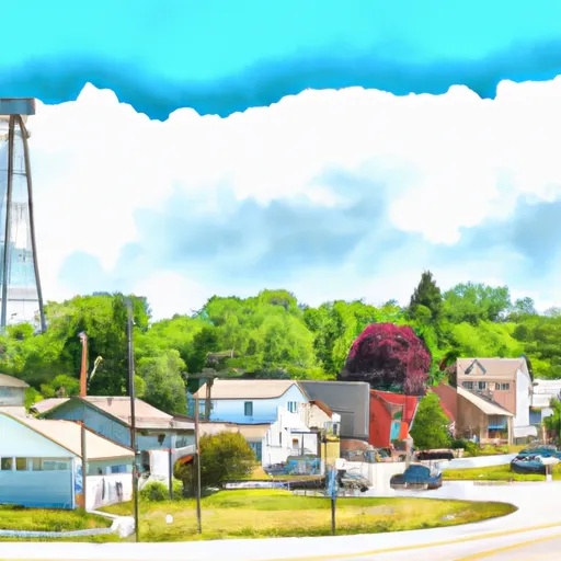
Roscommon is a charming village located in Northern Michigan, nestled in Roscommon County. The region experiences a humid continental climate with warm summers and cold winters. Summers typically see temperatures ranging from 70°F to 80°F, while winters can drop as low as 10°F with snowfall averaging 70 inches annually.
The area is blessed with several lakes, including Houghton Lake, the largest inland lake in the state, which covers over 20,000 acres. Other notable lakes in the vicinity include Higgins Lake and Lake St. Helen. These pristine water bodies contribute to the hydrology constituents of Roscommon, providing excellent opportunities for fishing, boating, and water sports enthusiasts.
Outdoor recreation is abundant in Roscommon. The region is surrounded by lush forests, making it a haven for hikers, bikers, and nature enthusiasts. The nearby Huron-Manistee National Forests offer numerous trails for exploration and camping sites for overnight stays. The Ausable River and South Branch AuSable River are renowned for their outstanding canoeing, kayaking, and fishing opportunities.
In summary, Roscommon, Michigan, presents a delightful destination for outdoor enthusiasts with its favorable climate, picturesque lakes, and diverse recreational activities.
What is the Eden Index?
The Snoflo Eden Index serves as a comprehensive rating system for regions, evaluating their desirability through a holistic assessment of climate health, outdoor recreation opportunities, and natural disaster risk, acknowledging the profound impact of these factors on livability and well-being.
Climate Health Indicator (CHI): 6.1
Roscommon receives approximately
780mm of rain per year,
with humidity levels near 84%
and air temperatures averaging around
7°C.
Roscommon has a plant hardyness factor of
4, meaning
plants and agriculture in this region thrive during a short period during spring and early summer. Most
plants will die off during the colder winter months.
By considering the ideal temperature range, reliable water supplies, clean air, and stable seasonal rain or snowpacks, the Climate Health Indicator (CHI) underscores the significance of a healthy climate as the foundation for quality living.
A healthy climate is paramount for ensuring a high quality of life and livability in a region, fostering both physical well-being and environmental harmony. This can be characterized by ideal temperatures, reliable access to water supplies, clean air, and consistent seasonal rain or snowpacks.
Weather Forecast
Streamflow Conditions
Northeastern Lake Michigan
Area Rivers
Northeastern Lake Michigan
Snowpack Depths
Northeastern Lake Michigan
Reservoir Storage Capacity
Northeastern Lake Michigan
Groundwater Levels
Recreational Opportunity Index (ROI): 4.2
The Recreational Opportunity Index (ROI) recognizes the value of outdoor recreational options, such as parks, hiking trails, camping sites, and fishing spots, while acknowledging that climate plays a pivotal role in ensuring the comfort and consistency of these experiences.
Access to outdoor recreational opportunities, encompassing activities such as parks, hiking, camping, and fishing, is crucial for overall well-being, and the climate plays a pivotal role in enabling and enhancing these experiences, ensuring that individuals can engage in nature-based activities comfortably and consistently.
Camping Areas
| Campground | Campsites | Reservations | Toilets | Showers | Elevation |
|---|---|---|---|---|---|
| Aloha State Park | 285 | 602 ft | |||
| Soldier Lake Rec Area | 43 | 908 ft | |||
| Kinross RV Park East | 64 | 781 ft | |||
| Kinross RV Park West | 52 | 795 ft | |||
| Brimley State Park | 235 | 628 ft | |||
| Monocle Lake Rec Area | 39 | 641 ft | |||
| Cecil Lakeview City Park | None | 579 ft | |||
| Straits State Park | 275 | 672 ft | |||
| Bay View | 24 | 622 ft | |||
| Carp River | 38 | 632 ft |
Nearby Ski Areas
Catastrophe Safeguard Index (CSI):
The Catastrophe Safeguard Index (CSI) recognizes that natural disaster risk, encompassing floods, fires, hurricanes, and tornadoes, can drastically affect safety and the overall appeal of an area.
The level of natural disaster risk in a region significantly affects safety and the overall livability, with climate change amplifying these risks by potentially increasing the frequency and intensity of events like floods, fires, hurricanes, and tornadoes, thereby posing substantial challenges to community resilience and well-being.
Community Resilience Indicator (CRI): 2.3
The Community Resilience Indicator (CRI) recognizes that education, healthcare, and socioeconomics are crucial to the well-being of a region. The CRI acknowledges the profound impact of these elements on residents' overall quality of life. By evaluating educational resources, healthcare accessibility, and economic inclusivity, the index captures the essential aspects that contribute to a thriving community, fostering resident satisfaction, equity, and social cohesion.