Ferril Lake Dam

Ferril Lake
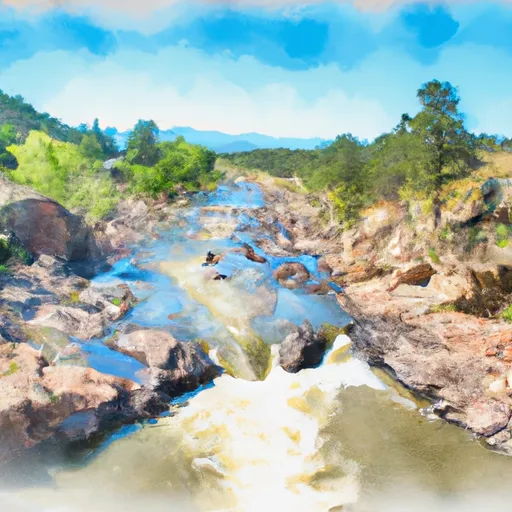
Ferril Lake, also known as City Park Lake, is a man-made reservoir located in Denver, Colorado, with a primary purpose of recreation. Managed by the local government, this lake is a popular spot for water resource and climate enthusiasts to enjoy outdoor activities and connect with nature. With a surface area of 23 acres and a maximum storage capacity of 255 acre-feet, Ferril Lake offers a peaceful retreat in the heart of the city.
Constructed with an earth dam type, Ferril Lake stands at a height of 15 feet and has a spillway width of 58 feet. Despite being classified as having a low hazard potential and a satisfactory condition assessment, the lake is subject to regular inspections to ensure its safety and integrity. The surrounding area, including the South Platte River, adds to the beauty and ecological significance of Ferril Lake, making it an essential part of the local water resource infrastructure.
The risk assessment for Ferril Lake is considered moderate, with management measures in place to mitigate potential hazards. With a history dating back to its completion date and regular maintenance checks, Ferril Lake continues to be a valuable asset for the community and a source of enjoyment for water enthusiasts and climate advocates alike. Its role in providing recreational opportunities while also serving as a regulated water resource reflects the importance of sustainable management practices in balancing human needs with environmental stewardship.
Plan around the weather
Same NOAA / yr.no feed Snoflo's iOS app uses. Watch the precipitation column on the meteogram -- rain on the basin upstream typically lifts inflow 24-72 hours later.
Next 5 days, hour by hour
Temperature line with weather symbols on top, snow + rain accumulation as columns, humidity as a dotted line.
5-day forecast table
Every 3 hours, broken out across temperature, snow, rain, humidity, and wind. Each cell is colour-coded relative to the column min/max.
| Time | Condition | Temp (°F) | Snow (in) | Rain (in) | Humidity (%) | Wind (mps) | Wind dir |
|---|---|---|---|---|---|---|---|
| Loading detailed forecast… | |||||||
15-day temperature & precipitation
Daily temperatures, snow, and rain projected over the next two weeks.
Nearby streamflow gauges
USGS streamgauges around Ferril Lake -- inflows here typically show up in storage 24-72 hours later.
| Streamgauge | Discharge | View |
|---|---|---|
| Cherry Creek At Denver | 8 cfs | → |
| South Platte River At Denver | 60 cfs | → |
| Sand Crk Abv Burlington Ditch Nr Commerce City | 6 cfs | → |
| South Platte R At 64th Ave. Commerce City | 46 cfs | → |
| Harvard Gulch At Harvard Park | 1 cfs | → |
| Harvard Gulch At Colorado Blvd. | · | → |


About Ferril Lake
Where does the data for Ferril Lake come from?
Structural and regulatory data come from the U.S. Army Corps of Engineers' National Inventory of Dams (NID). Weather forecast comes from NOAA / yr.no -- the same feed Snoflo's iOS app uses.
How often is the report updated?
NID structural data refreshes annually as the Corps publishes updated assessments. The weather forecast refreshes throughout the day.
What does the Low hazard rating mean?
The Corps of Engineers' hazard potential classification grades probable consequences if the dam fails: High = probable loss of human life; Significant = no probable loss of human life but possible economic loss / environmental damage; Low = no probable loss of human life, only minor economic / environmental losses. See the Dam Data Reference card below for the full definitions.
What's "% of normal"?
The current storage value compared to the historical average storage on this calendar day. 100% = right on average; values above 100% mean above-normal storage (wet year); values below mean below-normal (dry year or drought).
Can I get alerts when storage crosses a threshold?
Yes -- alerts are managed in the Snoflo iOS app. Favorite this dam, set a threshold, and you'll get a push the moment conditions cross.
Dam data reference
Condition Assessment
- Satisfactory
- No existing or potential dam safety deficiencies are recognized. Acceptable performance is expected under all loading conditions (static, hydrologic, seismic) in accordance with the minimum applicable state or federal regulatory criteria or tolerable risk guidelines.
- Fair
- No existing dam safety deficiencies are recognized for normal operating conditions. Rare or extreme hydrologic and/or seismic events may result in a dam safety deficiency. Risk may be in the range to take further action.
- Poor
- A dam safety deficiency is recognized for normal operating conditions which may realistically occur. Remedial action is necessary. POOR may also be used when uncertainties exist as to critical analysis parameters which identify a potential dam safety deficiency.
- Unsatisfactory
- A dam safety deficiency is recognized that requires immediate or emergency remedial action for problem resolution.
- Not Rated
- The dam has not been inspected, is not under state or federal jurisdiction, or has been inspected but, for whatever reason, has not been rated.
Hazard Potential Classification
- High
- Dams assigned the high hazard potential classification are those where failure or mis-operation will probably cause loss of human life.
- Significant
- Dams assigned the significant hazard potential classification are those dams where failure or mis-operation results in no probable loss of human life but can cause economic loss, environmental damage, disruption of lifeline facilities, or impact other concerns. Significant hazard potential classification dams are often located in predominantly rural or agricultural areas but could be in areas with population and significant infrastructure.
- Low
- Dams assigned the low hazard potential classification are those where failure or mis-operation results in no probable loss of human life and low economic and/or environmental losses. Losses are principally limited to the owner's property.
- Undetermined
- Dams for which a downstream hazard potential has not been designated or is not provided.