

-
 Snoflo Premium
Get unlimited access to all our content
With no Ad interruptions! - Start Your Free Trial Login with existing account
Berryville
Eden Index
Climate
8.3
•
Recreation
4.7
•
Community
2.8
•
Safeguard
5.6/10
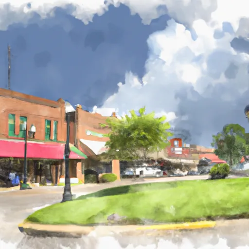
Berryville, Arkansas has a humid subtropical climate with hot summers and mild winters. The town is located near the Kings River, a major tributary of the White River, which provides opportunities for fishing and canoeing. The Kings River is known for its clear water and scenic views. Berryville is also located near the Ozark National Forest, which offers hiking, camping, and hunting opportunities. Additionally, the nearby Beaver Lake provides opportunities for boating and water sports. The hydrology constituents of the area include the Kings River watershed, which is home to several species of fish and other aquatic life. Overall, Berryville offers a variety of outdoor recreational activities for visitors and residents alike.
What is the Eden Index?
The Snoflo Eden Index serves as a comprehensive rating system for regions, evaluating their desirability through a holistic assessment of climate health, outdoor recreation opportunities, and natural disaster risk, acknowledging the profound impact of these factors on livability and well-being.
Climate Health Indicator (CHI): 8.3
Berryville receives approximately
1141mm of rain per year,
with humidity levels near 81%
and air temperatures averaging around
14°C.
Berryville has a plant hardyness factor of
6, meaning
plants and agriculture in this region thrive during a short period during spring and early summer. Most
plants will die off during the colder winter months.
By considering the ideal temperature range, reliable water supplies, clean air, and stable seasonal rain or snowpacks, the Climate Health Indicator (CHI) underscores the significance of a healthy climate as the foundation for quality living.
A healthy climate is paramount for ensuring a high quality of life and livability in a region, fostering both physical well-being and environmental harmony. This can be characterized by ideal temperatures, reliable access to water supplies, clean air, and consistent seasonal rain or snowpacks.
Weather Forecast
Streamflow Conditions
Upper White
Area Rivers
Upper White
Snowpack Depths
Upper White
Reservoir Storage Capacity
Upper White
Groundwater Levels
Recreational Opportunity Index (ROI): 4.7
The Recreational Opportunity Index (ROI) recognizes the value of outdoor recreational options, such as parks, hiking trails, camping sites, and fishing spots, while acknowledging that climate plays a pivotal role in ensuring the comfort and consistency of these experiences.
Access to outdoor recreational opportunities, encompassing activities such as parks, hiking, camping, and fishing, is crucial for overall well-being, and the climate plays a pivotal role in enabling and enhancing these experiences, ensuring that individuals can engage in nature-based activities comfortably and consistently.
Camping Areas
| Campground | Campsites | Reservations | Toilets | Showers | Elevation |
|---|---|---|---|---|---|
| Teague Lake Primitive | None | 199 ft | |||
| Fair City RV Park | 100 | 317 ft | |||
| Highway 157 Primitive | None | 203 ft | |||
| Dam Area - Lake Greeson | None | 431 ft | |||
| Buckhorn - Lake Greeson | 0 | 583 ft | |||
| Parker Creek - Lake Greeson | None | 684 ft | |||
| Hervey Access Camping | None | 247 ft | |||
| Pikeville - Lake Greeson | 12 | 568 ft | |||
| Frank Anthony RV Park | 30 | 242 ft | |||
| Crater of Diamonds State Park | None | 339 ft |
Nearby Ski Areas
Catastrophe Safeguard Index (CSI):
The Catastrophe Safeguard Index (CSI) recognizes that natural disaster risk, encompassing floods, fires, hurricanes, and tornadoes, can drastically affect safety and the overall appeal of an area.
The level of natural disaster risk in a region significantly affects safety and the overall livability, with climate change amplifying these risks by potentially increasing the frequency and intensity of events like floods, fires, hurricanes, and tornadoes, thereby posing substantial challenges to community resilience and well-being.
Community Resilience Indicator (CRI): 2.8
The Community Resilience Indicator (CRI) recognizes that education, healthcare, and socioeconomics are crucial to the well-being of a region. The CRI acknowledges the profound impact of these elements on residents' overall quality of life. By evaluating educational resources, healthcare accessibility, and economic inclusivity, the index captures the essential aspects that contribute to a thriving community, fostering resident satisfaction, equity, and social cohesion.