

-
 Snoflo Premium
Get unlimited access to all our content
With no Ad interruptions! - Start Your Free Trial Login with existing account
Mount-Ida
Eden Index
Climate
7.6
•
Recreation
9.6
•
Community
0.5
•
Safeguard
6.5/10
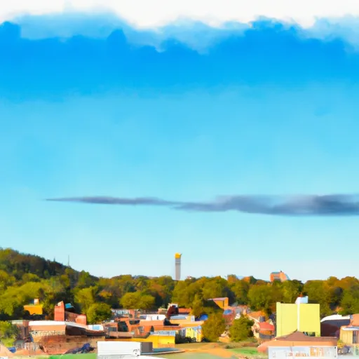
Mount Ida, located in the beautiful Ouachita Mountains of Arkansas, offers a serene escape with its picturesque landscapes and pleasant climate. The town experiences a humid subtropical climate, characterized by hot, humid summers and mild winters. Summers bring average temperatures of around 90°F (32°C), while winters see temperatures ranging from 30°F to 50°F (-1°C to 10°C). Spring and autumn offer mild and comfortable weather, making them ideal seasons to explore the outdoors.
Mount Ida is known for its stunning natural features, including crystal-clear lakes and pristine rivers. The area is rich in hydrology constituents, boasting numerous mineral springs, lakes, and streams. These water bodies offer excellent opportunities for fishing, boating, swimming, and kayaking. Lake Ouachita, one of the largest man-made lakes in the United States, is a popular destination for water enthusiasts.
For outdoor recreation, Mount Ida provides ample opportunities for hiking, camping, and exploring the surrounding mountains and forests. The nearby Ouachita National Forest offers miles of hiking trails, along with opportunities for wildlife viewing and birdwatching. The area is also known for its quartz crystal mines, allowing visitors to try their luck at gemstone hunting.
In summary, Mount Ida, Arkansas offers a pleasant climate, abundant hydrology constituents, and a variety of outdoor recreation opportunities, making it a perfect destination for nature lovers and adventure seekers.
What is the Eden Index?
The Snoflo Eden Index serves as a comprehensive rating system for regions, evaluating their desirability through a holistic assessment of climate health, outdoor recreation opportunities, and natural disaster risk, acknowledging the profound impact of these factors on livability and well-being.
Climate Health Indicator (CHI): 7.6
Mount-Ida receives approximately
1406mm of rain per year,
with humidity levels near 84%
and air temperatures averaging around
16°C.
Mount-Ida has a plant hardyness factor of
7, meaning
plants and agriculture in this region tend to thrive during the non-winter months.
By considering the ideal temperature range, reliable water supplies, clean air, and stable seasonal rain or snowpacks, the Climate Health Indicator (CHI) underscores the significance of a healthy climate as the foundation for quality living.
A healthy climate is paramount for ensuring a high quality of life and livability in a region, fostering both physical well-being and environmental harmony. This can be characterized by ideal temperatures, reliable access to water supplies, clean air, and consistent seasonal rain or snowpacks.
Weather Forecast
Streamflow Conditions
Upper Ouachita
Area Rivers
Upper Ouachita
Snowpack Depths
Upper Ouachita
Reservoir Storage Capacity
Upper Ouachita
Groundwater Levels
Recreational Opportunity Index (ROI): 9.6
The Recreational Opportunity Index (ROI) recognizes the value of outdoor recreational options, such as parks, hiking trails, camping sites, and fishing spots, while acknowledging that climate plays a pivotal role in ensuring the comfort and consistency of these experiences.
Access to outdoor recreational opportunities, encompassing activities such as parks, hiking, camping, and fishing, is crucial for overall well-being, and the climate plays a pivotal role in enabling and enhancing these experiences, ensuring that individuals can engage in nature-based activities comfortably and consistently.
Camping Areas
| Campground | Campsites | Reservations | Toilets | Showers | Elevation |
|---|---|---|---|---|---|
| North Toledo Bend State Park | None | 258 ft | |||
| Cypress Bend State Rec Area | None | 216 ft | |||
| Pleasure Point State Rec Area - Toledo Bend Lake | None | 197 ft | |||
| South Toledo Bend State Park | None | 221 ft | |||
| San Miguel Park State Rec Area | None | 228 ft | |||
| Indian Mounds | 37 | 190 ft | |||
| Hodges Gardens State Park | 30 | 320 ft | |||
| Willow Oak | 15 | 216 ft | |||
| Converse Bay Rec Area - Toledo Bend Lake | None | 231 ft | |||
| Toledo Bend Military | None | 203 ft |
Nearby Ski Areas
Catastrophe Safeguard Index (CSI):
The Catastrophe Safeguard Index (CSI) recognizes that natural disaster risk, encompassing floods, fires, hurricanes, and tornadoes, can drastically affect safety and the overall appeal of an area.
The level of natural disaster risk in a region significantly affects safety and the overall livability, with climate change amplifying these risks by potentially increasing the frequency and intensity of events like floods, fires, hurricanes, and tornadoes, thereby posing substantial challenges to community resilience and well-being.
Community Resilience Indicator (CRI): 0.5
The Community Resilience Indicator (CRI) recognizes that education, healthcare, and socioeconomics are crucial to the well-being of a region. The CRI acknowledges the profound impact of these elements on residents' overall quality of life. By evaluating educational resources, healthcare accessibility, and economic inclusivity, the index captures the essential aspects that contribute to a thriving community, fostering resident satisfaction, equity, and social cohesion.