

-
 Snoflo Premium
Get unlimited access to all our content
With no Ad interruptions! - Start Your Free Trial Login with existing account
Barling
Eden Index
Climate
8.3
•
Recreation
6.6
•
Community
2.6
•
Safeguard
6.3/10
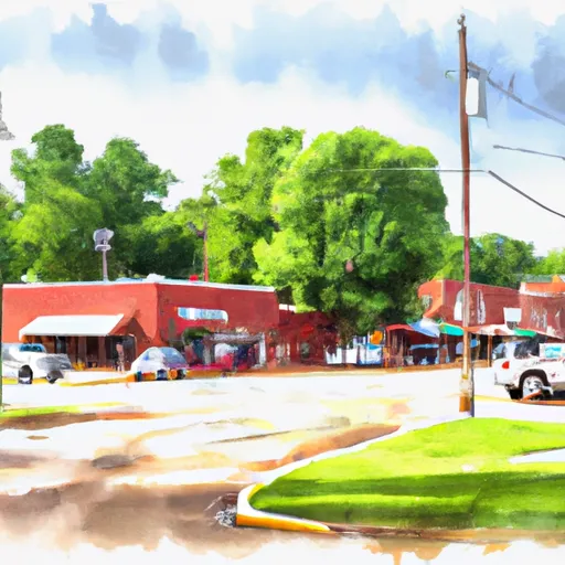
Barling, Arkansas is a small town located in the western part of the state. The climate in Barling is hot and humid in the summer, with temperatures ranging from the mid-70s to mid-90s. Winters are mild, with temperatures ranging from the mid-30s to mid-50s. The town is situated near the Arkansas River, which provides hydrology constituents for the area. Barling also has several parks and outdoor recreation opportunities, including the Barling Lake and Park, which offers fishing, boating, and hiking trails. The nearby Ozark National Forest provides opportunities for camping, hiking, and other outdoor activities.
What is the Eden Index?
The Snoflo Eden Index serves as a comprehensive rating system for regions, evaluating their desirability through a holistic assessment of climate health, outdoor recreation opportunities, and natural disaster risk, acknowledging the profound impact of these factors on livability and well-being.
Climate Health Indicator (CHI): 8.3
Barling receives approximately
1130mm of rain per year,
with humidity levels near 85%
and air temperatures averaging around
17°C.
Barling has a plant hardyness factor of
7, meaning
plants and agriculture in this region tend to thrive during the non-winter months.
By considering the ideal temperature range, reliable water supplies, clean air, and stable seasonal rain or snowpacks, the Climate Health Indicator (CHI) underscores the significance of a healthy climate as the foundation for quality living.
A healthy climate is paramount for ensuring a high quality of life and livability in a region, fostering both physical well-being and environmental harmony. This can be characterized by ideal temperatures, reliable access to water supplies, clean air, and consistent seasonal rain or snowpacks.
Weather Forecast
Streamflow Conditions
Lower Arkansas-Fourche La Fave
Area Rivers
Lower Arkansas-Fourche La Fave
Snowpack Depths
Lower Arkansas-Fourche La Fave
Reservoir Storage Capacity
Lower Arkansas-Fourche La Fave
Groundwater Levels
Recreational Opportunity Index (ROI): 6.6
The Recreational Opportunity Index (ROI) recognizes the value of outdoor recreational options, such as parks, hiking trails, camping sites, and fishing spots, while acknowledging that climate plays a pivotal role in ensuring the comfort and consistency of these experiences.
Access to outdoor recreational opportunities, encompassing activities such as parks, hiking, camping, and fishing, is crucial for overall well-being, and the climate plays a pivotal role in enabling and enhancing these experiences, ensuring that individuals can engage in nature-based activities comfortably and consistently.
Camping Areas
| Campground | Campsites | Reservations | Toilets | Showers | Elevation |
|---|---|---|---|---|---|
| Atlanta State Park | 60 | 286 ft | |||
| Kelly Creek Park - Lake Wright Patman | 80 | 252 ft | |||
| Rocky Point - Wright Patman Lake | 125 | 259 ft | |||
| Buckhorn Creek - Lake Of The Pines | 60 | 283 ft | |||
| Malden Lake - Wright Pattman Lake | 39 | 259 ft | |||
| Hurricane Creek - Lake of the Pines | 23 | 226 ft | |||
| Thomas Lake Park Dispersed | None | 241 ft | |||
| Cass County Park | 46 | 244 ft | |||
| Caddo Lake State Park | 28 | 281 ft | |||
| Jackson Creek Park - Lake Texarkana | None | 327 ft |
Nearby Ski Areas
Catastrophe Safeguard Index (CSI):
The Catastrophe Safeguard Index (CSI) recognizes that natural disaster risk, encompassing floods, fires, hurricanes, and tornadoes, can drastically affect safety and the overall appeal of an area.
The level of natural disaster risk in a region significantly affects safety and the overall livability, with climate change amplifying these risks by potentially increasing the frequency and intensity of events like floods, fires, hurricanes, and tornadoes, thereby posing substantial challenges to community resilience and well-being.
Community Resilience Indicator (CRI): 2.6
The Community Resilience Indicator (CRI) recognizes that education, healthcare, and socioeconomics are crucial to the well-being of a region. The CRI acknowledges the profound impact of these elements on residents' overall quality of life. By evaluating educational resources, healthcare accessibility, and economic inclusivity, the index captures the essential aspects that contribute to a thriving community, fostering resident satisfaction, equity, and social cohesion.