

-
 Snoflo Premium
Get unlimited access to all our content
With no Ad interruptions! - Start Your Free Trial Login with existing account
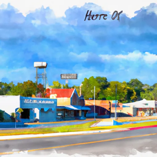
Horatio
Eden Index
Climate
7.8
•
Recreation
3.1
•
Community
0.9
•
Safeguard
4.4/10
Horatio, Arkansas is a small town located in Sevier County in the southwestern part of the state. The town has a humid subtropical climate, characterized by hot and humid summers and mild winters. The average temperature in July, the hottest month, is around 93°F (34°C), while in January, the coldest month, it drops to around 37°F (3°C). Horatio experiences moderate rainfall throughout the year, with the wettest months being May and June.
The area surrounding Horatio benefits from a number of hydrology constituents. The town is situated near the Little River, which provides opportunities for fishing, boating, and other water-based activities. Additionally, Cossatot River is located nearby, famous for its whitewater rapids, attracting enthusiasts for kayaking, canoeing, and rafting.
For outdoor recreation, Horatio offers several opportunities. The town is surrounded by picturesque countryside, creating a great environment for hiking, camping, and birdwatching. In particular, the nearby Cossatot River State Park-Natural Area provides numerous trails for exploration and opportunities to spot wildlife. The park is also renowned for its challenging whitewater rapids, attracting thrill-seekers.
In summary, Horatio, Arkansas experiences a humid subtropical climate with hot summers and mild winters. The town benefits from the presence of the Little River and Cossatot River, providing opportunities for water-based activities. Additionally, the surrounding countryside and the Cossatot River State Park-Natural Area offer various outdoor recreational activities, including hiking, camping, and birdwatching.
What is the Eden Index?
The Snoflo Eden Index serves as a comprehensive rating system for regions, evaluating their desirability through a holistic assessment of climate health, outdoor recreation opportunities, and natural disaster risk, acknowledging the profound impact of these factors on livability and well-being.
Climate Health Indicator (CHI): 7.8
Horatio receives approximately
1346mm of rain per year,
with humidity levels near 84%
and air temperatures averaging around
17°C.
Horatio has a plant hardyness factor of
8, meaning
plants and agriculture in this region tend to thrive here all year round.
By considering the ideal temperature range, reliable water supplies, clean air, and stable seasonal rain or snowpacks, the Climate Health Indicator (CHI) underscores the significance of a healthy climate as the foundation for quality living.
A healthy climate is paramount for ensuring a high quality of life and livability in a region, fostering both physical well-being and environmental harmony. This can be characterized by ideal temperatures, reliable access to water supplies, clean air, and consistent seasonal rain or snowpacks.
Weather Forecast
Streamflow Conditions
Red-Little
Area Rivers
Red-Little
Snowpack Depths
Red-Little
Reservoir Storage Capacity
Red-Little
Groundwater Levels
Recreational Opportunity Index (ROI): 3.1
The Recreational Opportunity Index (ROI) recognizes the value of outdoor recreational options, such as parks, hiking trails, camping sites, and fishing spots, while acknowledging that climate plays a pivotal role in ensuring the comfort and consistency of these experiences.
Access to outdoor recreational opportunities, encompassing activities such as parks, hiking, camping, and fishing, is crucial for overall well-being, and the climate plays a pivotal role in enabling and enhancing these experiences, ensuring that individuals can engage in nature-based activities comfortably and consistently.
Camping Areas
| Campground | Campsites | Reservations | Toilets | Showers | Elevation |
|---|---|---|---|---|---|
| Ebenezer - Sam Rayburn Reservoir | 30 | 192 ft | |||
| Jackson Hill - Sam Rayburn Reservoir | None | 187 ft | |||
| Hanks Creek - Sam Rayburn Reservoir | 45 | 181 ft | |||
| Cassells - Boykin County Park | 96 | 195 ft | |||
| Shirley Creek - Sam Rayburn Reservoir | None | 202 ft | |||
| Boykin Spring | 25 | 220 ft | |||
| Caney Creek | 25 | 164 ft | |||
| Sandy Creek | 15 | 161 ft | |||
| Townsend | 47 | 176 ft | |||
| Harvey Creek | 34 | 163 ft |
Nearby Ski Areas
Catastrophe Safeguard Index (CSI):
The Catastrophe Safeguard Index (CSI) recognizes that natural disaster risk, encompassing floods, fires, hurricanes, and tornadoes, can drastically affect safety and the overall appeal of an area.
The level of natural disaster risk in a region significantly affects safety and the overall livability, with climate change amplifying these risks by potentially increasing the frequency and intensity of events like floods, fires, hurricanes, and tornadoes, thereby posing substantial challenges to community resilience and well-being.
Community Resilience Indicator (CRI): 0.9
The Community Resilience Indicator (CRI) recognizes that education, healthcare, and socioeconomics are crucial to the well-being of a region. The CRI acknowledges the profound impact of these elements on residents' overall quality of life. By evaluating educational resources, healthcare accessibility, and economic inclusivity, the index captures the essential aspects that contribute to a thriving community, fostering resident satisfaction, equity, and social cohesion.