

-
 Snoflo Premium
Get unlimited access to all our content
With no Ad interruptions! - Start Your Free Trial Login with existing account
Waterville
Eden Index
Climate
6.5
•
Recreation
3.1
•
Community
2.6
•
Safeguard
4.3/10
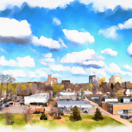
Waterville, Minnesota, is a charming small town located in Le Sueur County. The climate in Waterville is classified as humid continental, experiencing hot summers and cold winters. Average high temperatures in summer range from 80-85°F, while winter temperatures drop to an average low of 10-15°F. Snowfall is common during the winter months.
Waterville is surrounded by notable hydrology constituents, including Sakatah Lake and Cannon River. These bodies of water provide excellent opportunities for fishing, boating, and other water sports. Sakatah Lake State Park offers hiking trails, picnic areas, and a campground for outdoor enthusiasts to explore.
For avid anglers, the area is known for its excellent fishing opportunities, with common species including walleye, bass, and northern pike. The Cannon River also offers scenic canoeing and kayaking experiences.
In addition to water activities, Waterville boasts several parks and recreational areas, providing opportunities for hiking, biking, and bird-watching. The town also hosts various festivals and events throughout the year, showcasing its vibrant community spirit.
Overall, Waterville, Minnesota, offers a delightful combination of outdoor recreational opportunities, hydrology features, and a distinct climate that appeals to both residents and visitors alike.
What is the Eden Index?
The Snoflo Eden Index serves as a comprehensive rating system for regions, evaluating their desirability through a holistic assessment of climate health, outdoor recreation opportunities, and natural disaster risk, acknowledging the profound impact of these factors on livability and well-being.
Climate Health Indicator (CHI): 6.5
Waterville receives approximately
831mm of rain per year,
with humidity levels near 81%
and air temperatures averaging around
8°C.
Waterville has a plant hardyness factor of
4, meaning
plants and agriculture in this region thrive during a short period during spring and early summer. Most
plants will die off during the colder winter months.
By considering the ideal temperature range, reliable water supplies, clean air, and stable seasonal rain or snowpacks, the Climate Health Indicator (CHI) underscores the significance of a healthy climate as the foundation for quality living.
A healthy climate is paramount for ensuring a high quality of life and livability in a region, fostering both physical well-being and environmental harmony. This can be characterized by ideal temperatures, reliable access to water supplies, clean air, and consistent seasonal rain or snowpacks.
Weather Forecast
Streamflow Conditions
Upper Mississippi-Black-Root
Area Rivers
Upper Mississippi-Black-Root
Snowpack Depths
Upper Mississippi-Black-Root
Reservoir Storage Capacity
Upper Mississippi-Black-Root
Groundwater Levels
Recreational Opportunity Index (ROI): 3.1
The Recreational Opportunity Index (ROI) recognizes the value of outdoor recreational options, such as parks, hiking trails, camping sites, and fishing spots, while acknowledging that climate plays a pivotal role in ensuring the comfort and consistency of these experiences.
Access to outdoor recreational opportunities, encompassing activities such as parks, hiking, camping, and fishing, is crucial for overall well-being, and the climate plays a pivotal role in enabling and enhancing these experiences, ensuring that individuals can engage in nature-based activities comfortably and consistently.
Camping Areas
| Campground | Campsites | Reservations | Toilets | Showers | Elevation |
|---|---|---|---|---|---|
| Bray County Park | 43 | 1,068 ft | |||
| Clubhouse | 55 | 1,434 ft | |||
| Itasca County Fairgrounds | None | 1,302 ft | |||
| Father Hennepin State Park | 100 | 1,313 ft | |||
| Pokegama Rec Area | 21 | 1,291 ft | |||
| Mille Lacs Kathio State Park | 70 | 1,281 ft | |||
| Ann Lake - Sand Dunes State Forest | 30 | 990 ft | |||
| Riverside City Park - Princeton | None | 956 ft | |||
| Aitkin County Campground | 7 | 1,201 ft | |||
| Hill Lake City Park | 30 | 1,274 ft |
Nearby Fishing
Nearby Ski Areas
Catastrophe Safeguard Index (CSI):
The Catastrophe Safeguard Index (CSI) recognizes that natural disaster risk, encompassing floods, fires, hurricanes, and tornadoes, can drastically affect safety and the overall appeal of an area.
The level of natural disaster risk in a region significantly affects safety and the overall livability, with climate change amplifying these risks by potentially increasing the frequency and intensity of events like floods, fires, hurricanes, and tornadoes, thereby posing substantial challenges to community resilience and well-being.
Community Resilience Indicator (CRI): 2.6
The Community Resilience Indicator (CRI) recognizes that education, healthcare, and socioeconomics are crucial to the well-being of a region. The CRI acknowledges the profound impact of these elements on residents' overall quality of life. By evaluating educational resources, healthcare accessibility, and economic inclusivity, the index captures the essential aspects that contribute to a thriving community, fostering resident satisfaction, equity, and social cohesion.