Idaho Snowpack & Snow Report
As of Nov 3, 2026, Idaho's snowpack is at 42% of normal across 77 SNOTEL stations — the deepest is 114" at Nohrsc Snowschool 1. Live SNOTEL snow depth, snowfall, snow-water equivalent, and 5-day forecasts for every mountain in Idaho.
Idaho snow map
See Idaho’s snow on a live map
Every snow station and ski area, one tap each:
- On the ground — how deep it is now
- Last 24 hrs — who got new snow
- Coming up — 24/48/72-hr forecast, press play
✓ Free for 7 days · ✓ Cancel anytime
Idaho snow conditions today
What’s on the ground, how it compares to normal and what’s coming — refreshed daily from SNOTEL and NOAA.
Idaho's snowpack is at 42% of normal for today's date — well below the 70% drought-stress threshold. The deepest station is Nohrsc Snowschool 1 with 114" on the ground. Nohrsc Smiley Mountain is the coldest right now at 45°F. The biggest expected snowfall over the next 5 days is at Vienna Mine: 5".
The Idaho snowpack is monitored by the USDA NRCS SNOTEL network — automated stations sitting on the mountain that report snow depth, snow water equivalent (SWE), and air temperature every hour. Snoflo joins those live readings to a 5-day NOAA forecast for each station so you can see what's on the ground and what's coming.
Use the SNOTEL inventory below to find the closest station to where you're headed. Percent of normal tells you how today's snowpack compares to the historical average for the same date — below 70% is drought-stressed; above 130% is a fat year. Snow water content (SWC) indicates how wet and dense the snowpack is — useful for water-supply planning and avalanche stability assessment.
For backcountry travel always cross-reference with your regional avalanche center at avalanche.org.
Idaho snow report
| Snowpack monitoring site | Snowpack (in) | Snowfall (in) | 24hr fcst (in) | Next 72hrs (in) | Temp (°F) | % Normal | SWC (%) | Watershed | Elevation (ft) |
|---|---|---|---|---|---|---|---|---|---|
|
Bear Mountain, Id
Site 323 |
10 | 0 | 0 | 3 | 37 | 141% | 22% | Upper Kootenai | 5,400 |
|
Smiley Mountain, Id
Site 926 |
10 | 0 | 0 | 0 | 35 | 105% | 17% | Big Lost | 9,520 |
|
Nohrsc Bear Mountain, Id
Site BRMI1 |
10 | 0 | 0 | 3 | 37 | 100% | 23% | Upper Kootenai | 5,455 |
|
Nohrsc Smiley Mountain, Id
Site SMMI1 |
10 | 0 | 0 | 0 | 35 | % | 17% | Big Lost | 9,522 |
|
Mount Baird - Snow, Id
Site MBSBT_MADIS |
10 | 0 | 0 | 0 | 35 | % | % | Palisades | 8,908 |
|
Galena Summit, Id
Site 490 |
8 | 0 | 0 | 0 | 35 | 91% | 18% | Big Wood | 8,780 |
|
Meadow Lake, Id
Site 620 |
8 | 0 | 0 | 0 | 33 | 157% | 16% | Lemhi | 9,150 |
|
Nohrsc Galena Summit, Id
Site GLSI1 |
8 | 0 | 0 | 0 | 35 | 63% | 18% | Big Wood | 8,813 |
|
Nohrsc Hoodoo Basin, Id
Site HOOM8 |
8 | 0 | 0 | 0 | 39 | 89% | 18% | Middle Clark Fork | 6,075 |
|
Highway 12 Powell, Id
Site H12PL_MADIS |
8 | 0 | 0 | 0 | 52 | % | % | Lochsa | 3,638 |
|
Crater Meadows, Id
Site 425 |
7 | 0 | 0 | 1 | 41 | 145% | 21% | Upper North Fork Clearwater | 5,960 |
|
Schweitzer Basin, Id
Site 738 |
7 | 0 | 0 | 1 | 33 | 123% | 23% | Pend Oreille Lake | 6,090 |
|
Vienna Mine, Id
Site 845 |
7 | 1 | 0 | 0 | 38 | 62% | 14% | Upper Salmon | 8,960 |
|
Nohrsc Chicago Ridge, Id
Site CHIM8 |
7 | 0 | 0 | 3 | 37 | 74% | 23% | Lower Clark Fork | 5,720 |
|
Nohrsc Crater Meadows, Id
Site CRAI1 |
7 | 0 | 0 | 1 | 41 | 100% | 21% | Upper North Fork Clearwater | 5,950 |
|
Schweitzer Basin, Id
Site STZI1 |
7 | 0 | 0 | 0 | 33 | % | 23% | Pend Oreille Lake | 6,091 |
|
Lost Lake, Id
Site 600 |
6 | 0 | 0 | 1 | 42 | 115% | 23% | Lower North Fork Clearwater | 6,110 |
|
Trinity Mtn., Id
Site 830 |
6 | 0 | 0 | 0 | 39 | 106% | 30% | South Fork Boise | 7,770 |
|
Nohrsc Beagle Springs, Id
Site BEAM8 |
6 | 0 | 0 | 0 | 39 | % | 28% | Red Rock | 8,908 |
|
Nohrsc Lost Lake, Id
Site LSLI1 |
6 | 0 | 0 | 1 | 40 | 69% | 23% | Lower North Fork Clearwater | 5,550 |
|
Nohrsc Trinity Mtn., Id
Site TRMI1 |
6 | 0 | 0 | 0 | 39 | 61% | 30% | South Fork Boise | 7,813 |
|
Nohrsc Vienna Mine Snotel, Id
Site VNNI1 |
6 | 0 | 0 | 0 | 35 | 25% | 15% | Upper Salmon | 8,945 |
|
Nohrsc Mill Creek Summit, Id
Site MLKI1 |
5 | 0 | 0 | 0 | 38 | 100% | 16% | Upper Salmon | 8,823 |
|
Mill Creek Summit, Id
Site 627 |
5 | 0 | 0 | 0 | 38 | 100% | 16% | Upper Salmon | 8,800 |
|
Nohrsc Lemhi Ridge, Id
Site LMHM8 |
5 | 0 | 0 | 0 | 38 | 325% | 28% | Lemhi | 8,098 |
|
Nohrsc Poorman Creek, Id
Site PMNM8 |
5 | 0 | 0 | 2 | 37 | % | 22% | Upper Kootenai | 5,074 |
|
Banner Summit, Id
Site BNRI1 |
5 | 0 | 0 | 0 | 44 | % | % | South Fork Payette | 7,065 |
|
Cool Creek, Id
Site 411 |
4 | 0 | 0 | 1 | 39 | 118% | 33% | Upper North Fork Clearwater | 6,280 |
|
Hidden Lake, Id
Site 988 |
4 | 0 | 0 | 1 | 39 | 110% | 28% | Lower Kootenai | 5,040 |
|
Schwartz Lake, Id
Site 915 |
4 | 0 | 0 | 0 | 37 | 133% | 18% | Lemhi | 8,540 |
|
Nohrsc Cool Creek, Id
Site COLI1 |
4 | 0 | 0 | 1 | 39 | 82% | 33% | Upper North Fork Clearwater | 6,324 |
|
Nohrsc Hidden Lake, Id
Site HDLI1 |
4 | 0 | 0 | 1 | 39 | 65% | 28% | Lower Kootenai | 5,002 |
|
Nohrsc Mosquito Ridge, Id
Site MOQI1 |
4 | 0 | 0 | 0 | 40 | 150% | 25% | Upper Coeur D'Alene | 5,268 |
|
Nohrsc Schwartz Lake, Id
Site SCHI1 |
4 | 0 | 0 | 0 | 37 | % | 18% | Lemhi | 8,636 |
|
Soldier Mountain Study Plot, Id
Site SLDMS_MADIS |
4 | 0 | 0 | 0 | 36 | % | % | Camas | 8,023 |
|
Dollarhide Summit, Id
Site 450 |
3 | 0 | 0 | 0 | 36 | 118% | 40% | Big Wood | 8,420 |
|
Hemlock Butte, Id
Site 520 |
3 | 0 | 0 | 0 | 43 | 127% | 43% | Upper North Fork Clearwater | 5,810 |
|
Lost-Wood Divide, Id
Site 601 |
3 | 1 | 0 | 0 | 37 | 128% | 27% | Big Lost | 7,900 |
|
Mosquito Ridge, Id
Site 645 |
3 | -1 | 0 | 0 | 40 | 166% | 33% | Lower Clark Fork | 5,200 |
|
Savage Pass, Id
Site 735 |
3 | 0 | 0 | 0 | 42 | 128% | 27% | Lochsa | 6,170 |
|
Nohrsc Hawkins Lake, Id
Site HAWM8 |
3 | 0 | 0 | 0 | 36 | 72% | 30% | Moyie | 6,481 |
|
Nohrsc Dollarhide Summit, Id
Site DHDI1 |
3 | 0 | 0 | 0 | 36 | 97% | 40% | Big Wood | 8,423 |
|
Deadwood Summit, Id
Site 439 |
2 | 0 | 0 | 0 | 46 | 67% | 30% | South Fork Salmon | 6,860 |
|
Franklin Basin, Id
Site 484 |
2 | 0 | 0 | 0 | 38 | 0% | · | Little Bear-Logan | 8,170 |
|
Humboldt Gulch, Id
Site 535 |
2 | 0 | 0 | 1 | 41 | 0% | · | South Fork Coeur D'Alene | 4,250 |
|
Nohrsc Deadwood Summit, Id
Site DDSI1 |
2 | 0 | 0 | 0 | 46 | 19% | 30% | South Fork Salmon | 6,858 |
|
Lost-Wood Divide, Id
Site LWDI1 |
2 | 0 | 0 | 0 | 37 | 105% | 40% | Big Wood | 7,911 |
|
Nohrsc Humboldt Gulch, Id
Site HUGI1 |
2 | 0 | 0 | 1 | 42 | 0% | · | South Fork Coeur D'Alene | 4,277 |
|
Nohrsc Franklin Basin, Id
Site FBNI1 |
2 | 0 | 0 | 0 | 41 | 12% | · | Little Bear-Logan | 8,141 |
|
Nohrsc Tony Grove Lake, Id
Site TGLU1 |
2 | 0 | 0 | 0 | 41 | % | 5% | Little Bear-Logan | 8,459 |
|
Banner Summit, Id
Site 312 |
1 | 0 | 0 | 0 | 42 | 60% | 10% | South Fork Payette | 7,040 |
|
Big Creek Summit, Id
Site 338 |
1 | 0 | 0 | 0 | 47 | 20% | · | South Fork Salmon | 6,580 |
|
Bogus Basin, Id
Site 978 |
1 | 0 | 0 | 0 | 42 | 100% | · | Boise-Mores | 6,340 |
|
Crab Creek, Id
Site 424 |
1 | 0 | 0 | 0 | 40 | % | · | Beaver-Camas | 6,860 |
|
Elk Butte, Id
Site 466 |
1 | 0 | 0 | 0 | 39 | 300% | 80% | Lower North Fork Clearwater | 5,690 |
|
Giveout, Id
Site 493 |
1 | 1 | 0 | 0 | 43 | % | · | Bear Lake | 6,930 |
|
Hilts Creek, Id
Site 524 |
1 | 0 | 0 | 0 | 35 | 100% | 60% | Little Lost | 8,000 |
|
Howell Canyon, Id
Site 534 |
1 | 0 | 0 | 0 | 40 | 233% | 50% | Lake Walcott | 7,980 |
|
Pine Creek Pass, Id
Site 695 |
1 | 0 | 0 | 0 | 44 | 0% | · | Teton | 6,720 |
|
Sheep Mtn., Id
Site 749 |
1 | 0 | 0 | 0 | 43 | 2500% | · | Willow | 6,570 |
|
Stickney Mill, Id
Site 792 |
1 | 0 | 0 | 0 | 41 | 100% | · | Big Lost | 7,430 |
|
Sunset, Id
Site 803 |
1 | 0 | 0 | 0 | 42 | 34% | 10% | Upper Coeur D'Alene | 5,540 |
|
White Elephant, Id
Site 860 |
1 | 1 | 0 | 0 | 39 | 11% | 10% | Upper Henrys | 7,710 |
|
Nohrsc Bear Canyon, Id
Site BECI1 |
1 | 0 | 0 | 0 | 39 | % | 40% | Big Lost | 7,934 |
|
Nohrsc Bogus Basin, Id
Site BOGI1 |
1 | 0 | 0 | 0 | 42 | % | · | Boise-Mores | 6,360 |
|
Crab Creek, Id
Site CRBI1 |
1 | 0 | 0 | 0 | 40 | 0% | · | Beaver-Camas | 6,918 |
|
Hilts Creek, Id
Site HLTI1 |
1 | 0 | 0 | 0 | 35 | 171% | 50% | Little Lost | 8,125 |
|
Fox Trail Ridge, Id
Site TS718_MADIS |
1 | 0 | 0 | 0 | 53 | % | % | South Fork Payette | 6,180 |
|
Nohrsc Garden City Summit, Id
Site GDSU1 |
1 | 0 | 0 | 0 | 39 | 0% | · | Little Bear-Logan | 7,715 |
|
Nohrsc Elk Butte, Id
Site ELBI1 |
1 | 0 | 0 | 0 | 39 | 184% | 80% | Lower North Fork Clearwater | 5,678 |
|
Nohrsc Pine Creek Pass, Id
Site PCPI1 |
1 | 0 | 0 | 0 | 44 | % | % | Teton | 6,737 |
|
Nohrsc Sheep Mountain Snotel, Id
Site SPMI1 |
1 | 0 | 0 | 0 | 43 | % | 1820% | Willow | 6,721 |
|
Nohrsc Soldier R.S., Id
Site SRSI1 |
1 | 0 | 0 | 0 | 46 | % | · | Camas | 5,786 |
|
Nohrsc Stickney Mill, Id
Site STMI1 |
1 | 0 | 0 | 0 | 41 | % | · | Big Lost | 7,426 |
|
Nohrsc Brundage Reservoir, Id
Site BRRI1 |
1 | 0 | 0 | 0 | 44 | 50% | 10% | Little Salmon | 6,314 |
|
Nohrsc Giveout, Id
Site GIVI1 |
1 | 0 | 0 | 0 | 42 | 100% | · | Bear Lake | 6,937 |
|
Nohrsc Howell Canyon, Id
Site HWCI1 |
1 | 0 | 0 | 0 | 40 | 38% | 40% | Lake Walcott | 8,003 |
Idaho ski forecast
Per-resort interactive weather forecasts for the next 15 days — temperature curve, precipitation bars, weather symbols, and humidity at every Idaho ski area Snoflo tracks.
-
 Bald Mountain (Not Sun Valley)15-day forecast
Ski report →
-
 Bogus Basin15-day forecast
Ski report →
-
 Brundage Mountain Resort15-day forecast
Ski report →
-
 Cottonwood Butte15-day forecast
Ski report →
-
 Kelly Canyon Ski Area15-day forecast
Ski report →
-
 Little Ski Hill15-day forecast
Ski report →
-
 Lookout Pass15-day forecast
Ski report →
-
 Lost Trail15-day forecast
Ski report →
-
 Lost Trail Powder Mountain15-day forecast
Ski report →
-
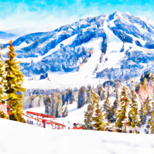 Mount Pandora15-day forecast
Ski report →
-
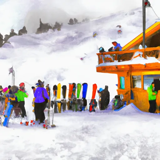 Pebble Creek Ski Area15-day forecast
Ski report →
-
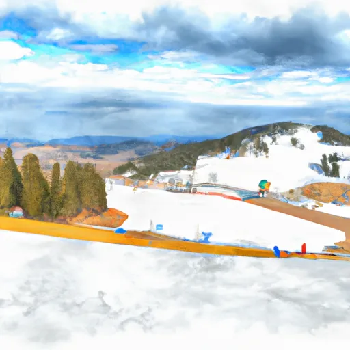 Pomerelle Ski Area15-day forecast
Ski report →
-
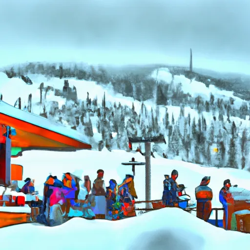 Schweitzer Mountain Resort15-day forecast
Ski report →
-
 Silver Mountain Resort15-day forecast
Ski report →
-
 Snowhaven Ski Area15-day forecast
Ski report →
-
 Soldier Mountain15-day forecast
Ski report →
-
 Sun Valley15-day forecast
Ski report →
-
 Sun Valley - Bald Mountain15-day forecast
Ski report →
-
 Sun Valley - Dollar Mountain15-day forecast
Ski report →
-
 Tamarack Resort15-day forecast
Ski report →
About Idaho snowpack
What is Idaho's snowpack right now?
As of November 3, 2026, Idaho's snowpack is at 42% of normal across 77 SNOTEL stations, and the deepest station is Nohrsc Snowschool 1 with 114" on the ground. The full SNOTEL table is below.
Where is the deepest snow in Idaho right now?
As of November 3, 2026, the deepest snowpack in Idaho is 114" at Nohrsc Snowschool 1. See the SNOTEL station table for the full ranking by depth and snow-water equivalent.
Is Idaho's snowpack above or below normal?
Compare the statewide percent-of-normal on this page: 100% is right at the historical average for the date, below 70% is drought-stressed, and above 130% is a well-above-normal year. Each SNOTEL station also shows its own percent of normal.
Where does the Idaho snowpack data come from?
The USDA NRCS SNOTEL network (SNOpack TELemetry) -- automated mountain stations that continuously measure snow depth, snow water equivalent, precipitation, and air temperature. Snoflo aggregates the live readings and joins them to a 5-day NOAA forecast for each station.
What is Snow Water Equivalent (SWE)?
The depth of water you'd get if you melted the entire snowpack. A 30-inch snowpack with 8 inches of SWE is wetter and denser than one with 5 inches -- useful for water-supply forecasting and avalanche assessment. The "SWC %" column shows the ratio.
What does Percent Normal mean?
Current snowpack as a percentage of the historical average for the same date at that station. 100% is right at the historical norm. Below 70% indicates drought-stressed snowpack; above 130% is a fat year.
How fresh is the Idaho data?
SNOTEL stations transmit hourly; Snoflo re-pulls throughout the day. The 5-day forecasts regenerate from NOAA NOHRSC analysis fields and NWS forecast guidance.
Why are SNOTEL stations only in some states?
The NRCS SNOTEL network is concentrated in the western mountain U.S. -- where the snowpack drives federal water supply forecasts for irrigation, hydropower, and municipal water. Eastern snowpack is measured by other networks (CoCoRaHS, NWS) which Snoflo includes elsewhere.
Is this a substitute for the local avalanche center?
No. For backcountry travel always consult your regional avalanche forecast at avalanche.org. Snoflo is informational data only.