

-
 Snoflo Premium
Get unlimited access to all our content
With no Ad interruptions! - Start Your Free Trial Login with existing account
Lambrook
Eden Index
Climate
7.9
•
Recreation
1.7
•
Community
•
Safeguard
3.7/10
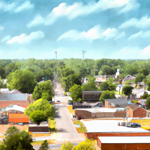
Lambrook, Arkansas is a small rural town located in Phillips County. The climate in Lambrook is characterized by hot, humid summers and mild, wet winters. Summers are often accompanied by temperatures averaging around 90°F (32°C), while winters see temperatures averaging around 50°F (10°C). The area receives approximately 50 inches of rainfall annually.
Hydrology constituents in Lambrook are influenced by the nearby Mississippi River. The river provides vital water resources and contributes to the region's fertile soil. Additionally, there are several smaller creeks and streams that flow through Lambrook, enhancing the area's natural beauty.
Outdoor recreation opportunities in Lambrook are plentiful. The town is surrounded by picturesque landscapes, offering visitors and residents opportunities for activities such as fishing, boating, and hiking. The Mississippi River provides great fishing spots, with abundant catfish, bass, and crappie. Hunters can also enjoy a variety of game, including deer and waterfowl, in designated hunting areas nearby. With its charming natural surroundings and diverse outdoor activities, Lambrook is a destination that appeals to nature enthusiasts and those seeking an escape to the great outdoors.
What is the Eden Index?
The Snoflo Eden Index serves as a comprehensive rating system for regions, evaluating their desirability through a holistic assessment of climate health, outdoor recreation opportunities, and natural disaster risk, acknowledging the profound impact of these factors on livability and well-being.
Climate Health Indicator (CHI): 7.9
Lambrook receives approximately
1303mm of rain per year,
with humidity levels near 83%
and air temperatures averaging around
17°C.
Lambrook has a plant hardyness factor of
8, meaning
plants and agriculture in this region tend to thrive here all year round.
By considering the ideal temperature range, reliable water supplies, clean air, and stable seasonal rain or snowpacks, the Climate Health Indicator (CHI) underscores the significance of a healthy climate as the foundation for quality living.
A healthy climate is paramount for ensuring a high quality of life and livability in a region, fostering both physical well-being and environmental harmony. This can be characterized by ideal temperatures, reliable access to water supplies, clean air, and consistent seasonal rain or snowpacks.
Weather Forecast
Streamflow Conditions
Lower White
Area Rivers
Lower White
Snowpack Depths
Lower White
Reservoir Storage Capacity
Lower White
Groundwater Levels
Recreational Opportunity Index (ROI): 1.7
The Recreational Opportunity Index (ROI) recognizes the value of outdoor recreational options, such as parks, hiking trails, camping sites, and fishing spots, while acknowledging that climate plays a pivotal role in ensuring the comfort and consistency of these experiences.
Access to outdoor recreational opportunities, encompassing activities such as parks, hiking, camping, and fishing, is crucial for overall well-being, and the climate plays a pivotal role in enabling and enhancing these experiences, ensuring that individuals can engage in nature-based activities comfortably and consistently.
Camping Areas
| Campground | Campsites | Reservations | Toilets | Showers | Elevation |
|---|---|---|---|---|---|
| Natchez State Park | None | 236 ft | |||
| Lake Bruin State Park | None | 75 ft | |||
| Lamar Dixon Expo RV Center | 300 | 11 ft | |||
| Farr Park | 108 | 26 ft | |||
| Rocky Springs - Natchez Trace Pkwy | 22 | 235 ft | |||
| Grand Gulf Military Park | 42 | 238 ft | |||
| Clear Spgs Rec Area | 45 | 317 ft | |||
| Little Sunflower River | None | 107 ft | |||
| Lake End Park | 167 | 4 ft | |||
| Lake End City Park | 74 | 4 ft |
Nearby Ski Areas
Catastrophe Safeguard Index (CSI):
The Catastrophe Safeguard Index (CSI) recognizes that natural disaster risk, encompassing floods, fires, hurricanes, and tornadoes, can drastically affect safety and the overall appeal of an area.
The level of natural disaster risk in a region significantly affects safety and the overall livability, with climate change amplifying these risks by potentially increasing the frequency and intensity of events like floods, fires, hurricanes, and tornadoes, thereby posing substantial challenges to community resilience and well-being.
Community Resilience Indicator (CRI):
The Community Resilience Indicator (CRI) recognizes that education, healthcare, and socioeconomics are crucial to the well-being of a region. The CRI acknowledges the profound impact of these elements on residents' overall quality of life. By evaluating educational resources, healthcare accessibility, and economic inclusivity, the index captures the essential aspects that contribute to a thriving community, fostering resident satisfaction, equity, and social cohesion.