Flood Warning
2026-11-07T14:00:00-07:00

* WHAT...Flooding caused by upstream dam release continues. * WHERE...Maricopa County in south central Arizona... * WHEN...Until 200 PM MST Saturday. * IMPACTS...Flooding of rivers, creeks, streams, and other low-lying and flood-prone locations is occurring. Low-water crossings are inundated with water and may not be passable. * ADDITIONAL DETAILS... - At 940 PM MST, upstream floodgate release from Tempe Town Lake and continued releases from Granite Reef Dam farther upstream has lead to flooding in the warned area. A US Army Core of Engineers streamflow gauge on the Gila River showed a flow near Old US 80 was around 8700 cfs and inflow into Painted Rock Reservoir was around 15700 cfs. - Flooding is occurring along the Salt and Gila Rivers. - Some locations that will experience flooding include... Goodyear, Painted Rock Dam, Liberty, Phoenix International Raceway and Arlington. - http://www.weather.gov/safety/flood
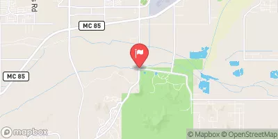
Gila River At Estrella Parkway, Near Goodyear, Az. Historical Data

Historical Data


Streamflow Range


Date Average 2026 2025 2024 2023 2022 2021 2020 2019 2018 2017 2016 2015 2014 2013 2012 2011
01-01 3.16
01-02 2.95
01-03 2.37
01-04 1.44
01-05 3.35
01-06 3.59
01-07 5.08
01-08 3.98
01-09 3.33
01-10 2.7
01-11 3.63
01-12 2.94
01-13 3.07
01-14 3.35
01-15 2.9
01-16 2.62
01-17 2.78
01-18 3.06
01-19 3.42
01-20 3.88
01-21 3.32
01-22 3.59
01-23 3.06
01-24 3.77
01-25 4.48
01-26 4.7
01-27 5.0
01-28 4.14
01-29 3.87
01-30 8.95
01-31 4.56
02-01 4.85
02-02 5.04
02-03 4.18
02-04 3.28
02-05 2.63
02-06 3.7
02-07 4.35
02-08 4.61
02-09 5.18
02-10 17.88
02-11 18.7
02-12 17.27
02-13 4.1
02-14 3.96
02-15 4.15
02-16 4.25
02-17 4.17
02-18 4.69
02-19 8.59
02-20 10.24
02-21 11.47
02-22 7.06
02-23 4.31
02-24 4.2
02-25 6.38
02-26 10.48
02-27 7.38
02-28 6.54
02-29 2.05
03-01 5.75
03-02 6.32
03-03 7.15
03-04 6.24
03-05 5.98
03-06 107.72
03-07 240.3
03-08 113.21
03-09 36.88
03-10 24.48
03-11 177.18
03-12 151.47
03-13 212.62
03-14 385.94
03-15 582.75
03-16 937.95
03-17 1245.44
03-18 2541.5
03-19 1949.71
03-20 2179.85
03-21 2172.18
03-22 2255.82
03-23 2458.24
03-24 8306.59
03-25 5240.34
03-26 1604.36
03-27 1346.14
03-28 1236.53
03-29 1389.67
03-30 1172.11
03-31 1494.95
04-01 1536.66
04-02 1532.42
04-03 1524.6
04-04 1522.58
04-05 1590.74
04-06 1274.16
04-07 1372.29
04-08 1547.38
04-09 1332.79
04-10 1419.03
04-11 1310.04
04-12 1103.95
04-13 1409.62
04-14 1789.31
04-15 1747.55
04-16 1171.92
04-17 1480.56
04-18 1460.88
04-19 571.3
04-20 322.33
04-21 231.47
04-22 191.06
04-23 158.56
04-24 51.95
04-25 49.34
04-26 46.4
04-27 32.2
04-28 40.17
04-29 61.61
04-30 65.39
05-01 65.09
05-02 130.0
05-03 72.6
05-04 52.8
05-05 38.8
05-06 167.0
05-07 198.0
05-08 204.0
05-09 227.0
05-10 347.0
05-11 157.0
05-12 81.2
05-13 64.7
05-14 42.5
05-15 42.5
05-16 35.3
05-17 27.5
05-18 23.5
05-19 22.2
05-20 19.8
05-21 23.5
05-22 26.1
05-23 26.1
05-24 26.1
05-25 12.9
05-26 10.5
05-27 9.78
05-28 9.09
05-29 7.81
05-30 7.22
05-31 6.13
06-01 5.16
06-02 4.3
06-03 3.54
06-04 2.88
06-05 2.3
06-06 1.81
06-07 1.22
06-08 0.77
06-09 0.45
06-10 0.24
06-11 0.11
06-12 0.01
07-26 467.0
07-27 119.0
07-28 107.0
07-30 185.0
07-31 81.2
08-01 87.3
08-02 46.4
08-03 0.19
08-22 475.0
08-23 125.0
08-24 15.6
08-25 1.81
09-09 2770.0
09-10 612.0
09-11 323.0
09-12 157.0
09-13 141.0
09-14 88.0
09-15 137.0
09-16 166.0
09-17 104.0
09-18 114.0
09-19 114.0
09-20 101.0
09-21 4.8
09-22 0.31
09-28 229.0
09-29 79.0
09-30 5.9
10-01 2.7
10-02 1.5
10-03 1.1
10-04 0.76
10-05 8.5
10-06 5.3
10-07 8.5
10-08 16.3
10-09 26.75
10-10 35.6
10-11 34.35
10-12 24.5
10-13 14.74
10-14 182.5
10-15 65.1
10-16 4.98
10-17 90.27
10-18 84.6
10-19 81.67
10-20 42.3
10-21 48.1
10-22 52.43
10-23 9.46
10-24 5.08
10-25 4.4
10-26 5.72
10-27 4.69
10-28 6.5
10-29 6.5
10-30 3.02
10-31 30.34
11-01 34.33
11-02 38.87
11-03 1670.49
11-04 4428.9
11-05 2393.2
11-06 522.08
11-07 51.44
11-08 59.65
11-09 60.46
11-10 56.27
11-11 55.99
11-12 59.46
11-13 58.87
11-14 57.24
11-15 52.33
11-16 56.85
11-17 63.07
11-18 60.07
11-19 37.51
11-20 32.13
11-21 53.9
11-22 34.92
11-23 36.36
11-24 57.24
11-25 48.23
11-26 53.15
11-27 48.91
11-28 54.95
11-29 51.9
11-30 31.35
12-01 41.4
12-02 52.8
12-03 32.12
12-04 32.8
12-05 34.96
12-06 33.76
12-07 28.16
12-08 24.72
12-09 26.95
12-10 5.4
12-11 7.51
12-12 4.49
12-13 4.16
12-14 4.56
12-15 5.33
12-16 5.14
12-17 2.34
12-18 1.2
12-19 2.15
12-20 3.98
12-21 3.98
12-22 2.78
12-23 0.47
12-24 0.58
12-25 1.12
12-26 4.36
12-27 3.0
12-28 1.7
12-29 2.09
12-30 1.5
12-31 3.1

Annual Peak Streamflow


Seasonal Comparison


Oceanic Nino Index