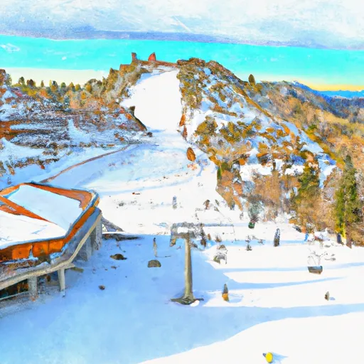
California snowpack
Live SNOTEL readings, fresh snowfall, snow-water content, and 5-day forecasts at every monitored peak in California. Sourced from USDA NRCS and NOAA NOHRSC.
California's snowpack is at 57% of normal for today's date — well below the 70% drought-stress threshold. The deepest station is Nohrsc Tuolumne Meadows with 124" on the ground (seasonal average 97"). Blackcap Basin Goes is the coldest right now at 43°F.
The California snowpack is monitored by the USDA NRCS SNOTEL network — automated stations sitting on the mountain that report snow depth, snow water equivalent (SWE), and air temperature every hour. Snoflo joins those live readings to a 5-day NOAA forecast for each station so you can see what's on the ground and what's coming.
Use the SNOTEL inventory below to find the closest station to where you're headed. Percent of normal tells you how today's snowpack compares to the historical average for the same date — below 70% is drought-stressed; above 130% is a fat year. Snow water content (SWC) indicates how wet and dense the snowpack is — useful for water-supply planning and avalanche stability assessment.
For backcountry travel always cross-reference with your regional avalanche center at avalanche.org.
State-wide snowpack overview
Today's standouts across the California SNOTEL network -- the deepest snowpack, coldest mountain, biggest expected snowfall, and how the state sits versus normal.
Percent of normal
100% is the historical norm for today's date. Below 70% is drought-stressed; above 130% is a fat year.
Deepest snowpack
vs 97" seasonal average
Coldest station
Elevation 10,292 ft
California snowpack monitoring sites
Showing the top 10 deepest SNOTEL stations in California — 24 more hidden. Tap any station for its full history.
| Snowpack monitoring site | Snowpack (in) | Snowfall (in) | 24hr fcst (in) | Next 72hrs (in) | Temp (°F) | % Normal | SWC (%) | Watershed | Elevation (ft) |
|---|---|---|---|---|---|---|---|---|---|
|
Nohrsc Kaiser Point, Ca
Site KSPC1 |
175 | 174 | 0 | 0 | 63 | 516% | 0% | Upper San Joaquin | 9,194 |
|
Nohrsc Tuolumne Meadows, Ca
Site TUMC1 |
123 | 0 | 0 | 0 | 62 | 147% | 1% | Upper Tuolumne | 8,640 |
|
Stouts Meadow Goes, Ca
Site STMC1 |
88 | -4 | 0 | 0 | 74 | 113% | 41% | Mccloud | 5,297 |
|
Leavitt Lake, Ca
Site 574 |
58 | 0 | 0 | 0 | 57 | 54% | 54% | West Walker | 9,617 |
|
Nohrsc Leavitt Lake, Ca
Site LELC1 |
58 | -2 | 0 | 0 | 51 | 72% | 54% | West Walker | 9,604 |
|
Nohrsc Peterson Flat, Ca
Site PTFC1 |
53 | 8 | 0 | 0 | 73 | 147% | · | Trinity | 6,373 |
|
Lost Lake Snotel, Ca
Site LLXC1 |
33 | -3 | 0 | 0 | 60 | 77% | 54% | Upper Mokelumne | 8,679 |
|
Nohrsc Silver Lake (Goes), Ca
Site SILC1 |
33 | 0 | 0 | 0 | 73 | 78% | 3% | South Fork American | 7,200 |
|
Nohrsc Tioga Pass-Dana Meadows, Ca
Site TIOC1 |
30 | 0 | 0 | 0 | 58 | 100% | 2% | Upper Tuolumne | 9,817 |
|
Independence Lake, Ca
Site 541 |
23 | 0 | 0 | 0 | 61 | 31% | 52% | Truckee | 8,352 |
24 more California SNOTEL stations
You're seeing the top 10 deepest. Snoflo Premium unlocks every SNOTEL station in California, sortable by any column, filterable, with custom alerts and unlimited favorites.
- All 34 stations
- Sort & filter
- Unlimited alerts & favorites
- 15-day forecasts
California ski-area meteograms
Per-resort interactive weather forecasts for the next 15 days — temperature curve, precipitation bars, weather symbols, and humidity at every California ski area Snoflo tracks.
-
 Alpine Meadows Ski Area
→
Alpine Meadows Ski Area
→
-
 Badger Pass Ski Area
→
Badger Pass Ski Area
→
-
 Bear Mountain
→
Bear Mountain
→
-
 Bear Mountain Resort
→
Bear Mountain Resort
→
-
 Bear Valley Mountain Resort
→
Bear Valley Mountain Resort
→
-
 Boreal Mountain Resort
→
Boreal Mountain Resort
→
-
 Buckhorn Ski Club
→
Buckhorn Ski Club
→
-
 China Peak (Sierra Summit)
→
China Peak (Sierra Summit)
→
-
 Cuyamaca Peak
→
Cuyamaca Peak
→
-
 Dodge Ridge Ski Area
→
Dodge Ridge Ski Area
→
-
 Donner Ski Ranch
→
Donner Ski Ranch
→
-
 Granlibakken Ski Resort
→
Granlibakken Ski Resort
→
-
 Homewood Mountain Resort
→
Homewood Mountain Resort
→
-
 June Mountain
→
June Mountain
→
-
 Kirkwood
→
Kirkwood
→
-
 Mammoth Mountain
→
Mammoth Mountain
→
-
 Mount Baldy
→
Mount Baldy
→
-
 Mountain High Resort
→
Mountain High Resort
→
-
 Mt. Baldy Ski Lifts
→
Mt. Baldy Ski Lifts
→
-
 Mt. Waterman
→
Mt. Waterman
→
-
 Northstar
→
Northstar
→
-
 Sierra At Tahoe
→
Sierra At Tahoe
→
-
 Snow Summit Mountain Resort
→
Snow Summit Mountain Resort
→
-
 Snow Valley Ski Resort
→
Snow Valley Ski Resort
→
-
 Soda Springs
→
Soda Springs
→
-
 Squaw Valley
→
Squaw Valley
→
-
 Sugar Bowl Resort
→
Sugar Bowl Resort
→
-
 Sunrise
→
Sunrise
→
-
 Tahoe Donner
→
Tahoe Donner
→
-
 Trinity Mountain Resort
→
Trinity Mountain Resort
→
About California snowpack
Where does the California snowpack data come from?
The USDA NRCS SNOTEL network (SNOpack TELemetry) -- automated mountain stations that continuously measure snow depth, snow water equivalent, precipitation, and air temperature. Snoflo aggregates the live readings and joins them to a 5-day NOAA forecast for each station.
What is Snow Water Equivalent (SWE)?
The depth of water you'd get if you melted the entire snowpack. A 30-inch snowpack with 8 inches of SWE is wetter and denser than one with 5 inches -- useful for water-supply forecasting and avalanche assessment. The "SWC %" column shows the ratio.
What does Percent Normal mean?
Current snowpack as a percentage of the historical average for the same date at that station. 100% is right at the historical norm. Below 70% indicates drought-stressed snowpack; above 130% is a fat year.
How fresh is the California data?
SNOTEL stations transmit hourly; Snoflo re-pulls throughout the day. The 5-day forecasts regenerate from NOAA NOHRSC analysis fields and NWS forecast guidance.
Why are SNOTEL stations only in some states?
The NRCS SNOTEL network is concentrated in the western mountain U.S. -- where the snowpack drives federal water supply forecasts for irrigation, hydropower, and municipal water. Eastern snowpack is measured by other networks (CoCoRaHS, NWS) which Snoflo includes elsewhere.
Is this a substitute for the local avalanche center?
No. For backcountry travel always consult your regional avalanche forecast at avalanche.org. Snoflo is informational data only.