

-
 Snoflo Premium
Get unlimited access to all our content
With no Ad interruptions! - Start Your Free Trial Login with existing account
Ridgely
Eden Index
Climate
7.9
•
Recreation
2.8
•
Community
0.8
•
Safeguard
4.4/10
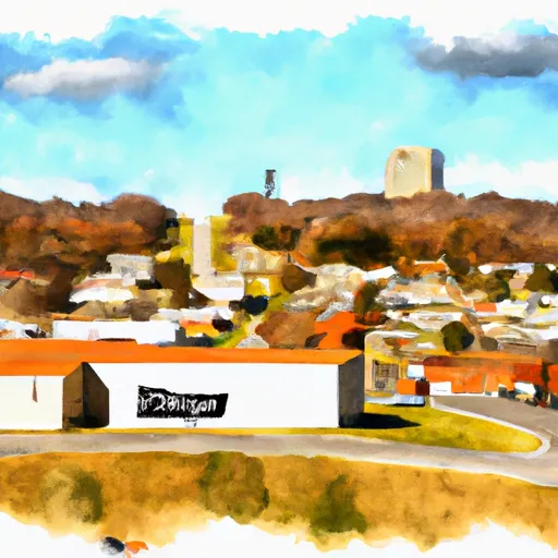
Ridgely, Tennessee is a small town located in Lake County, situated in the western part of the state. The climate in Ridgely is classified as humid subtropical, with hot and humid summers and mild winters. Summers are characterized by temperatures ranging from the mid-80s to low 90s°F, while winter temperatures typically range from the mid-30s to low 50s°F.
Hydrologically, Ridgely benefits from its proximity to the Mississippi River, which is located just a few miles to the west. The nearby Reelfoot Lake, formed by a series of earthquakes in the early 19th century, also contributes to the hydrology of the area. It provides a variety of recreational opportunities, including boating, fishing, and bird-watching.
Outdoor recreation enthusiasts will find ample opportunities in Ridgely. Apart from the recreational activities available at Reelfoot Lake, the town offers access to public parks, nature trails, and camping sites. Visitors can explore the scenic landscapes, engage in wildlife photography, or enjoy hiking and biking trails that take them through the picturesque countryside.
In summary, Ridgely, Tennessee offers a humid subtropical climate, benefiting from its proximity to the Mississippi River and Reelfoot Lake. The town provides a diverse range of outdoor recreational opportunities, making it an attractive destination for nature lovers and adventure seekers alike.
What is the Eden Index?
The Snoflo Eden Index serves as a comprehensive rating system for regions, evaluating their desirability through a holistic assessment of climate health, outdoor recreation opportunities, and natural disaster risk, acknowledging the profound impact of these factors on livability and well-being.
Climate Health Indicator (CHI): 7.9
Ridgely receives approximately
1277mm of rain per year,
with humidity levels near 84%
and air temperatures averaging around
15°C.
Ridgely has a plant hardyness factor of
7, meaning
plants and agriculture in this region tend to thrive during the non-winter months.
By considering the ideal temperature range, reliable water supplies, clean air, and stable seasonal rain or snowpacks, the Climate Health Indicator (CHI) underscores the significance of a healthy climate as the foundation for quality living.
A healthy climate is paramount for ensuring a high quality of life and livability in a region, fostering both physical well-being and environmental harmony. This can be characterized by ideal temperatures, reliable access to water supplies, clean air, and consistent seasonal rain or snowpacks.
Weather Forecast
Streamflow Conditions
Hatchie-Obion
Area Rivers
Hatchie-Obion
Snowpack Depths
Hatchie-Obion
Reservoir Storage Capacity
Hatchie-Obion
Groundwater Levels
Recreational Opportunity Index (ROI): 2.8
The Recreational Opportunity Index (ROI) recognizes the value of outdoor recreational options, such as parks, hiking trails, camping sites, and fishing spots, while acknowledging that climate plays a pivotal role in ensuring the comfort and consistency of these experiences.
Access to outdoor recreational opportunities, encompassing activities such as parks, hiking, camping, and fishing, is crucial for overall well-being, and the climate plays a pivotal role in enabling and enhancing these experiences, ensuring that individuals can engage in nature-based activities comfortably and consistently.
Camping Areas
| Campground | Campsites | Reservations | Toilets | Showers | Elevation |
|---|---|---|---|---|---|
| Little Black Creek Waterpark | None | 296 ft | |||
| McLeod Water Park | None | 22 ft | |||
| Roosevelt State Park | None | 562 ft | |||
| Okatoma Water Park | None | 396 ft | |||
| Marathon Lake | 71 | 481 ft | |||
| Big Creek Waterpark | None | 254 ft | |||
| Lake Mike Conner | 20 | 314 ft | |||
| Shockaloe Base Camp I | 10 | 578 ft | |||
| Buccaneer State Park | 276 | 5 ft | |||
| Lake Ross Barnett | 22 | 402 ft |
Nearby Ski Areas
Catastrophe Safeguard Index (CSI):
The Catastrophe Safeguard Index (CSI) recognizes that natural disaster risk, encompassing floods, fires, hurricanes, and tornadoes, can drastically affect safety and the overall appeal of an area.
The level of natural disaster risk in a region significantly affects safety and the overall livability, with climate change amplifying these risks by potentially increasing the frequency and intensity of events like floods, fires, hurricanes, and tornadoes, thereby posing substantial challenges to community resilience and well-being.
Community Resilience Indicator (CRI): 0.8
The Community Resilience Indicator (CRI) recognizes that education, healthcare, and socioeconomics are crucial to the well-being of a region. The CRI acknowledges the profound impact of these elements on residents' overall quality of life. By evaluating educational resources, healthcare accessibility, and economic inclusivity, the index captures the essential aspects that contribute to a thriving community, fostering resident satisfaction, equity, and social cohesion.