

-
 Snoflo Premium
Get unlimited access to all our content
With no Ad interruptions! - Start Your Free Trial Login with existing account
Sprankle-Mills
Eden Index
Climate
8.7
•
Recreation
3.4
•
Community
•
Safeguard
4.7/10
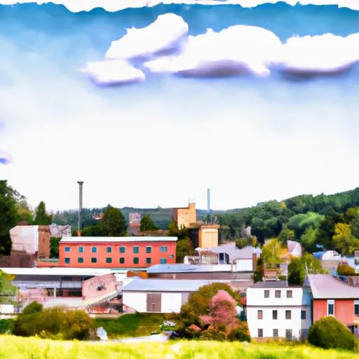
Sprankle-Mills, Pennsylvania is a small community located in Jefferson County. The climate in this region is classified as humid continental, characterized by warm summers and cold winters. Average temperatures range from 20°F (-6°C) in winter to 80°F (27°C) in summer, with precipitation fairly evenly distributed throughout the year.
Hydrologically, Sprankle-Mills is situated near several water resources. The Mahoning Creek flows through the area, offering opportunities for fishing, kayaking, and canoeing. Additionally, there are several small lakes and ponds in the vicinity, providing serene spots for swimming or boating.
Outdoor recreation opportunities are abundant in Sprankle-Mills. The area is surrounded by vast forests, making it a perfect destination for hiking and camping enthusiasts. There are numerous trails that offer breathtaking views of the surrounding landscapes and wildlife. Hunting is also popular in the region, with opportunities to pursue deer, turkey, and small game.
In conclusion, Sprankle-Mills, Pennsylvania boasts a typical humid continental climate with distinct seasons. Its proximity to water bodies like Mahoning Creek, along with its lush forests, provides ample opportunities for outdoor recreation such as fishing, boating, hiking, camping, and hunting.
What is the Eden Index?
The Snoflo Eden Index serves as a comprehensive rating system for regions, evaluating their desirability through a holistic assessment of climate health, outdoor recreation opportunities, and natural disaster risk, acknowledging the profound impact of these factors on livability and well-being.
Climate Health Indicator (CHI): 8.7
Sprankle-Mills receives approximately
1159mm of rain per year,
with humidity levels near 79%
and air temperatures averaging around
9°C.
Sprankle-Mills has a plant hardyness factor of
5, meaning
plants and agriculture in this region thrive during a short period during spring and early summer. Most
plants will die off during the colder winter months.
By considering the ideal temperature range, reliable water supplies, clean air, and stable seasonal rain or snowpacks, the Climate Health Indicator (CHI) underscores the significance of a healthy climate as the foundation for quality living.
A healthy climate is paramount for ensuring a high quality of life and livability in a region, fostering both physical well-being and environmental harmony. This can be characterized by ideal temperatures, reliable access to water supplies, clean air, and consistent seasonal rain or snowpacks.
Weather Forecast
Streamflow Conditions
Allegheny
Area Rivers
Allegheny
Snowpack Depths
Allegheny
Reservoir Storage Capacity
Allegheny
Groundwater Levels
Recreational Opportunity Index (ROI): 3.4
The Recreational Opportunity Index (ROI) recognizes the value of outdoor recreational options, such as parks, hiking trails, camping sites, and fishing spots, while acknowledging that climate plays a pivotal role in ensuring the comfort and consistency of these experiences.
Access to outdoor recreational opportunities, encompassing activities such as parks, hiking, camping, and fishing, is crucial for overall well-being, and the climate plays a pivotal role in enabling and enhancing these experiences, ensuring that individuals can engage in nature-based activities comfortably and consistently.
Camping Areas
| Campground | Campsites | Reservations | Toilets | Showers | Elevation |
|---|---|---|---|---|---|
| Beaver Meadows Rec Area | 51 | 1,753 ft | |||
| Laurel Hill State Park | None | 2,235 ft | |||
| Lorain Borough Park | None | 1,316 ft | |||
| Cook Forest State Park | None | 1,554 ft | |||
| Redbank Valley Municipal Park | None | 1,135 ft | |||
| Quemahoning Family Rec Area | 63 | 1,668 ft | |||
| Kooser State Park | None | 2,312 ft | |||
| Milton Loop | None | 1,150 ft | |||
| Loleta Rec Area | 89 | 1,350 ft | |||
| Clear Creek State Park | None | 1,322 ft |
Nearby Ski Areas
Catastrophe Safeguard Index (CSI):
The Catastrophe Safeguard Index (CSI) recognizes that natural disaster risk, encompassing floods, fires, hurricanes, and tornadoes, can drastically affect safety and the overall appeal of an area.
The level of natural disaster risk in a region significantly affects safety and the overall livability, with climate change amplifying these risks by potentially increasing the frequency and intensity of events like floods, fires, hurricanes, and tornadoes, thereby posing substantial challenges to community resilience and well-being.
Community Resilience Indicator (CRI):
The Community Resilience Indicator (CRI) recognizes that education, healthcare, and socioeconomics are crucial to the well-being of a region. The CRI acknowledges the profound impact of these elements on residents' overall quality of life. By evaluating educational resources, healthcare accessibility, and economic inclusivity, the index captures the essential aspects that contribute to a thriving community, fostering resident satisfaction, equity, and social cohesion.